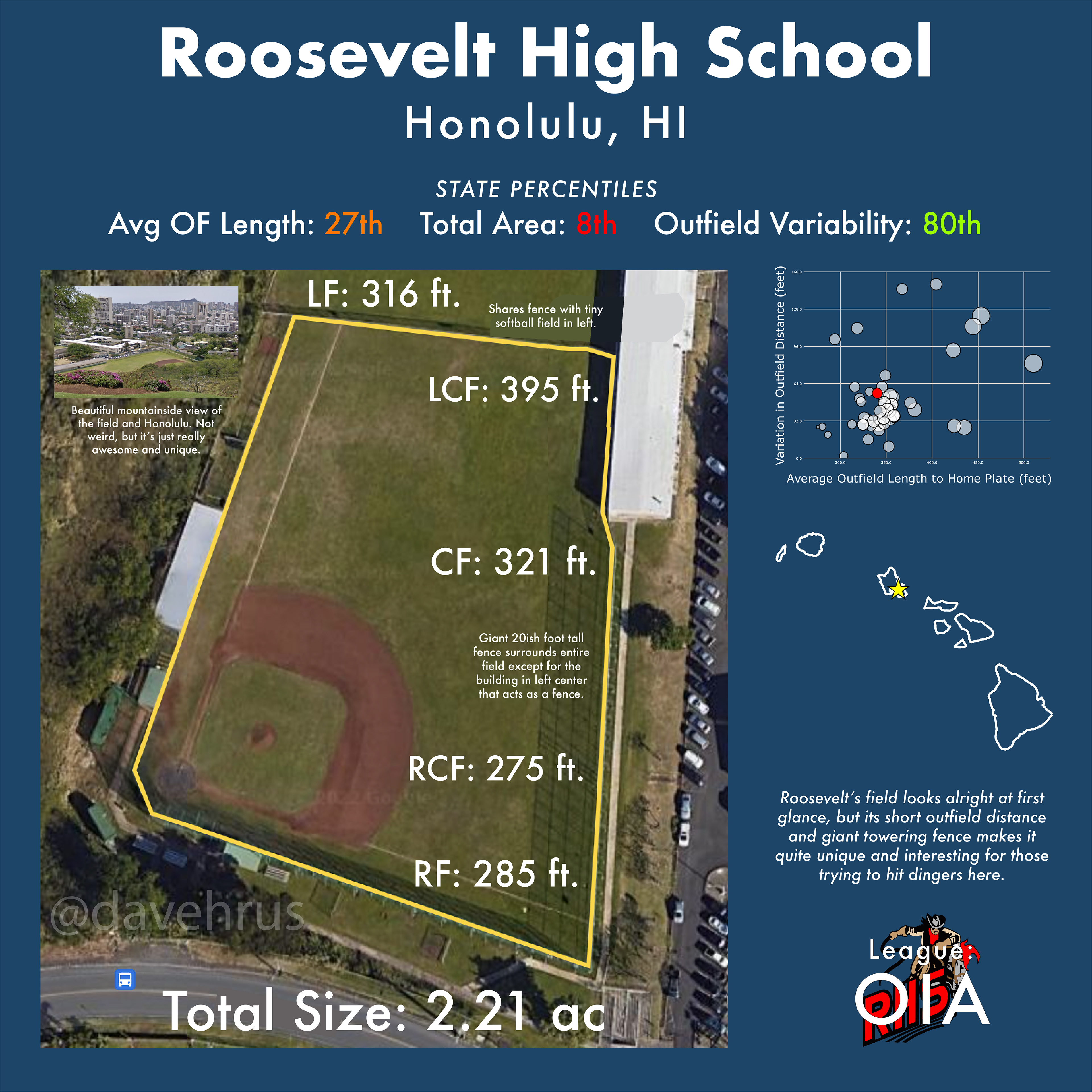
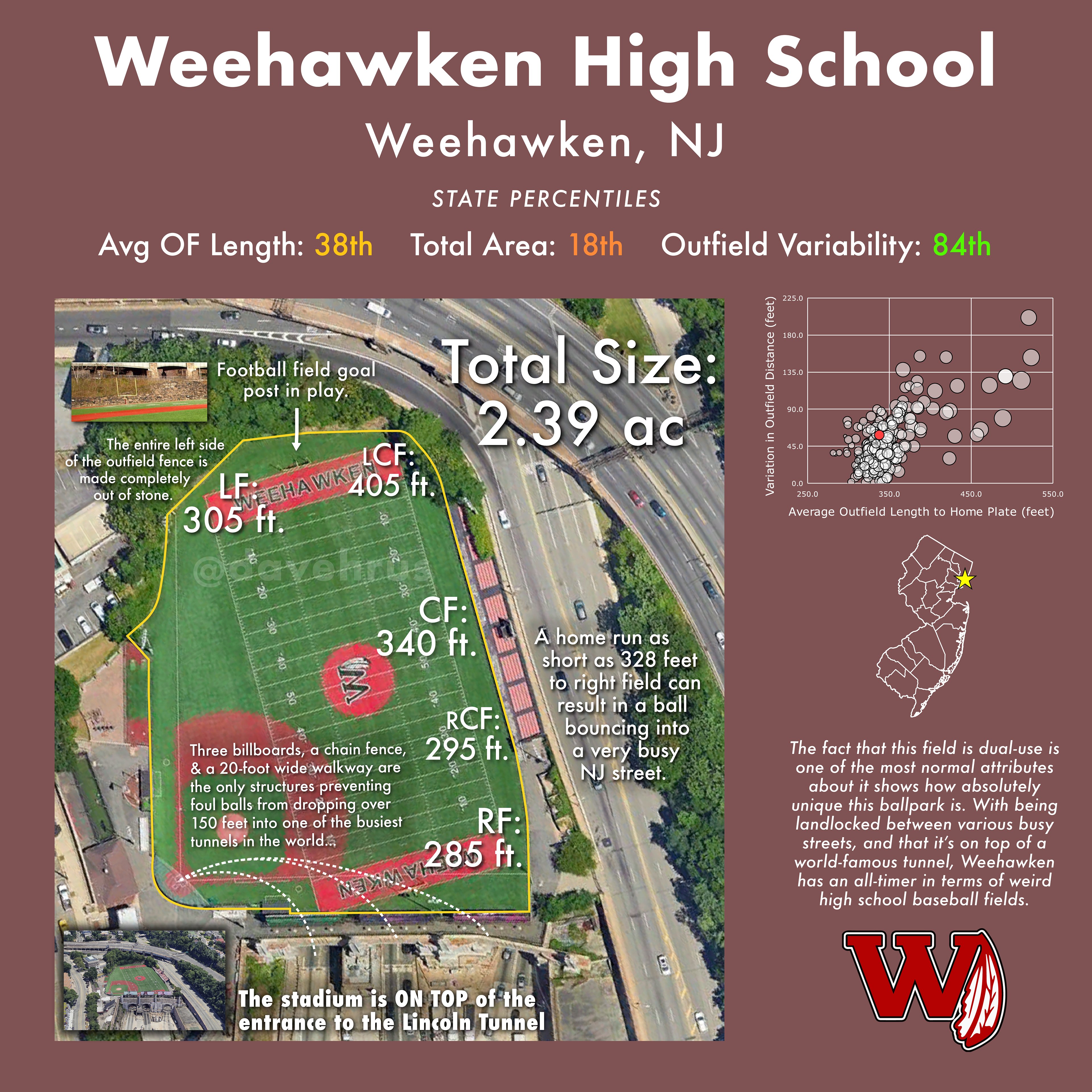
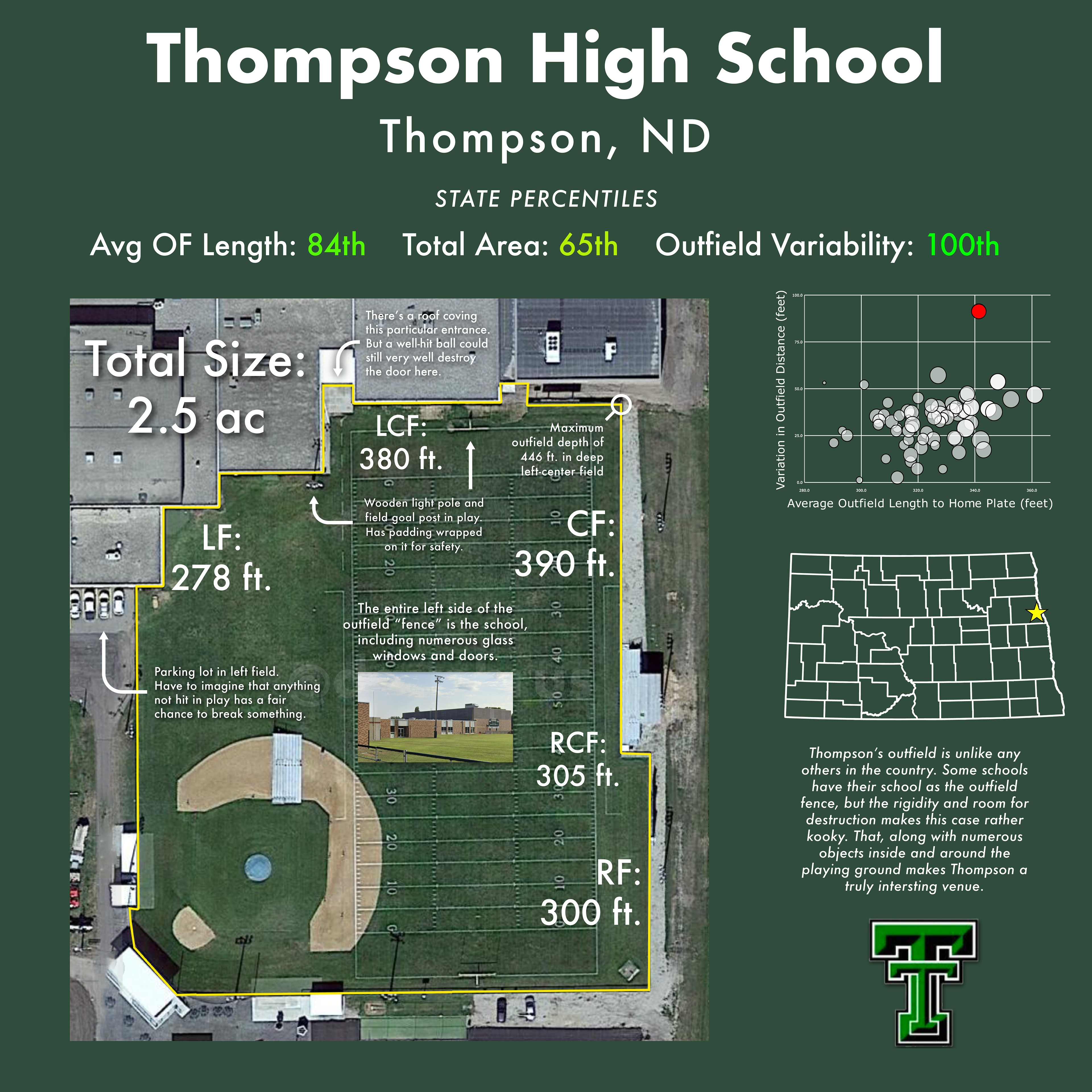
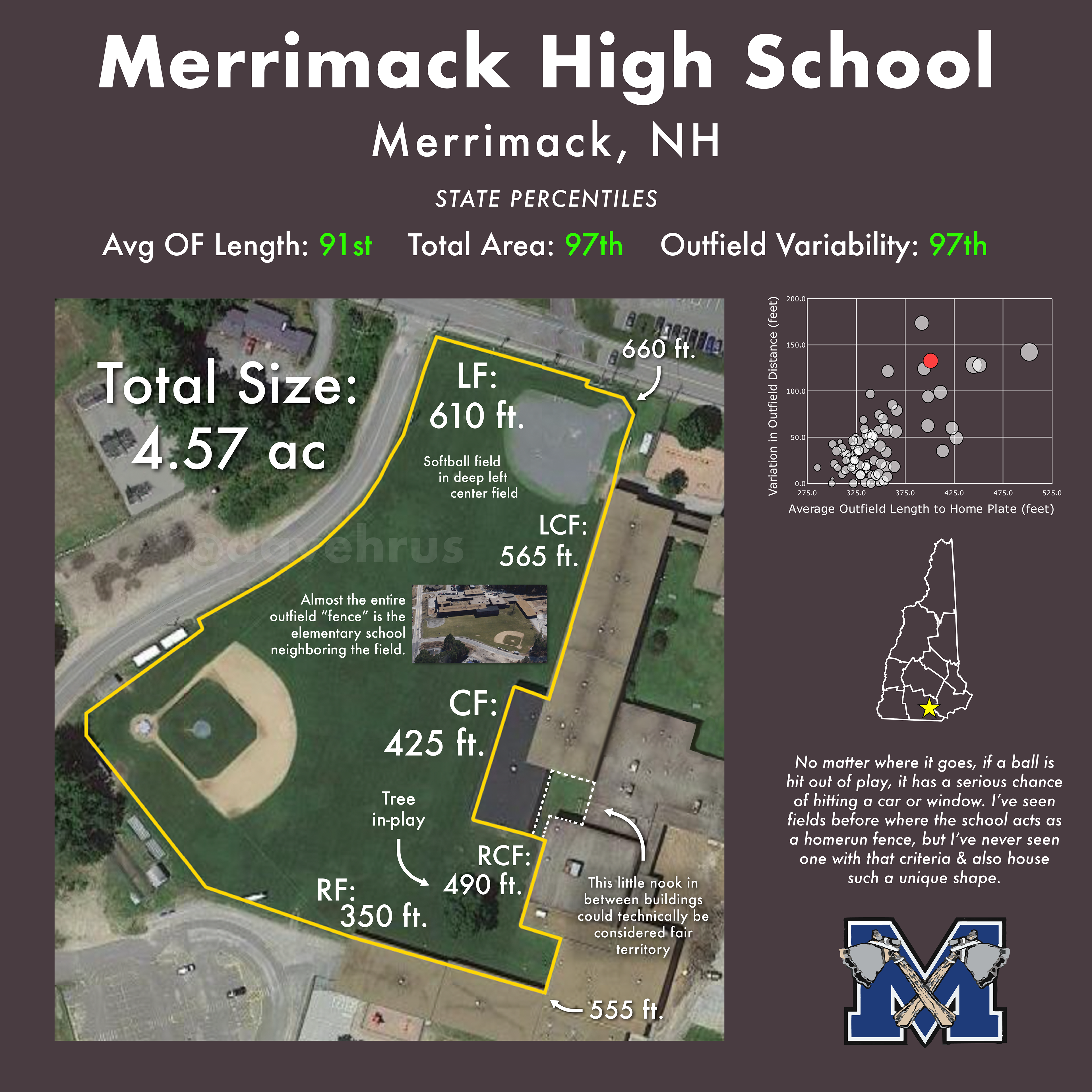
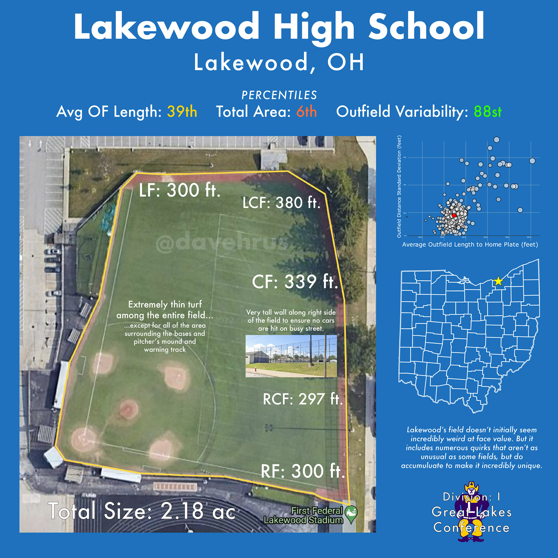
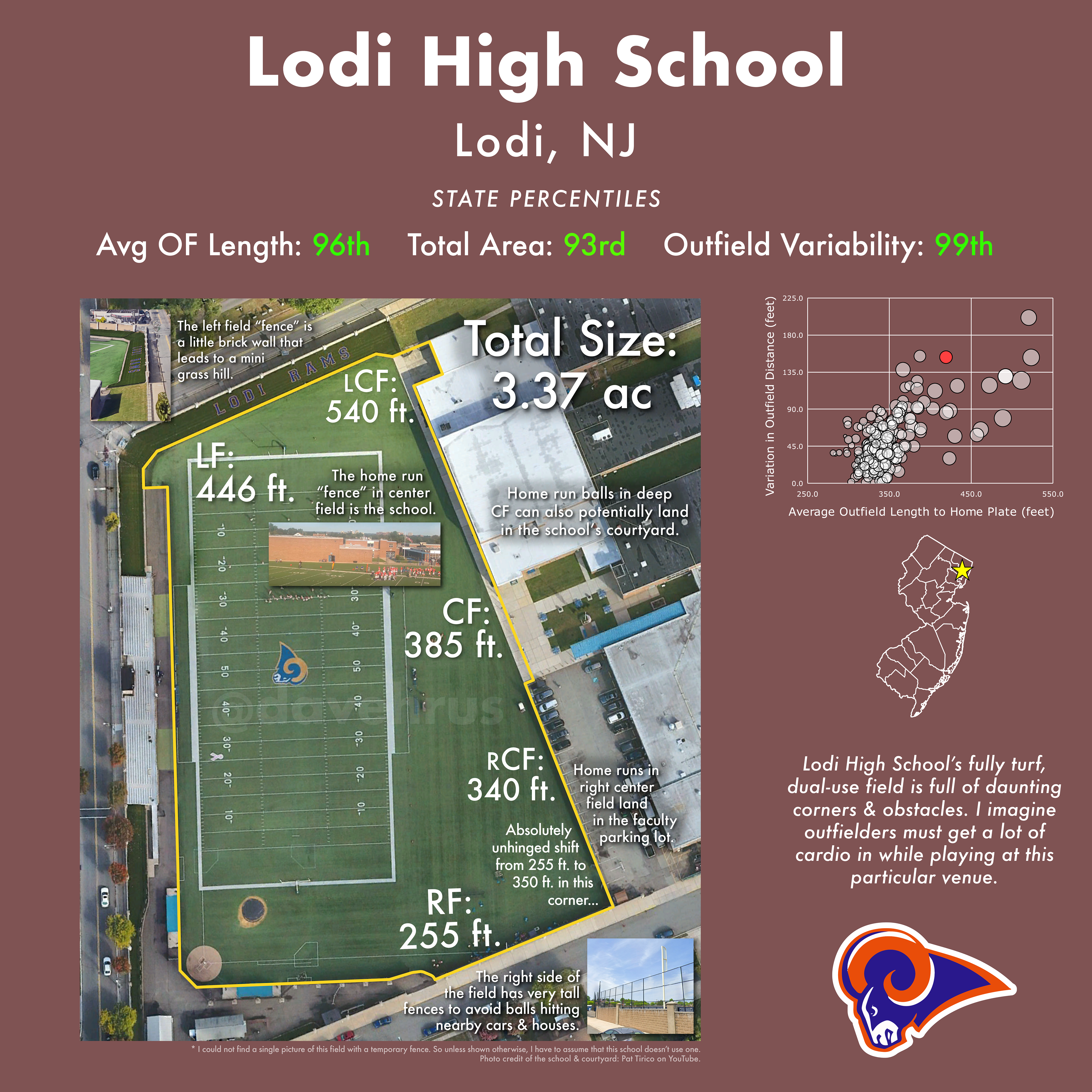
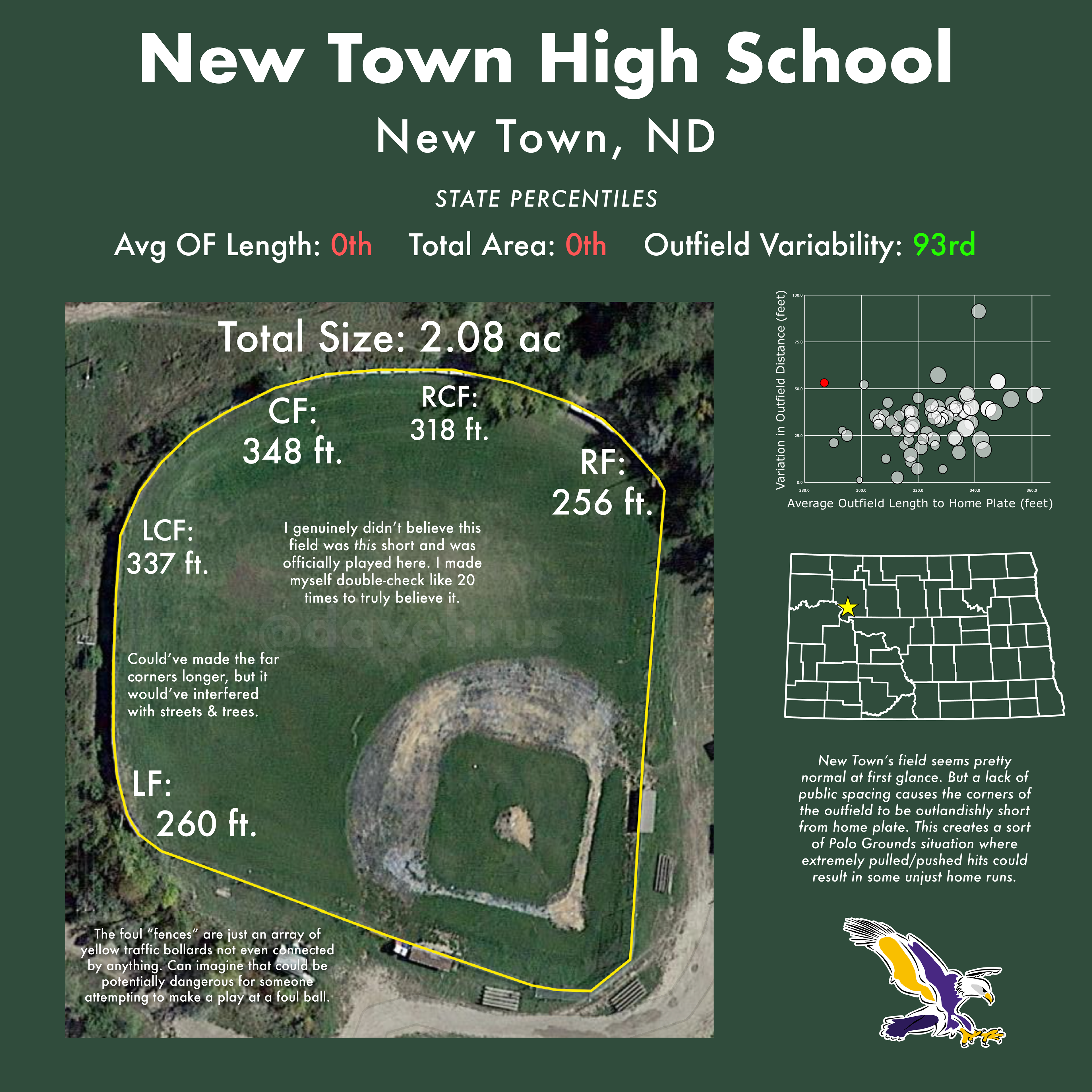
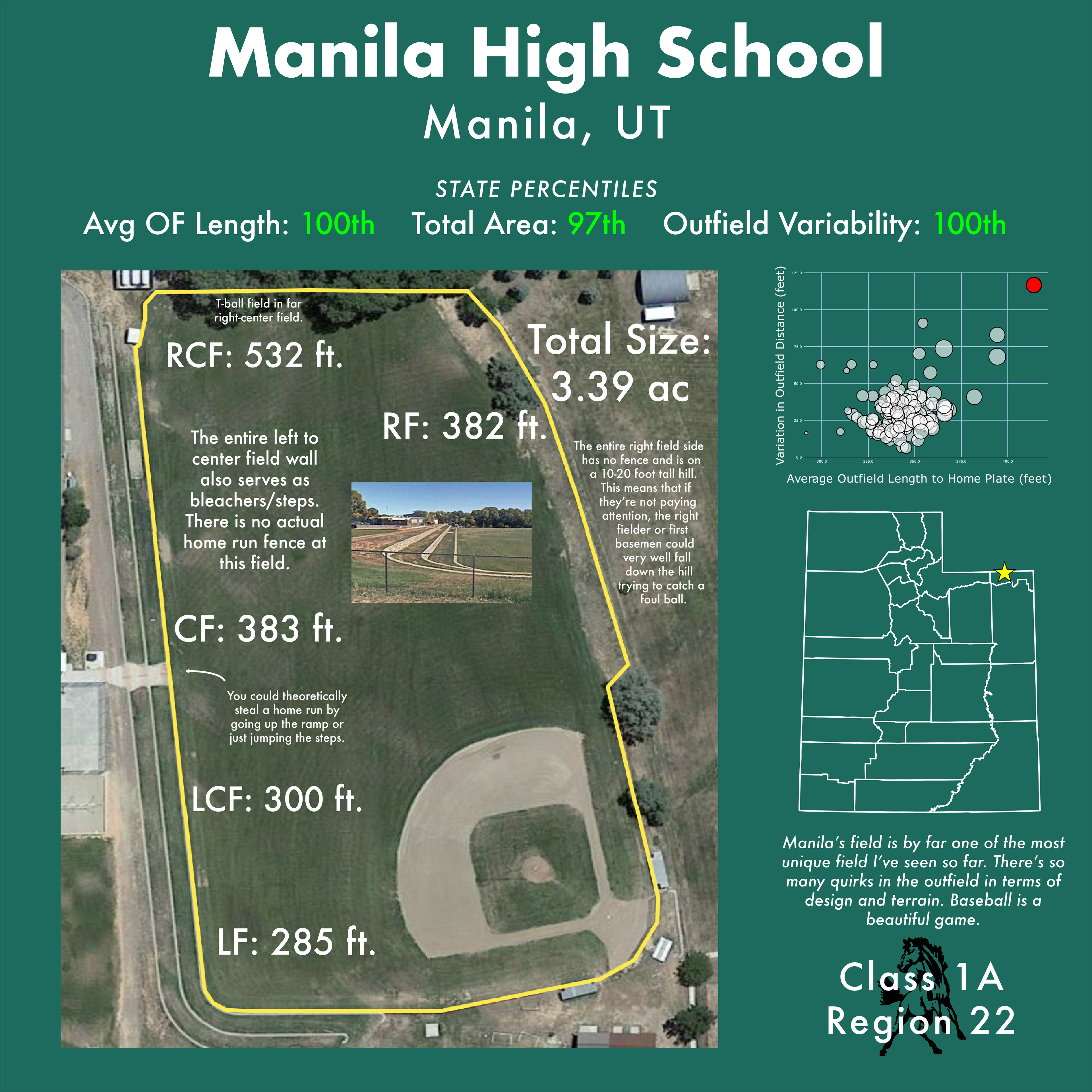
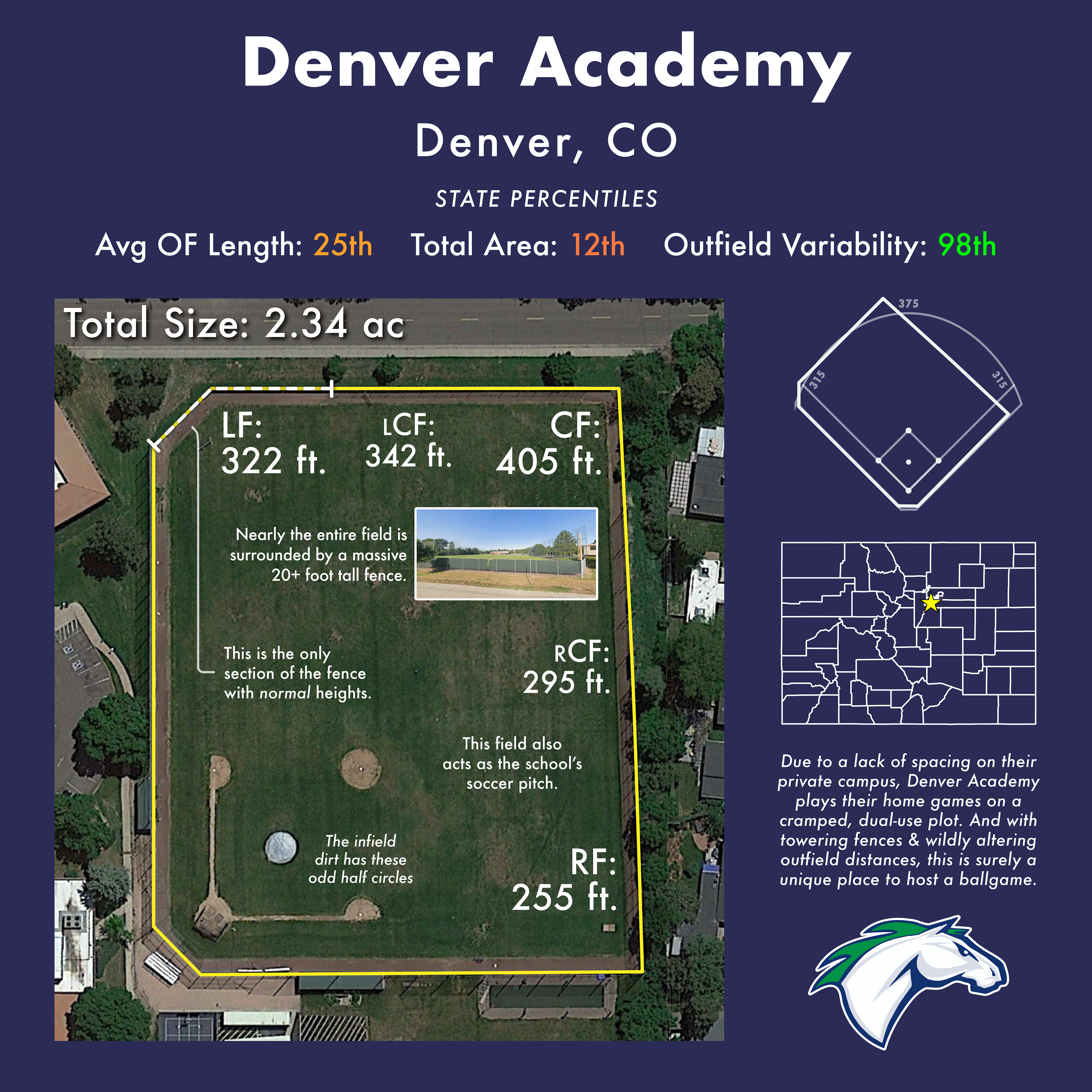
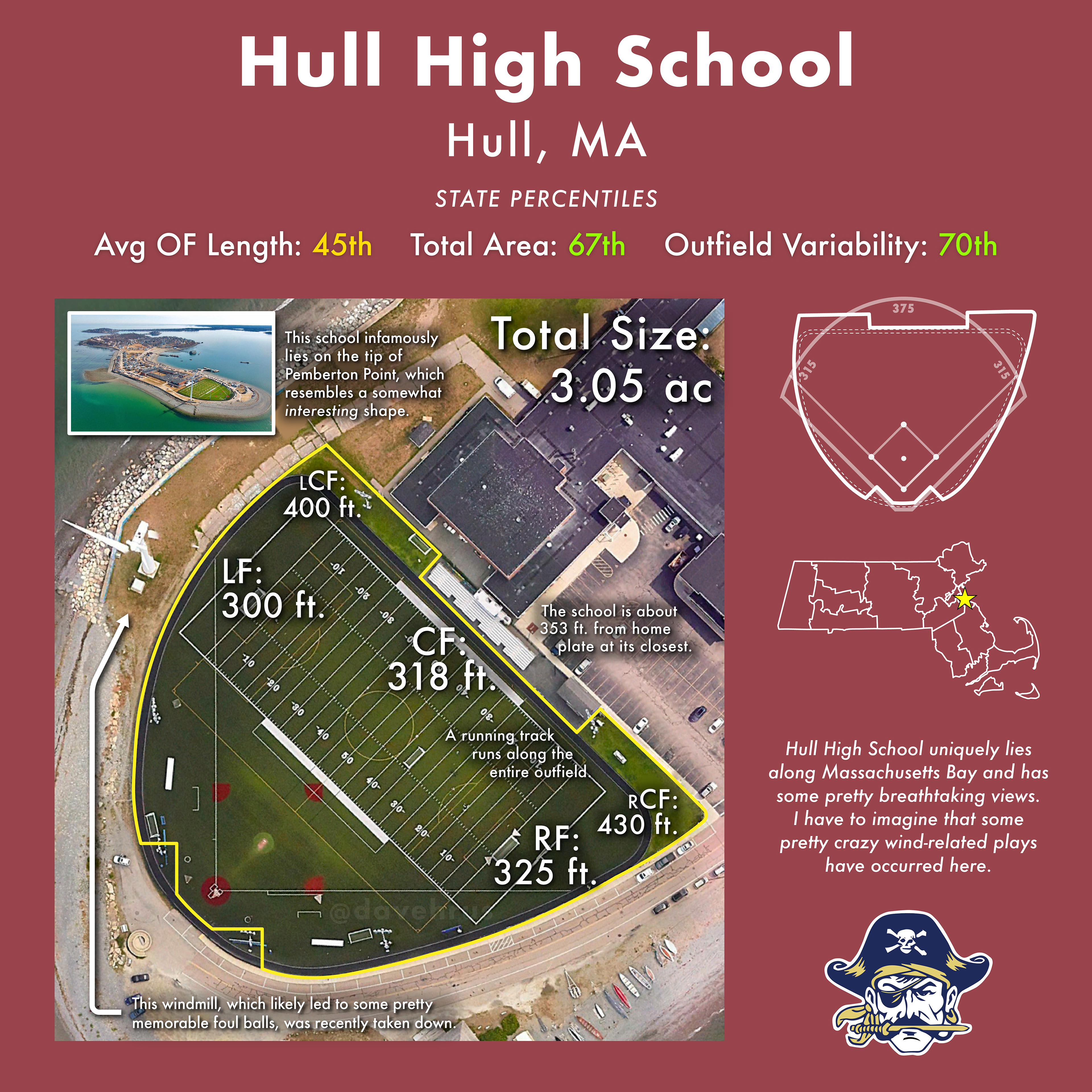
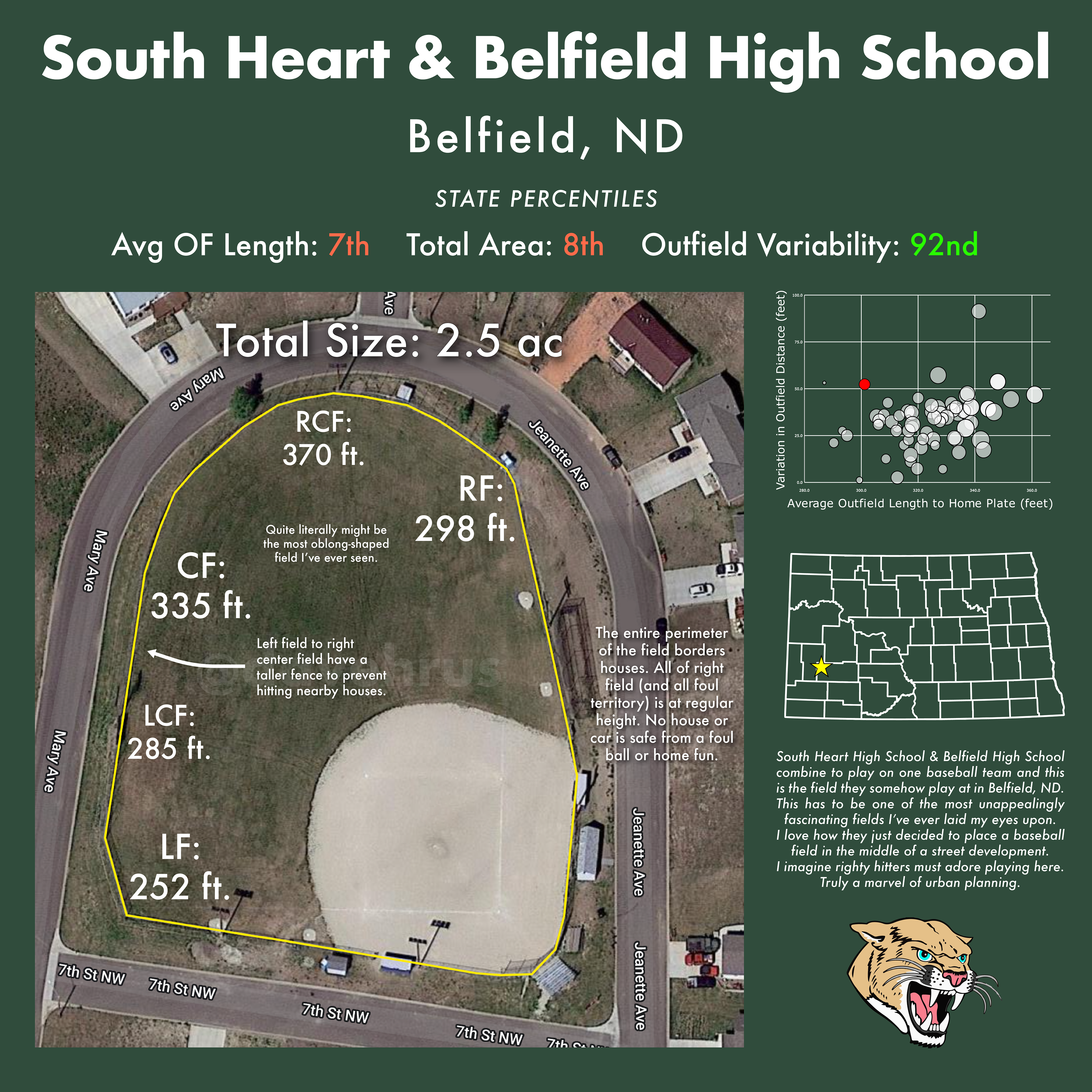
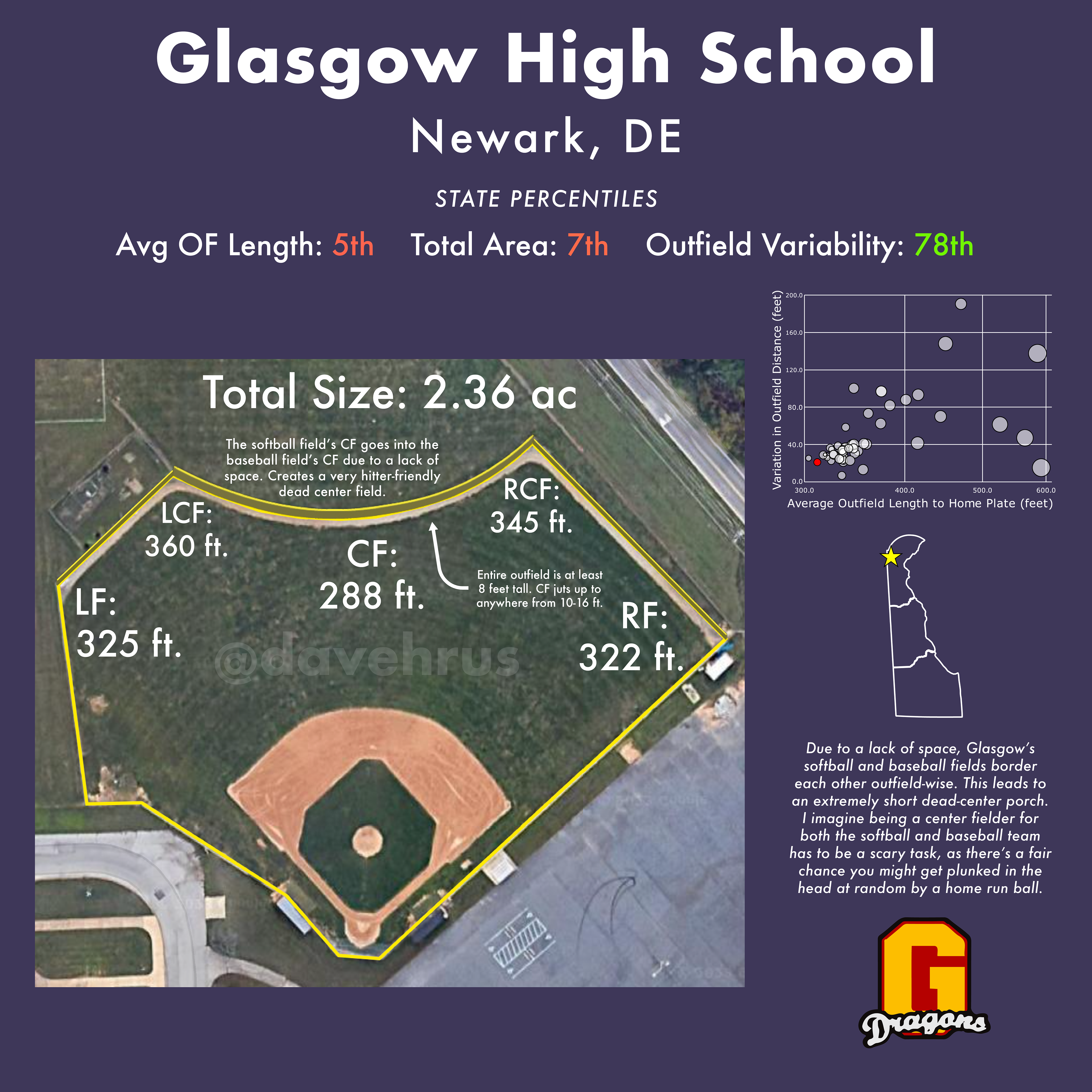
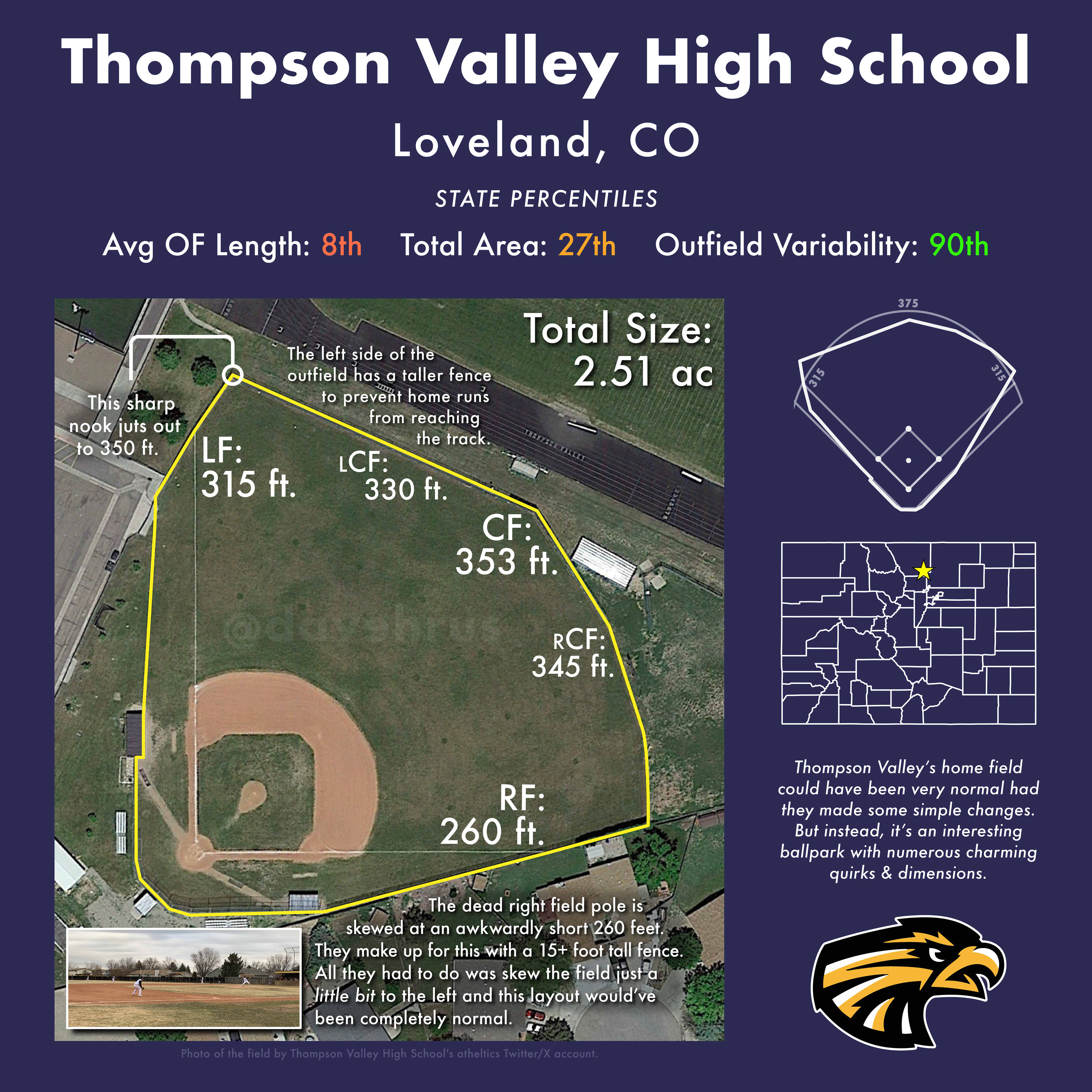
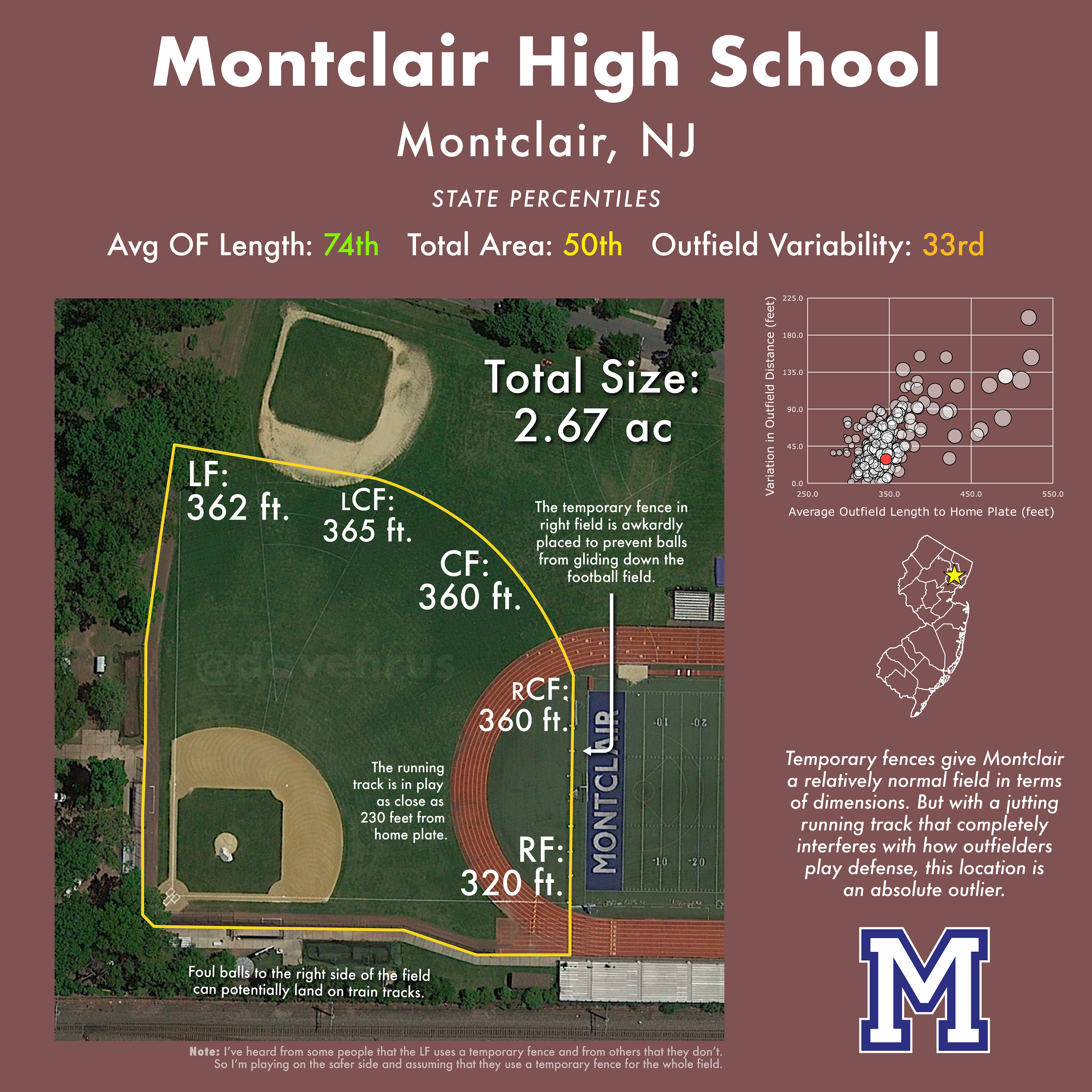
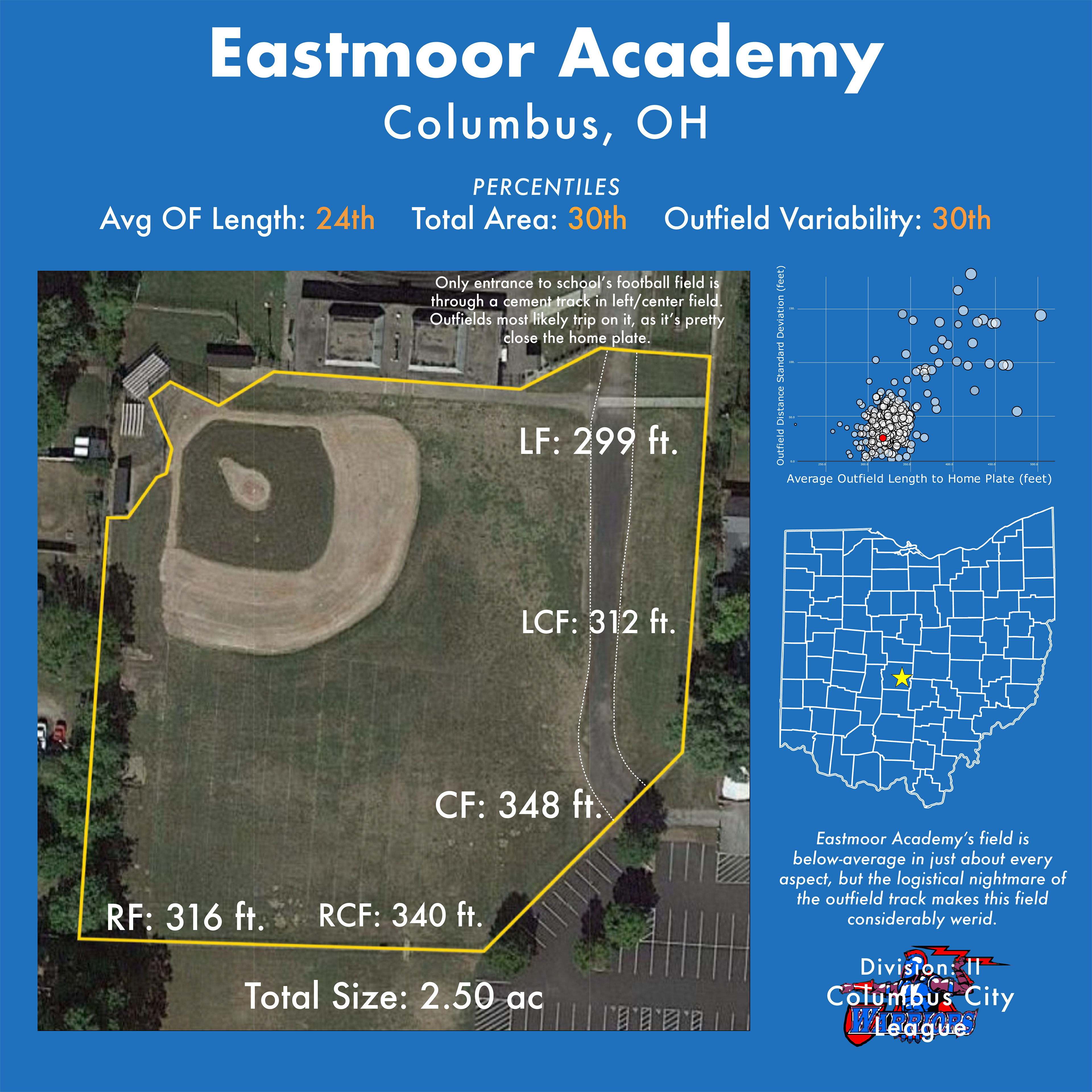
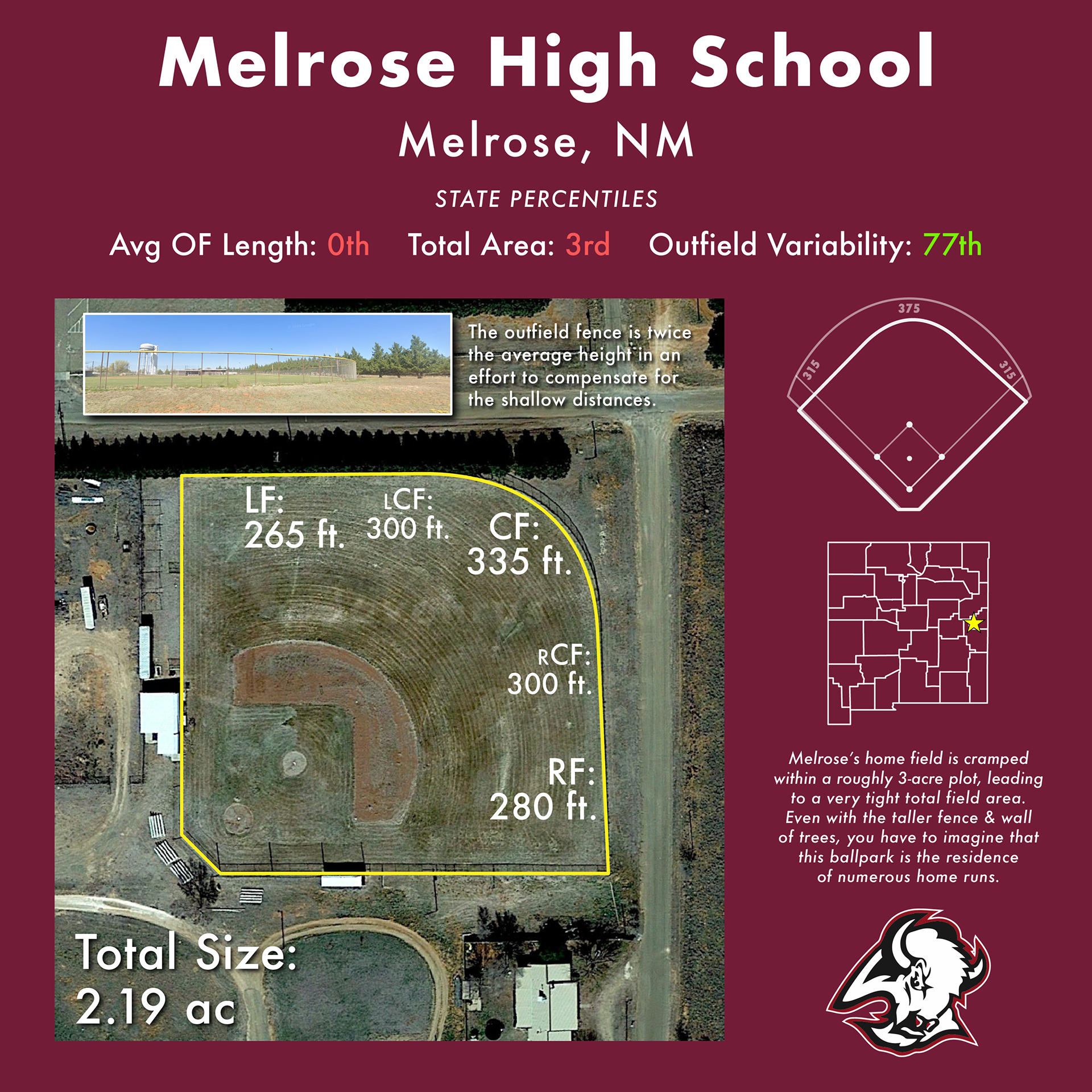
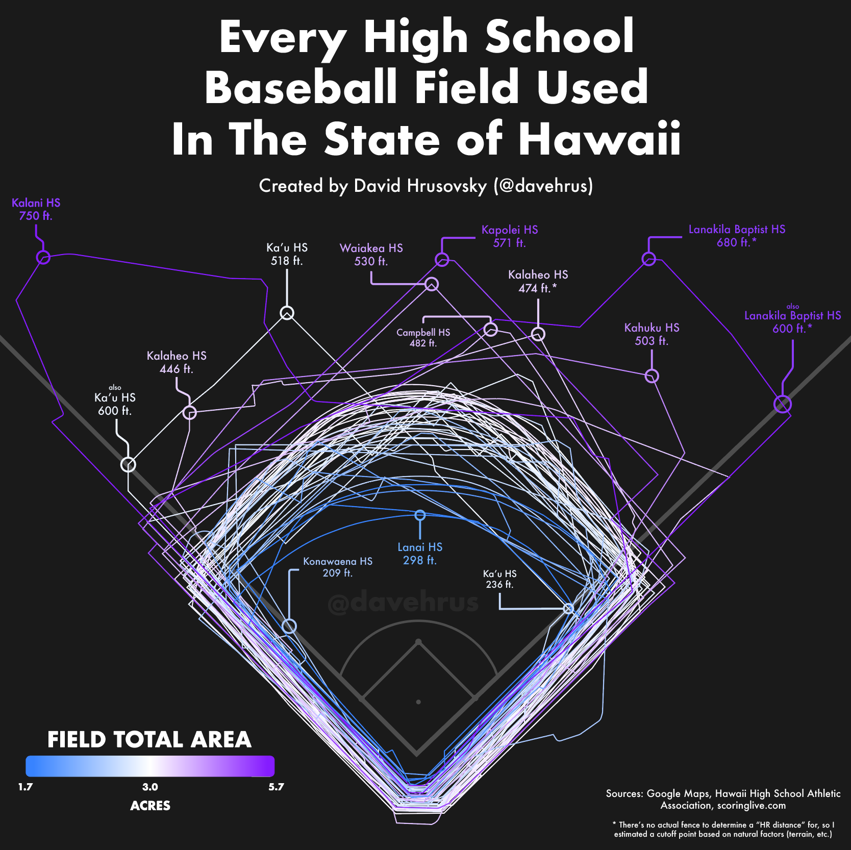
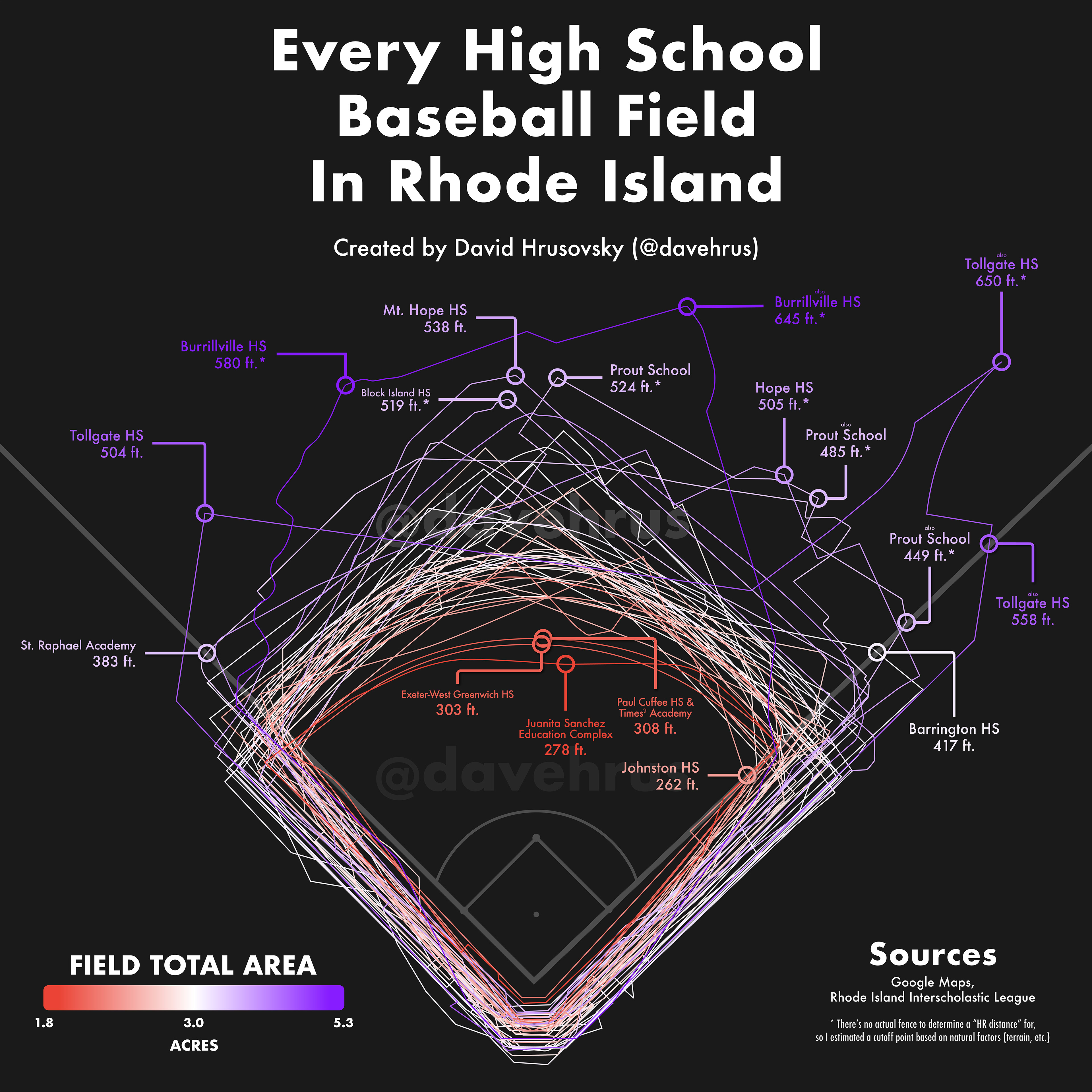
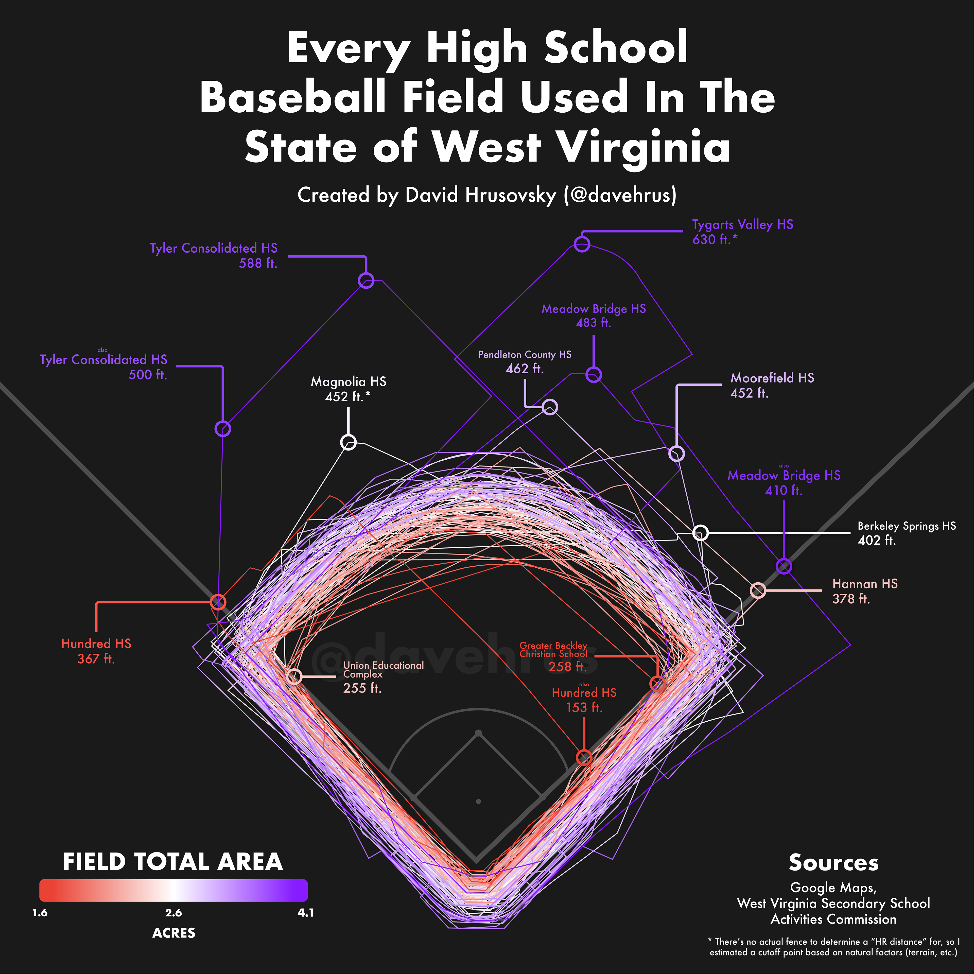
I am currently in the process of plotting, mapping, and calculating the distances of every baseball field used for varsity high school games in America. I started this project in early April 2020. Since then, I have accumulated the data for over 2,000 fields spanning 13 states: (Alaska, Connecticut, Delaware, Hawaii, Maine, Nebraska, Nevada, New Hampshire, North Dakota, Ohio, Rhode Island, Utah, & West Virginia) and eventually plan on completing all 50 states.
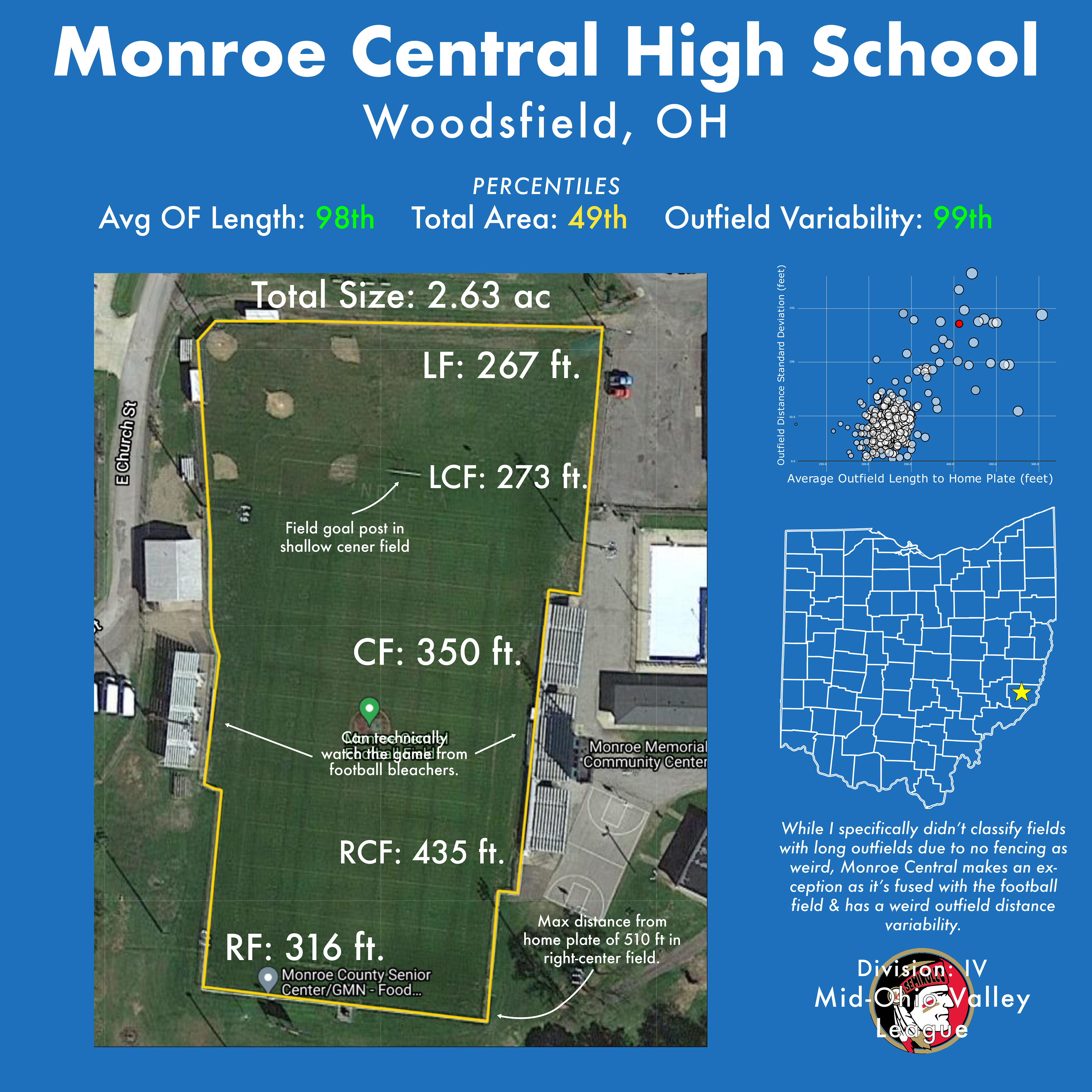
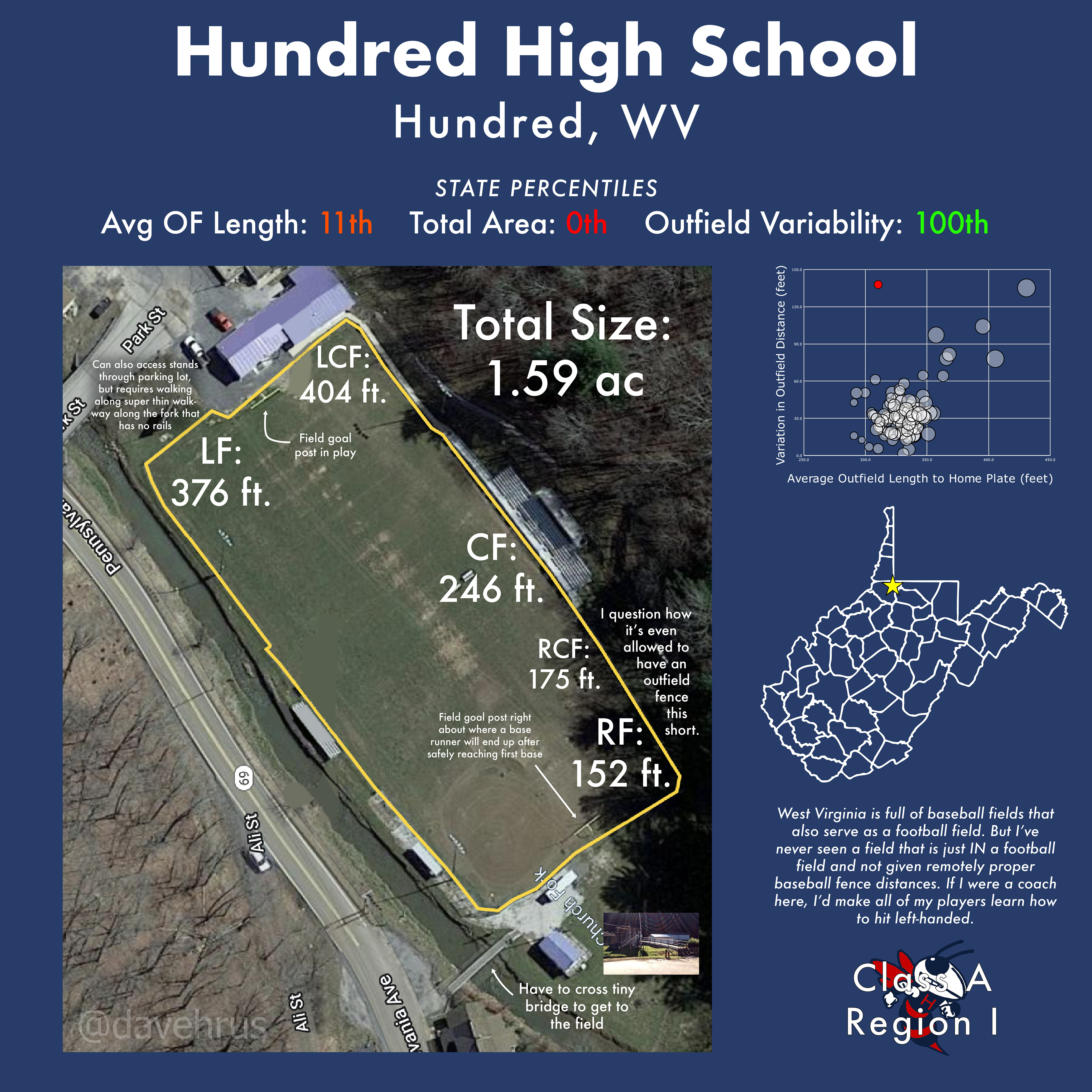
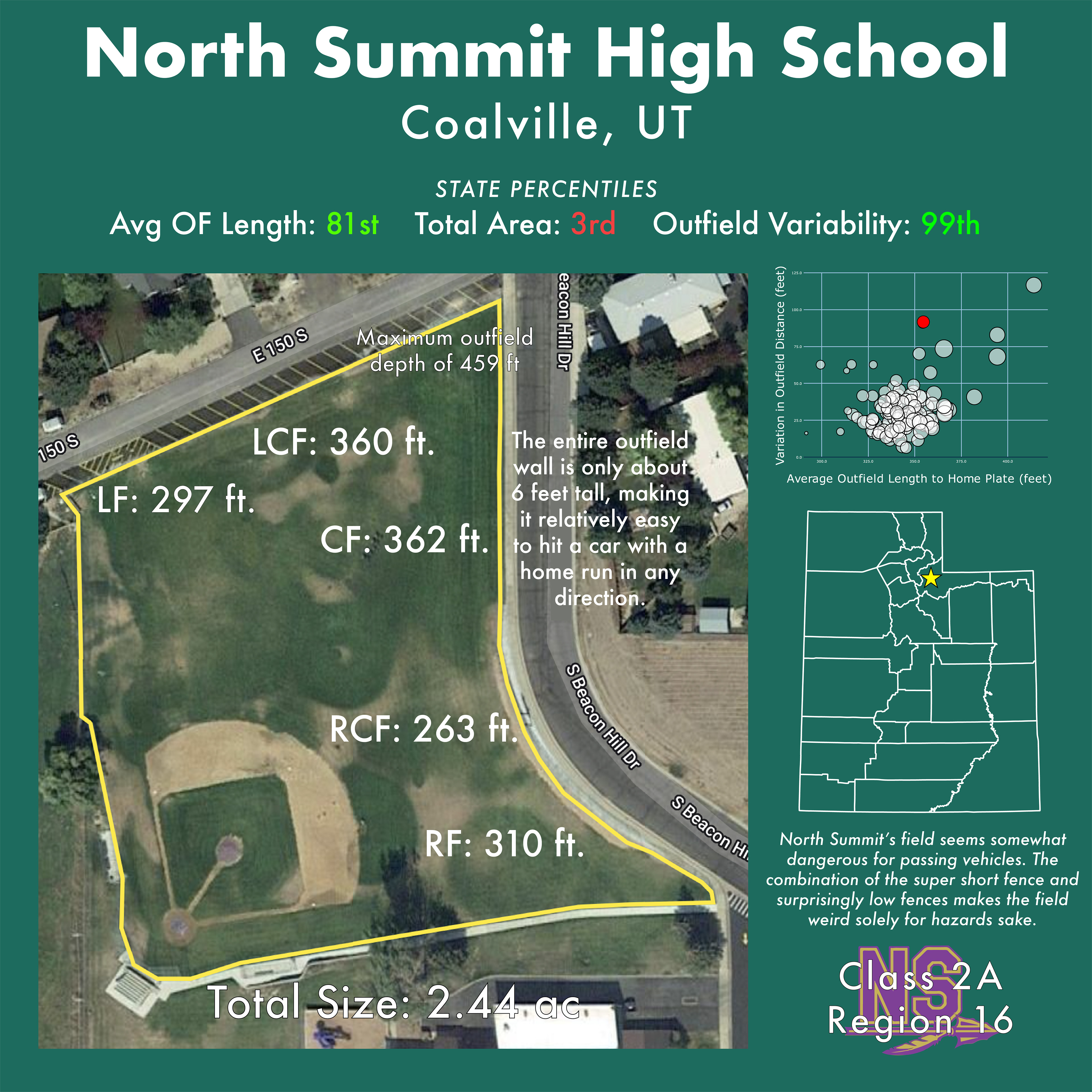
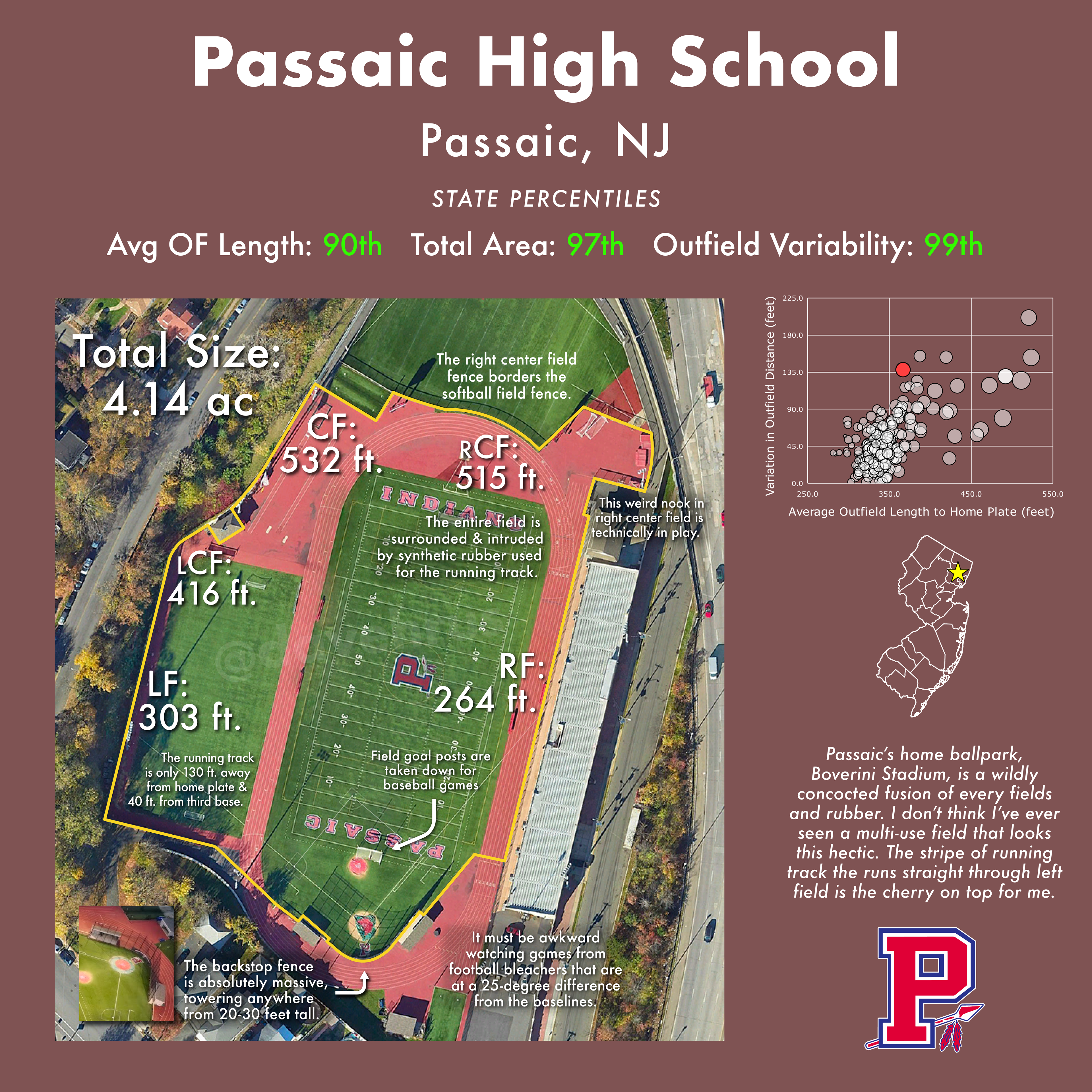
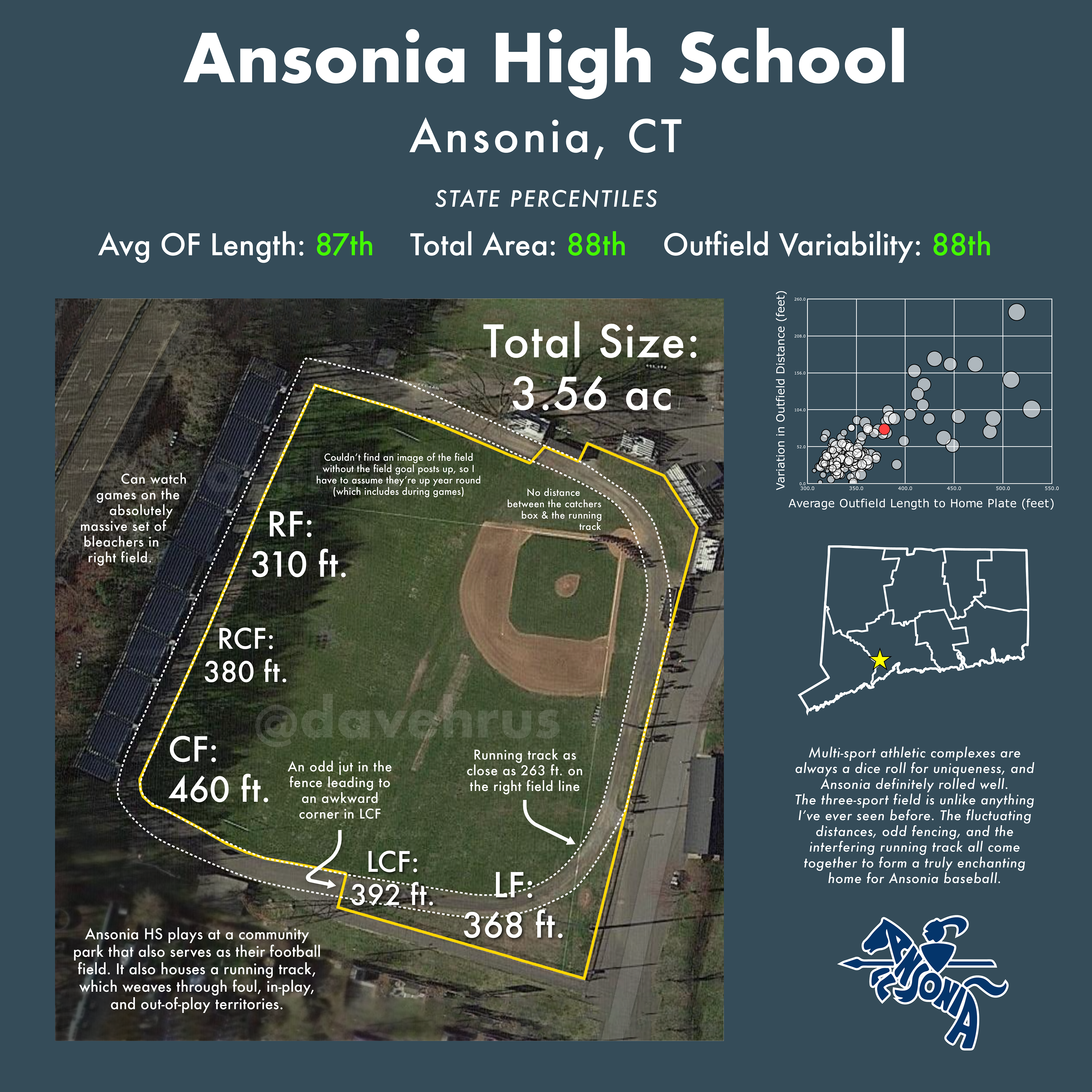
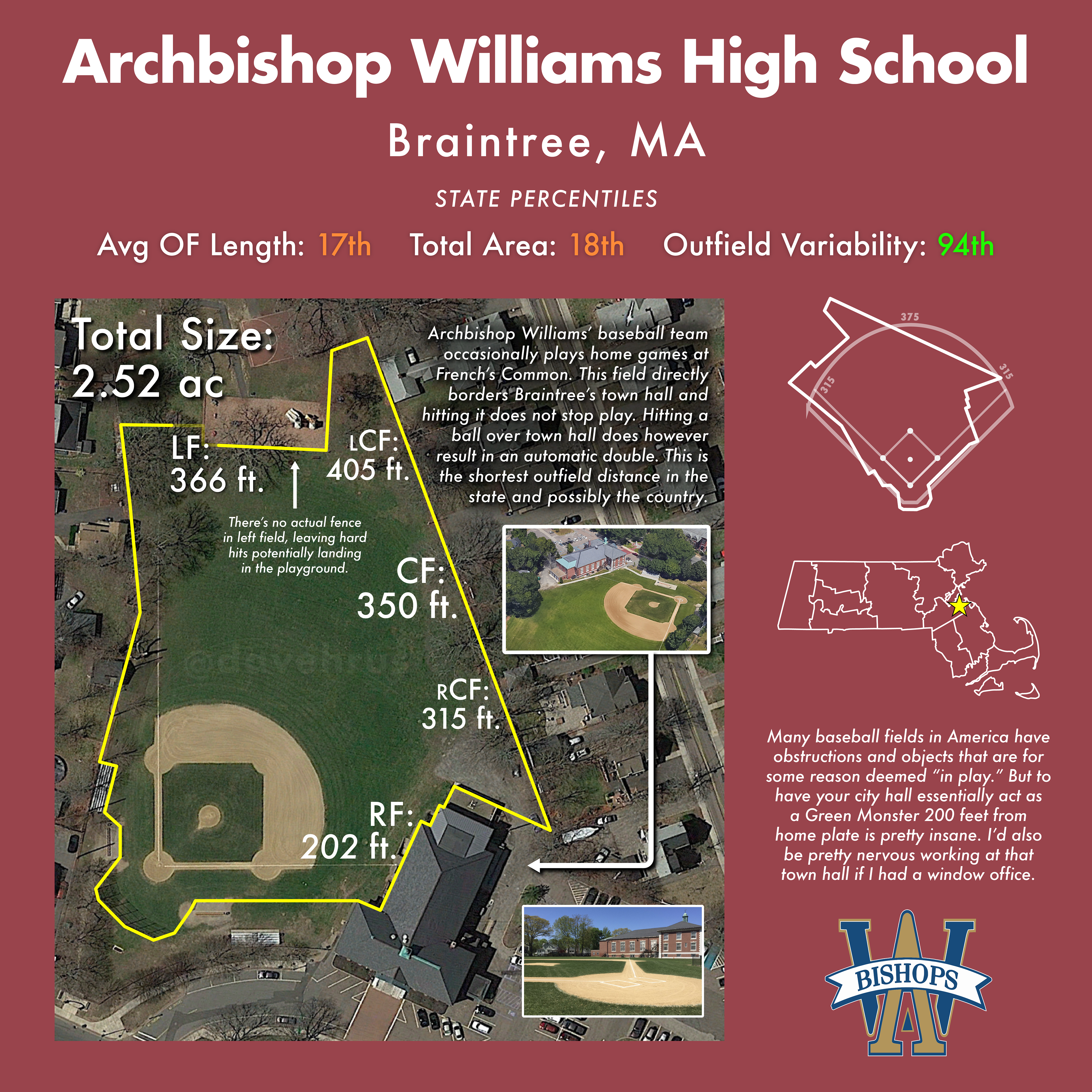
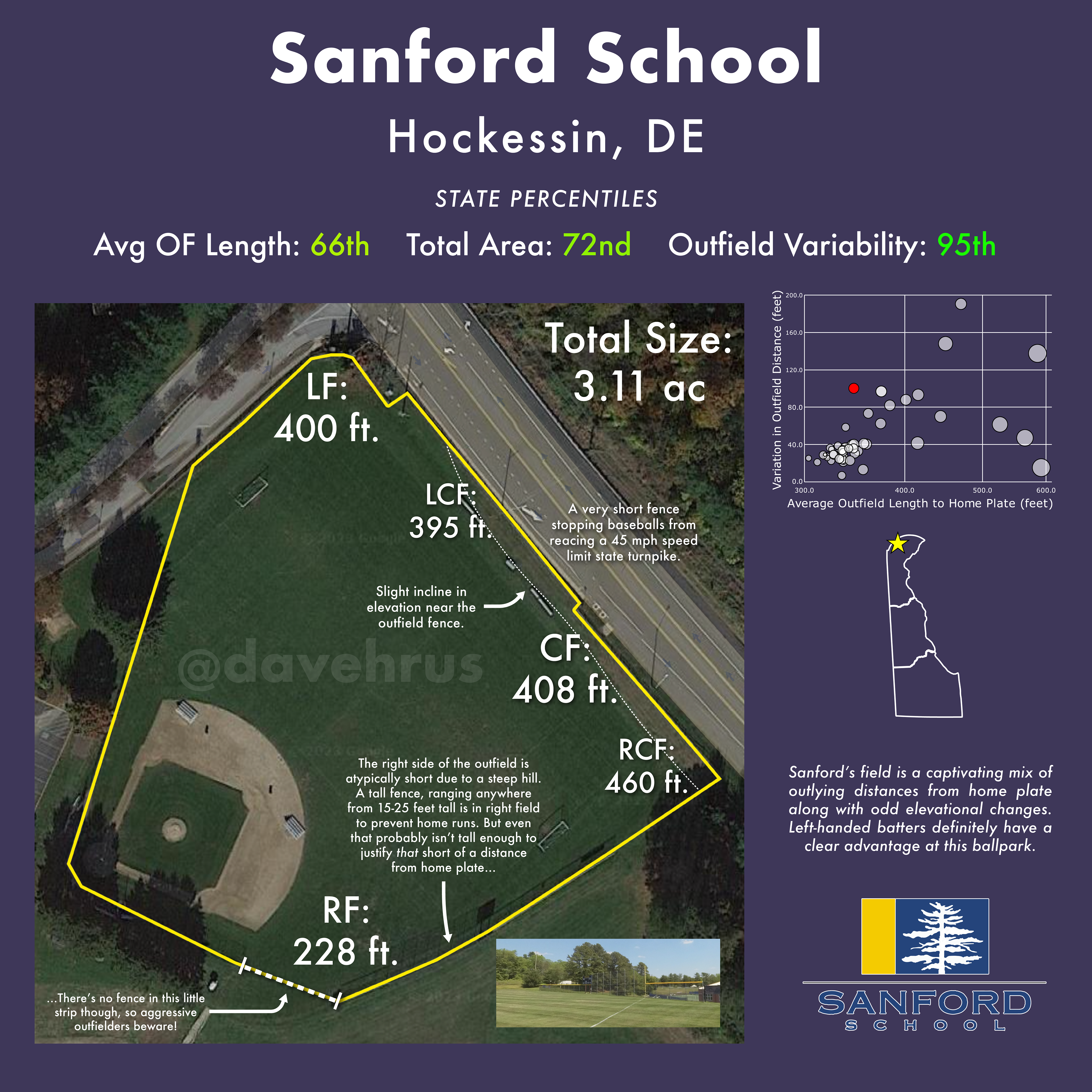
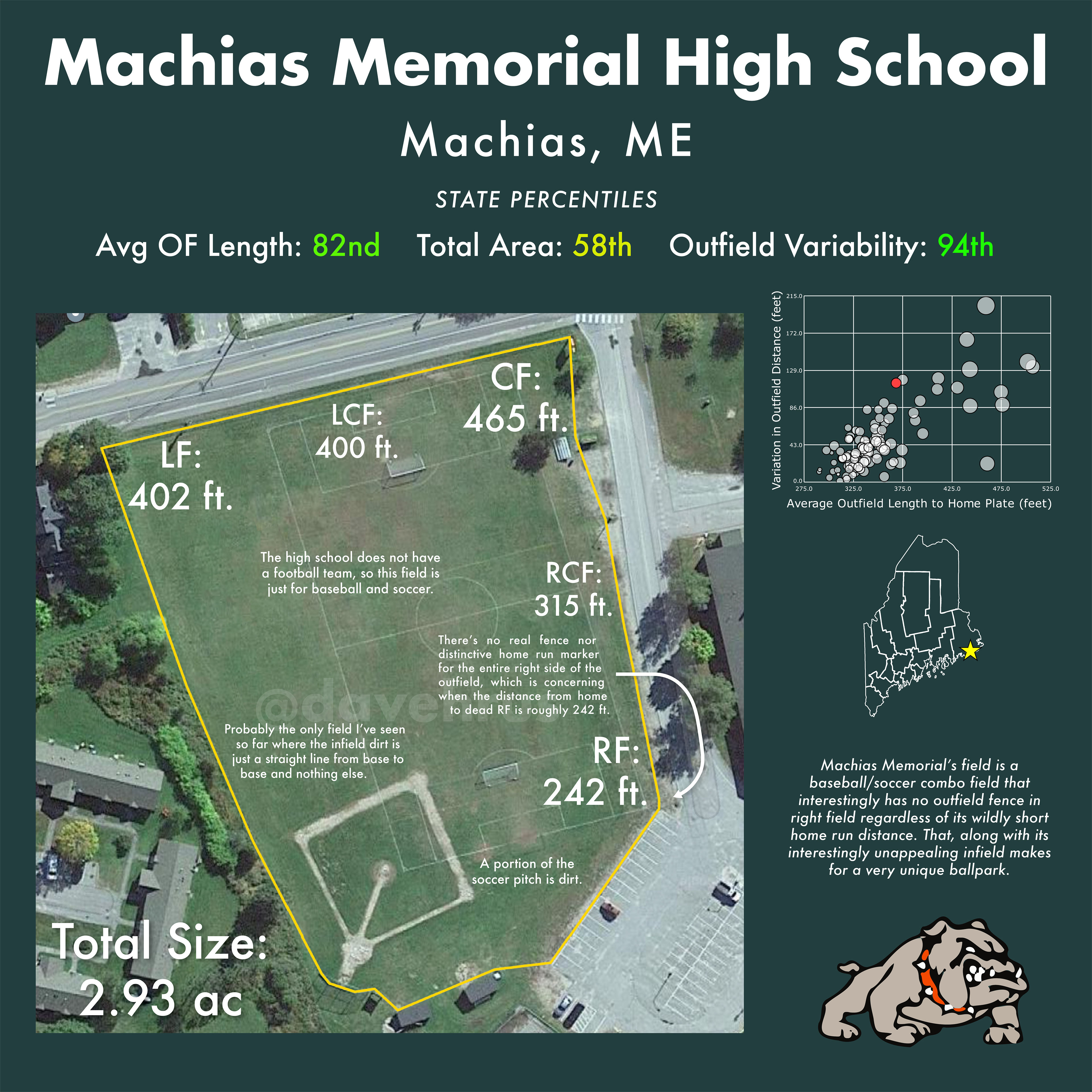
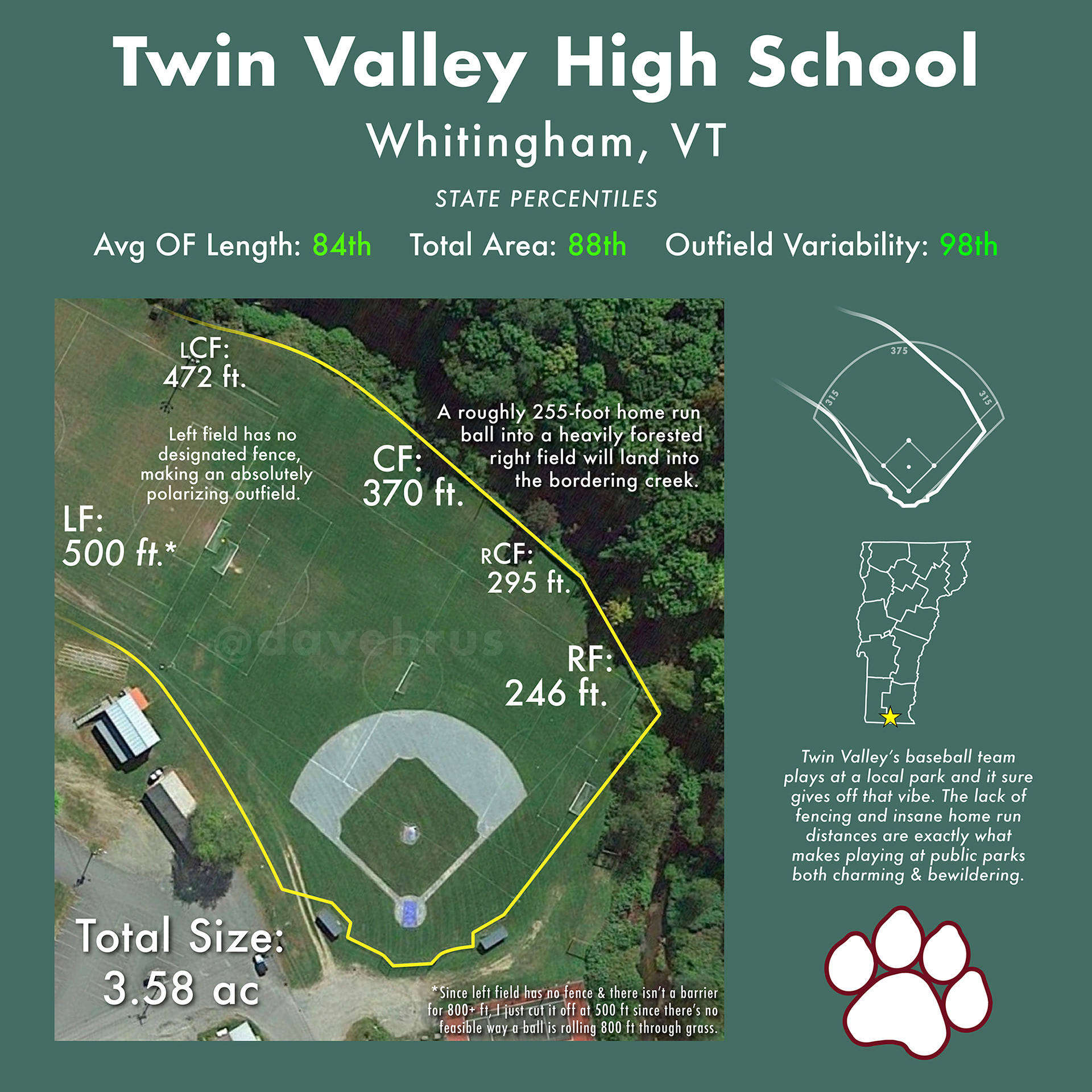
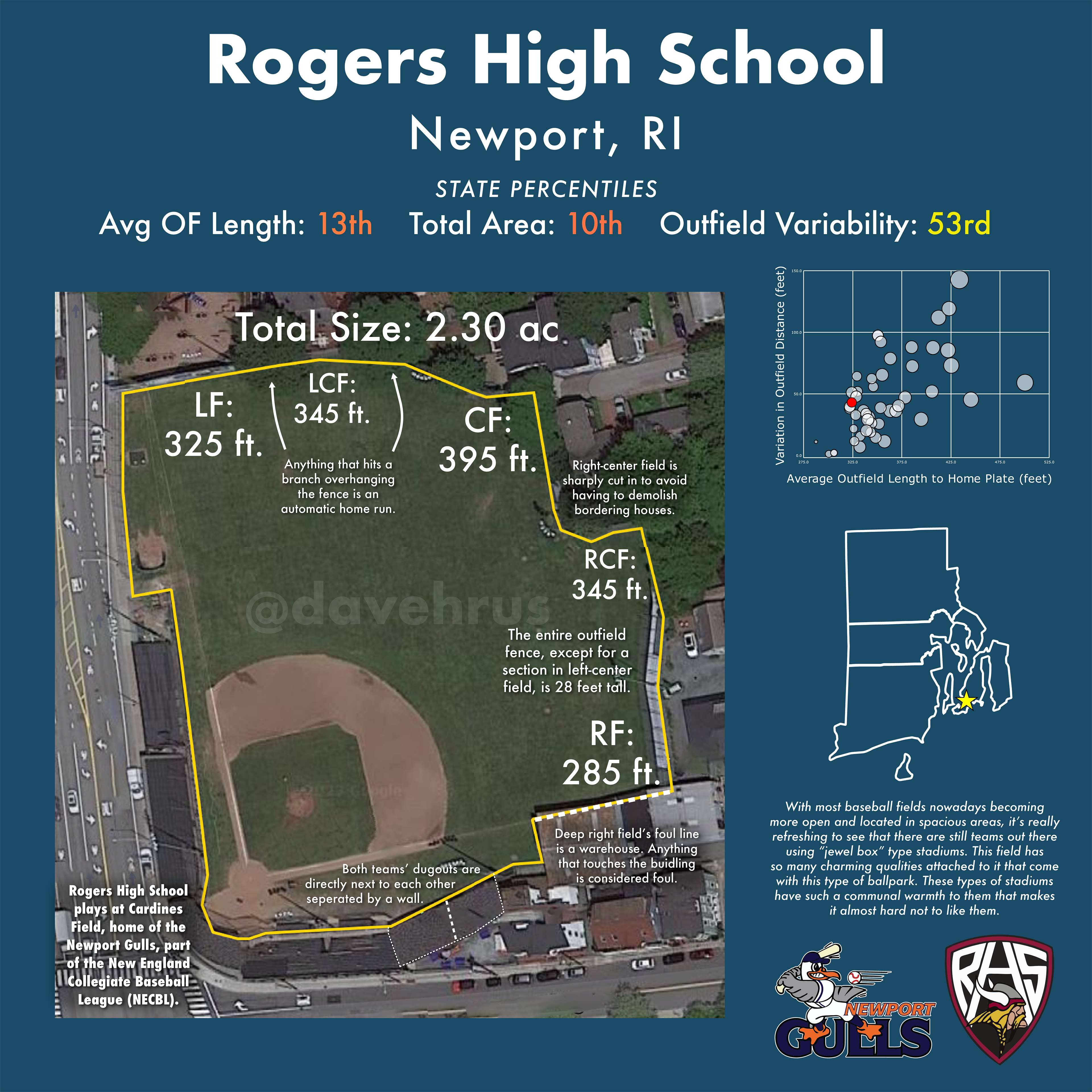
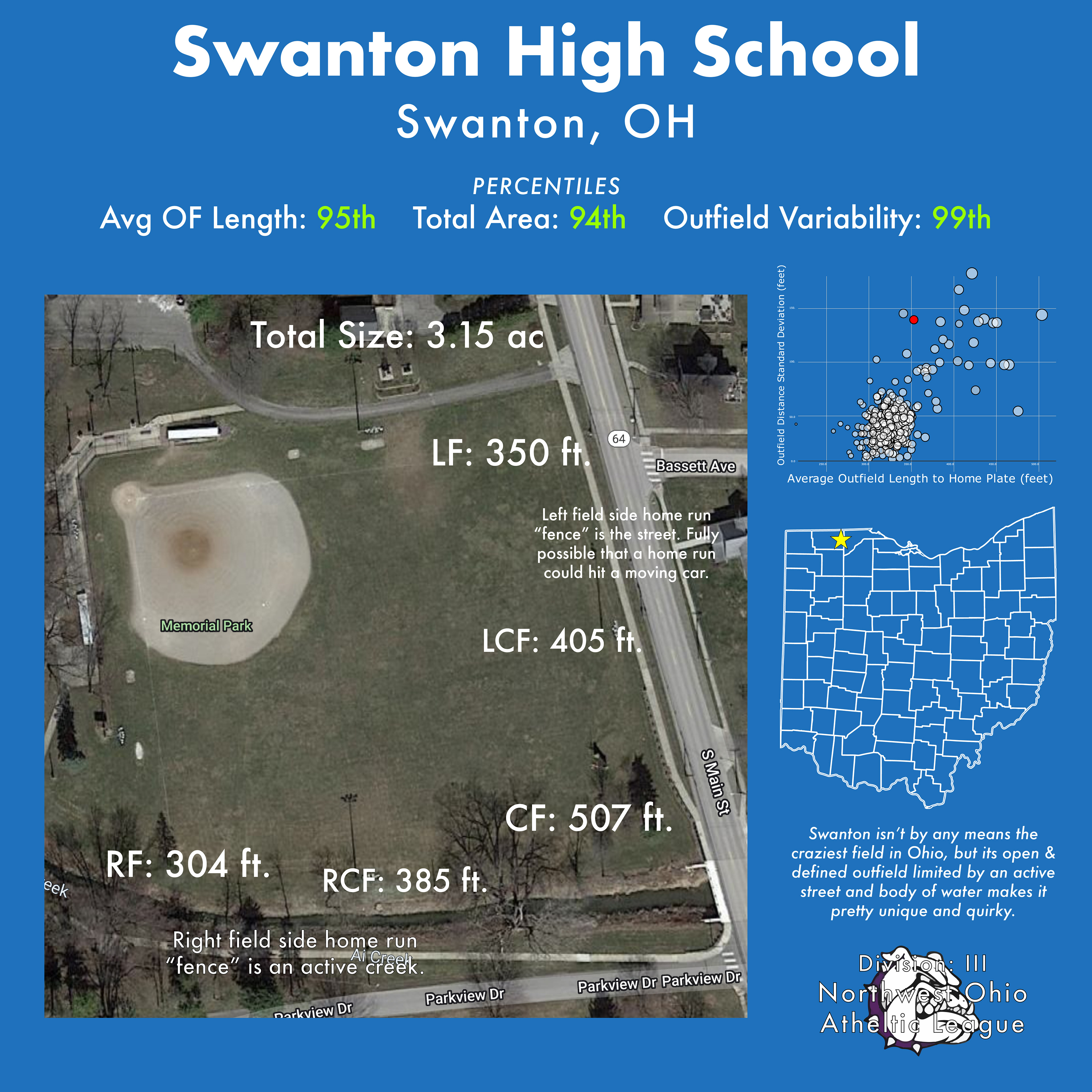
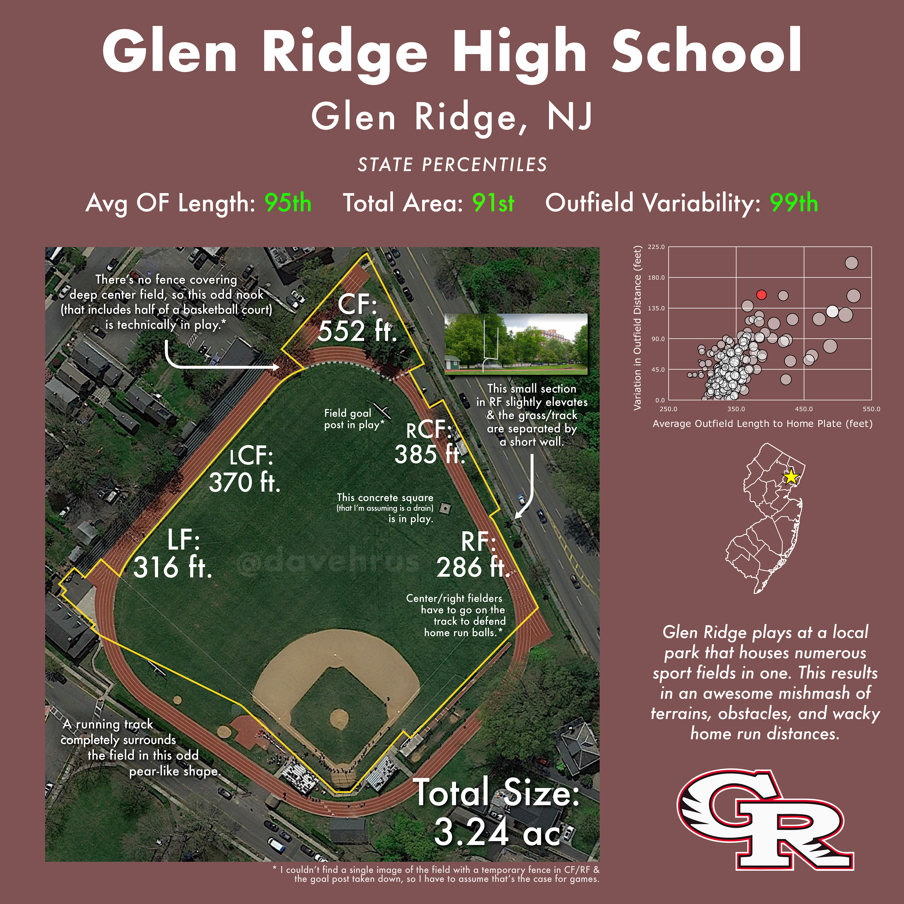
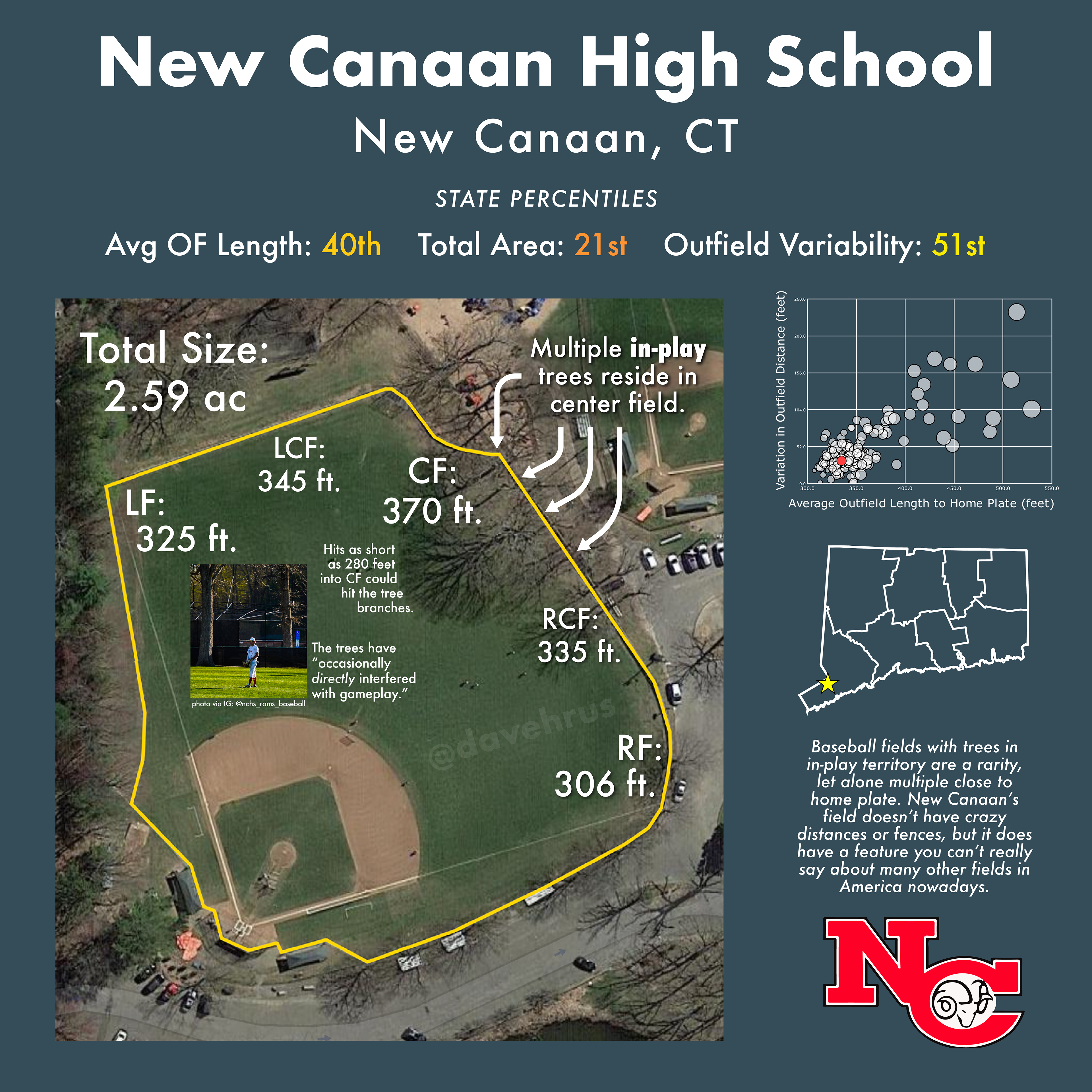
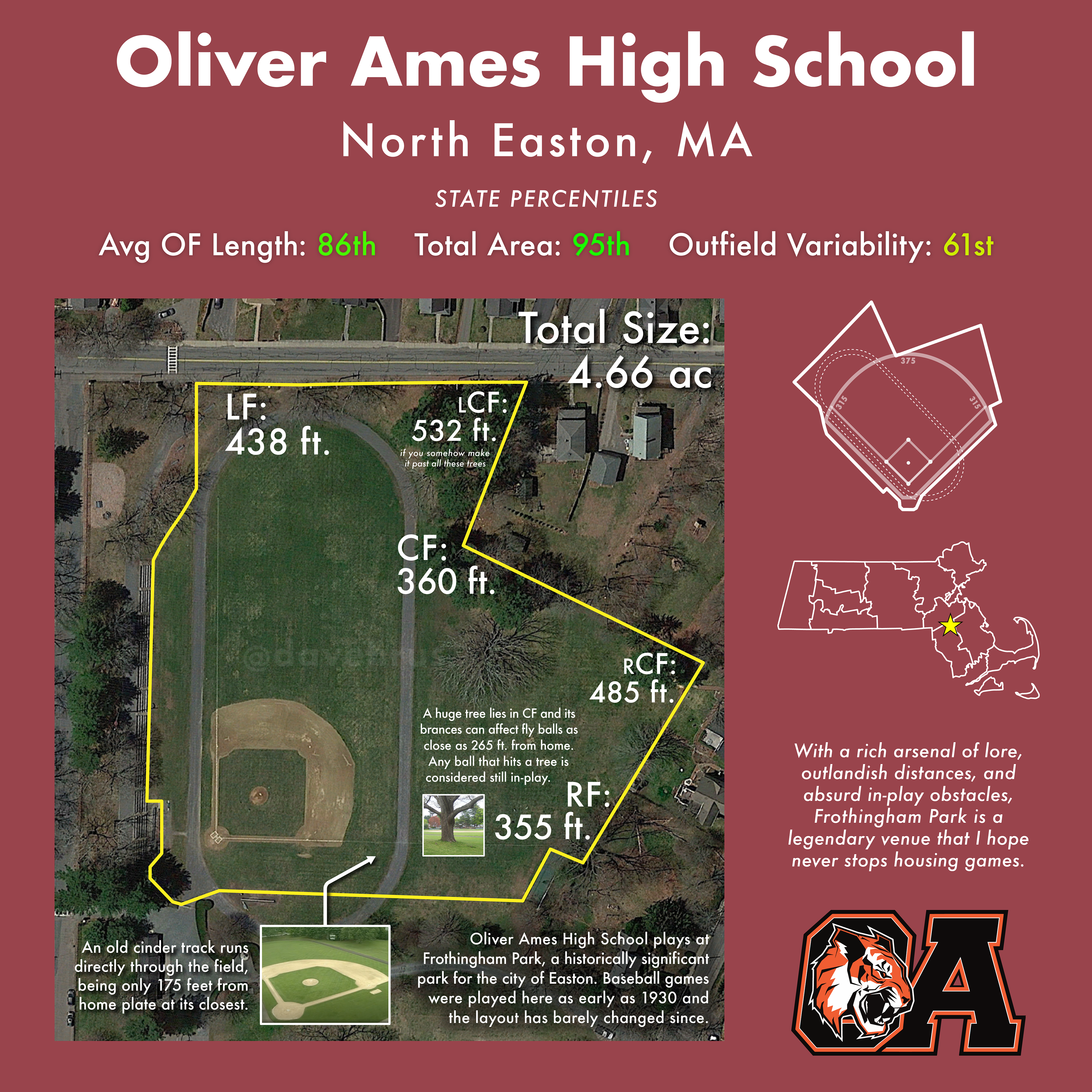
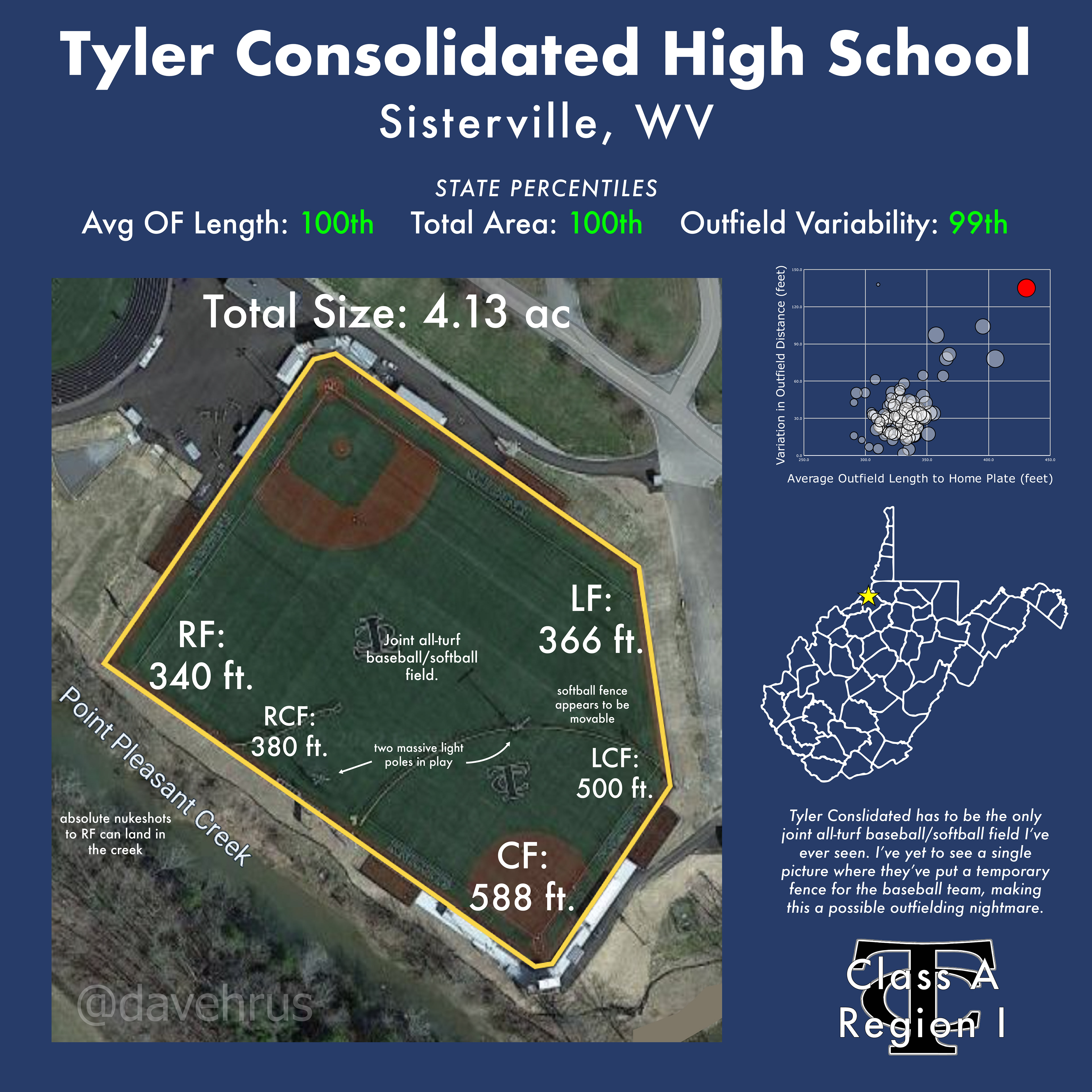
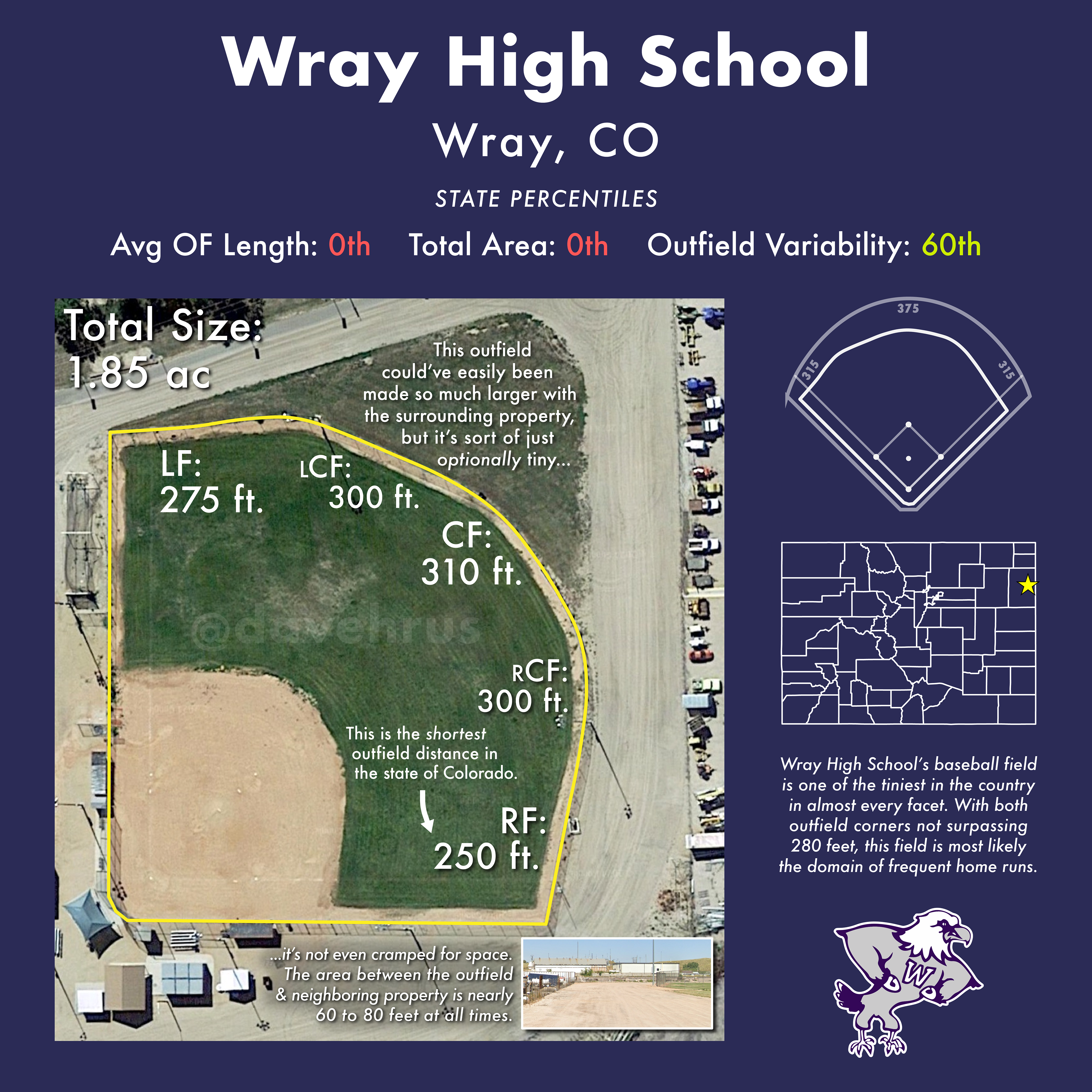
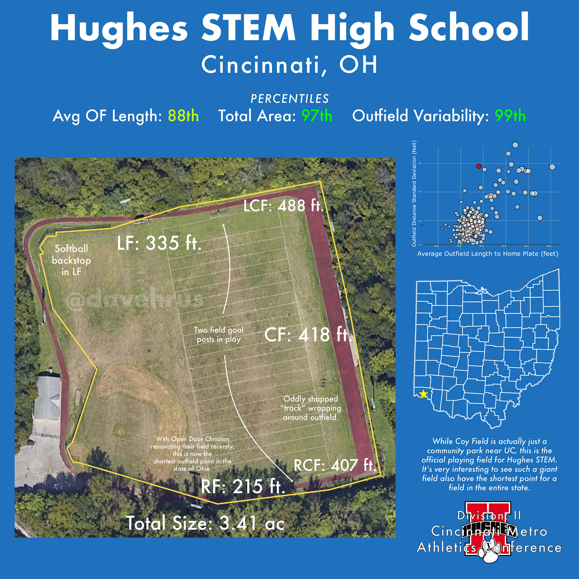
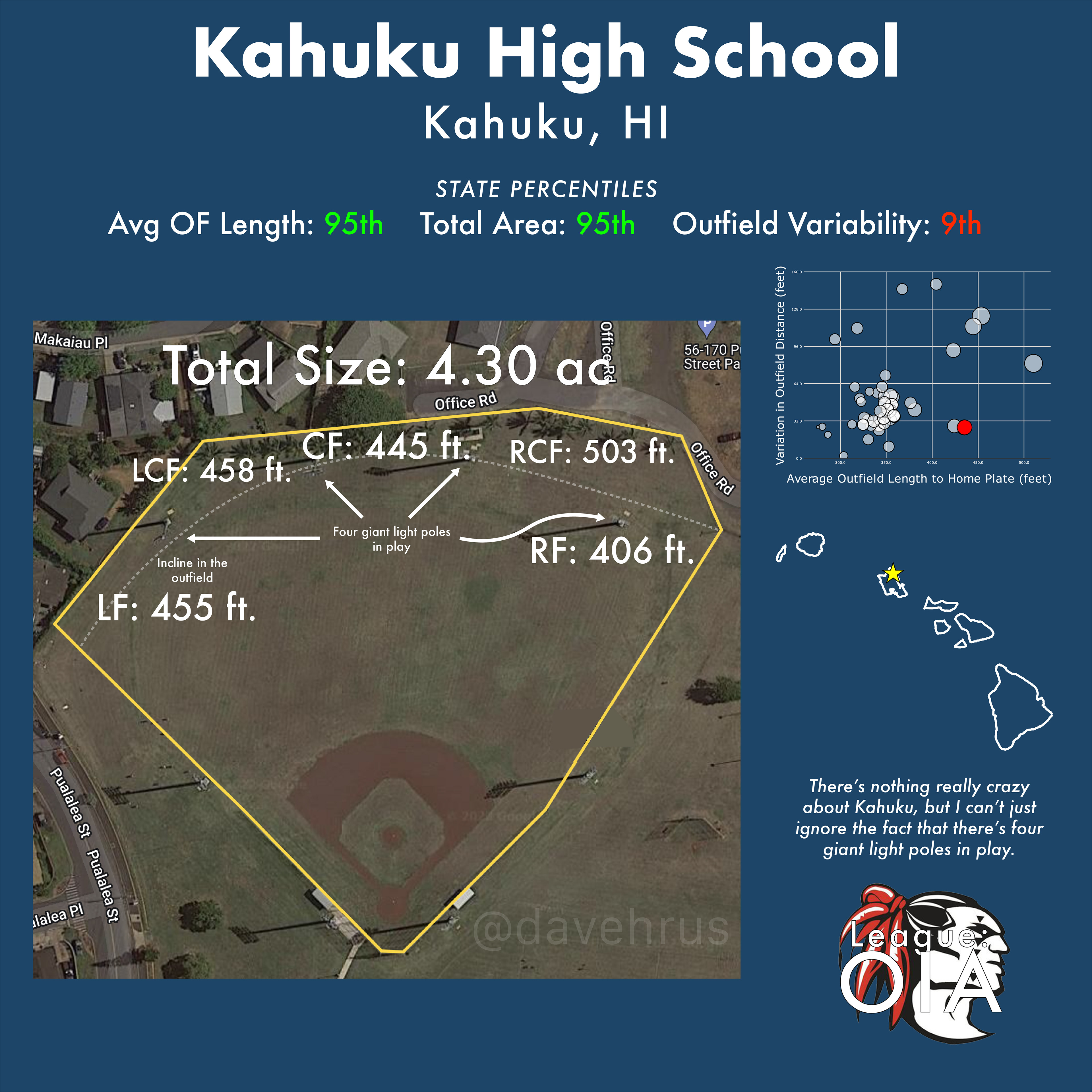
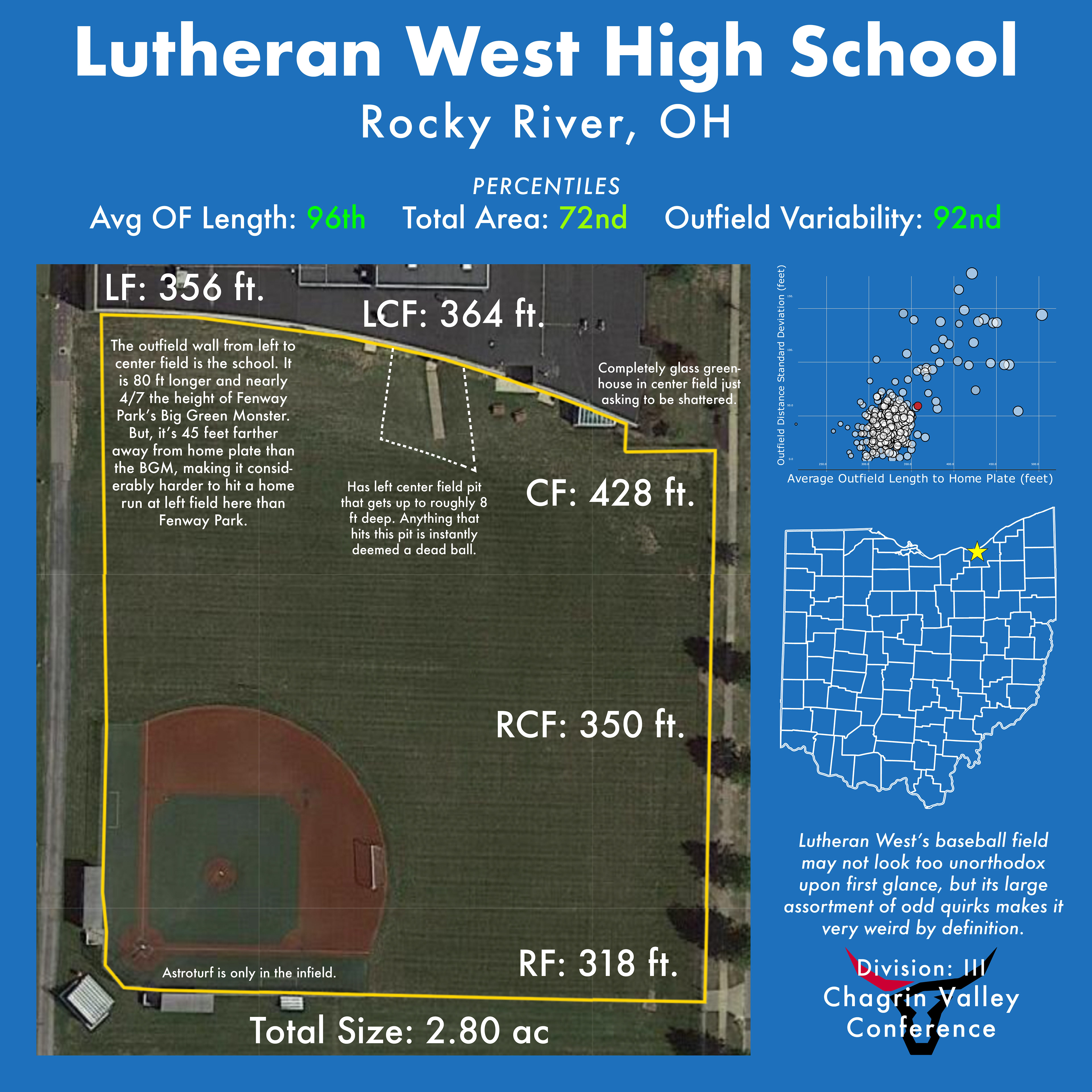
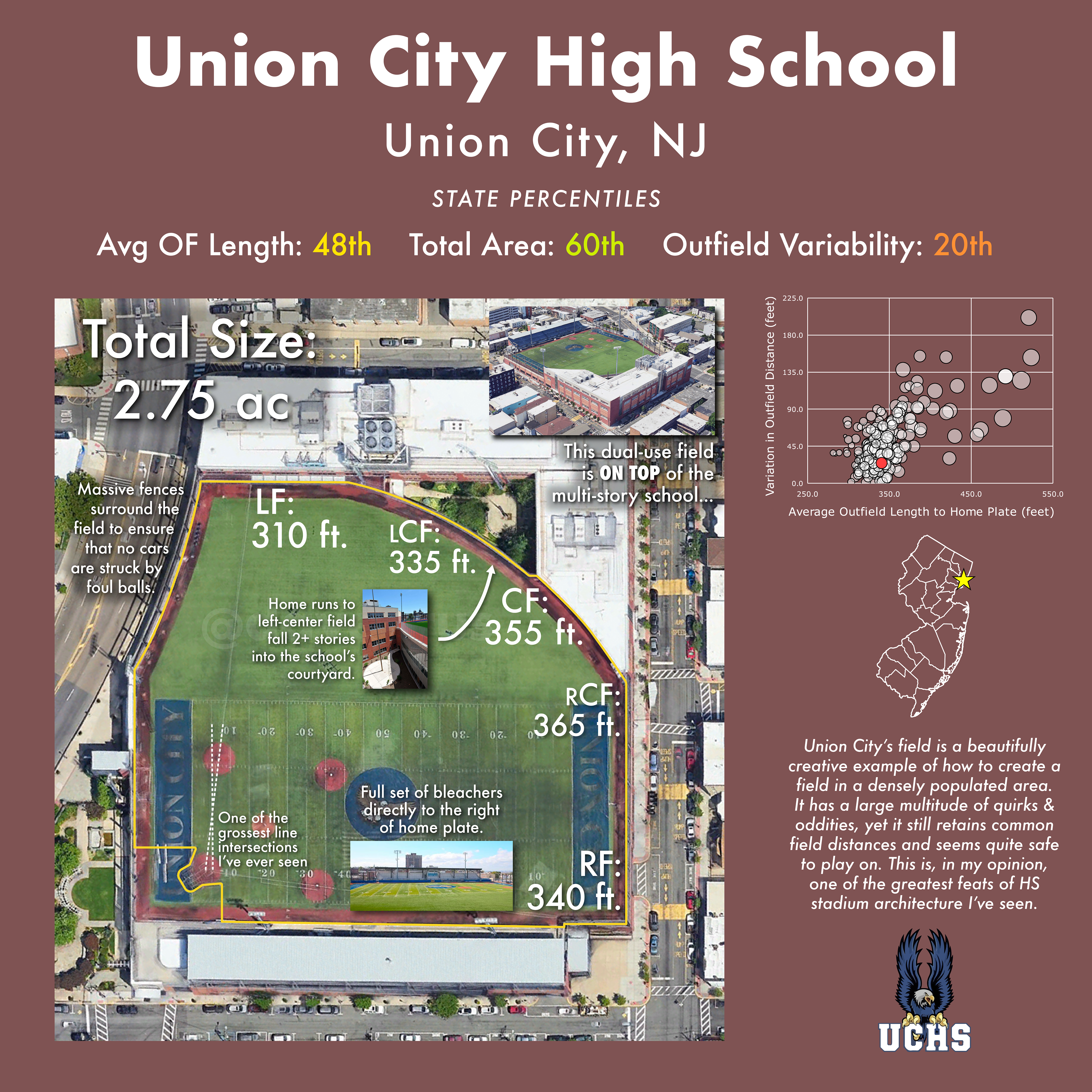
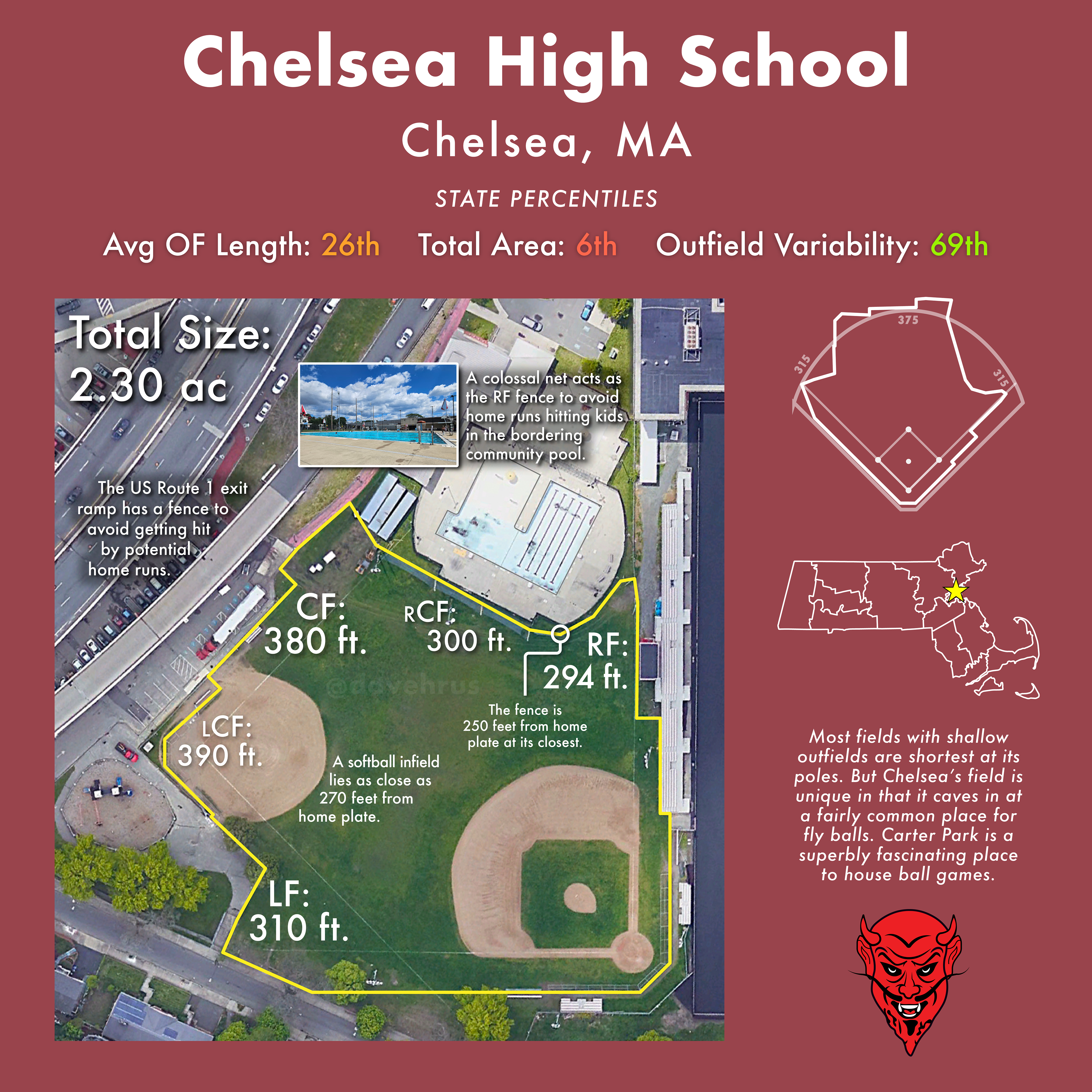
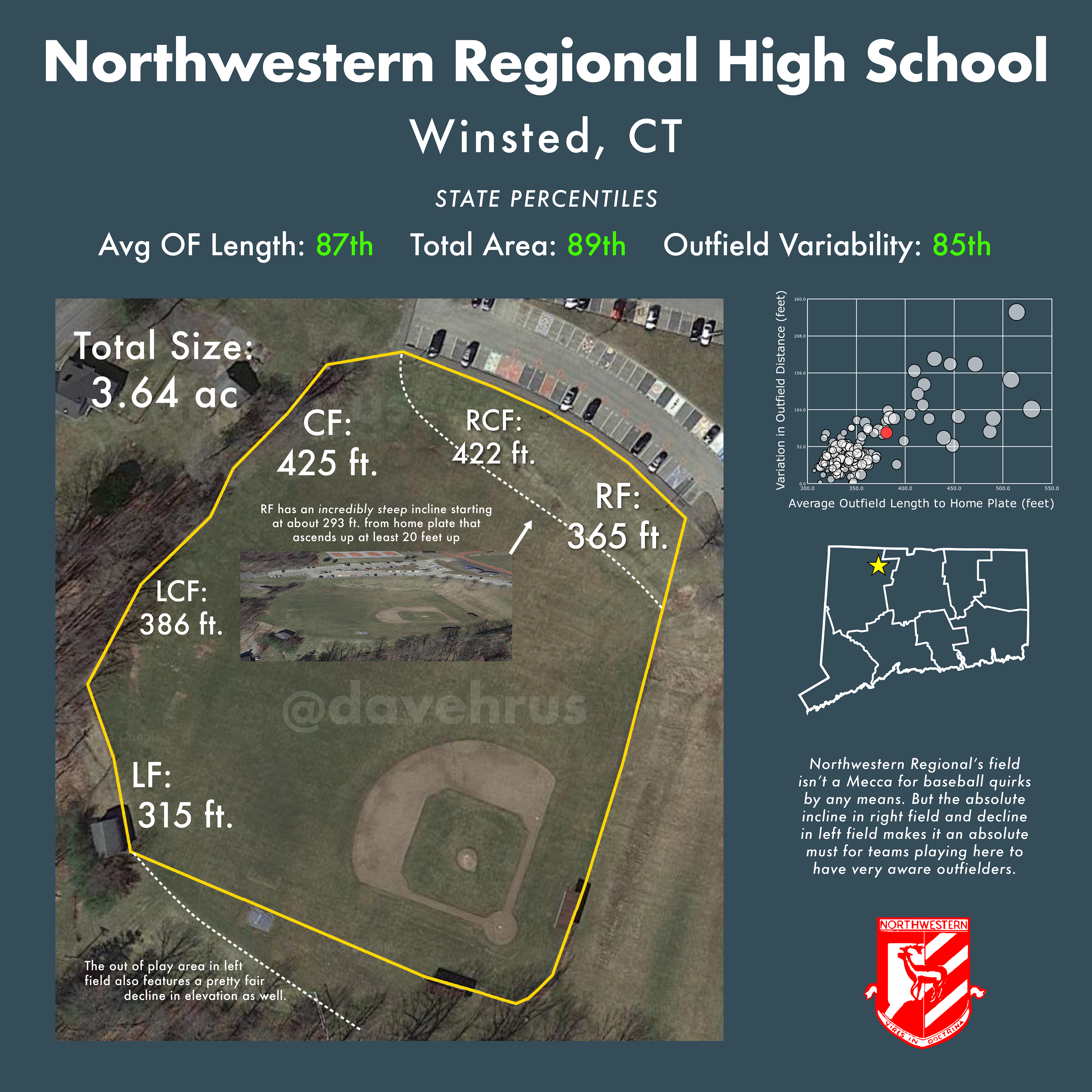
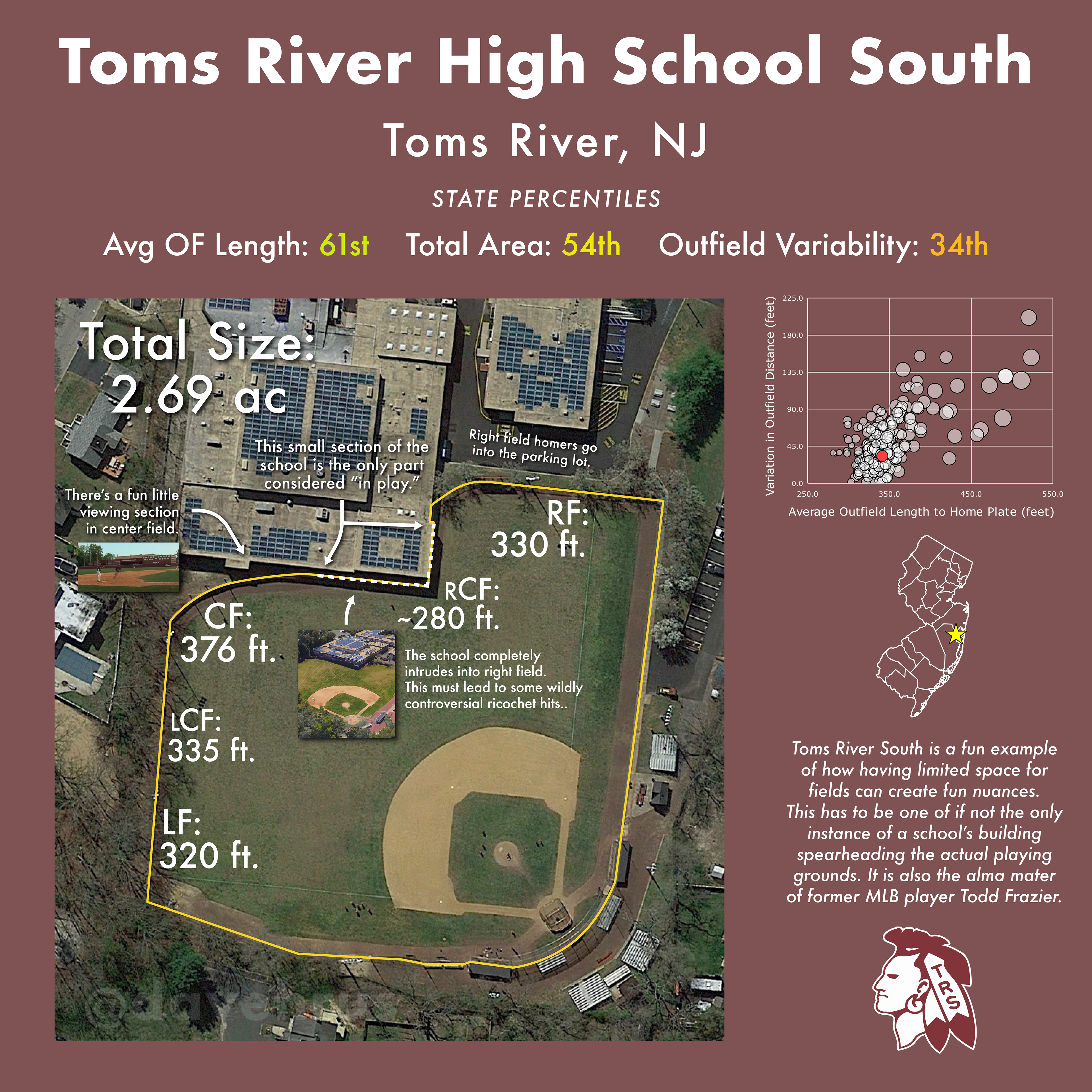
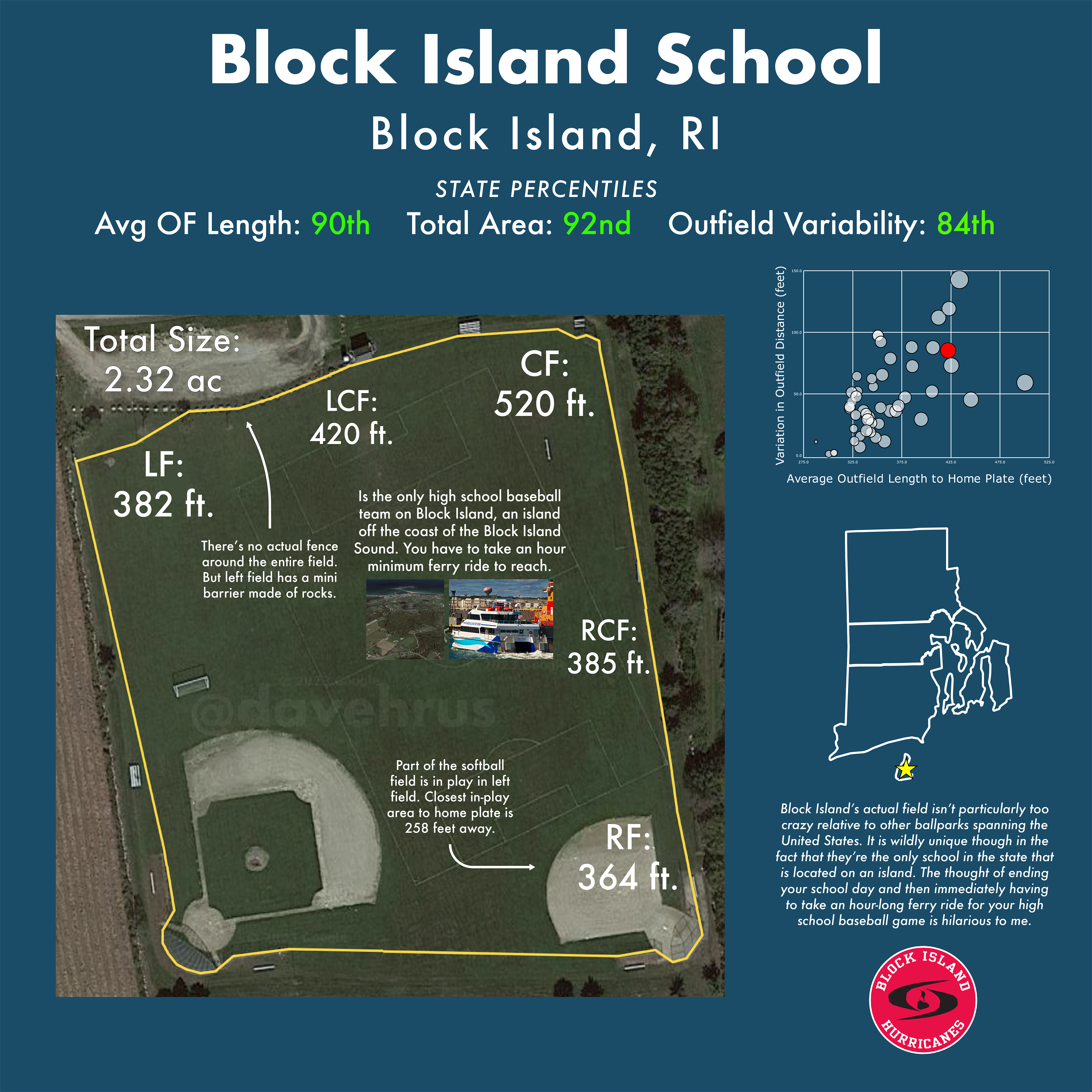
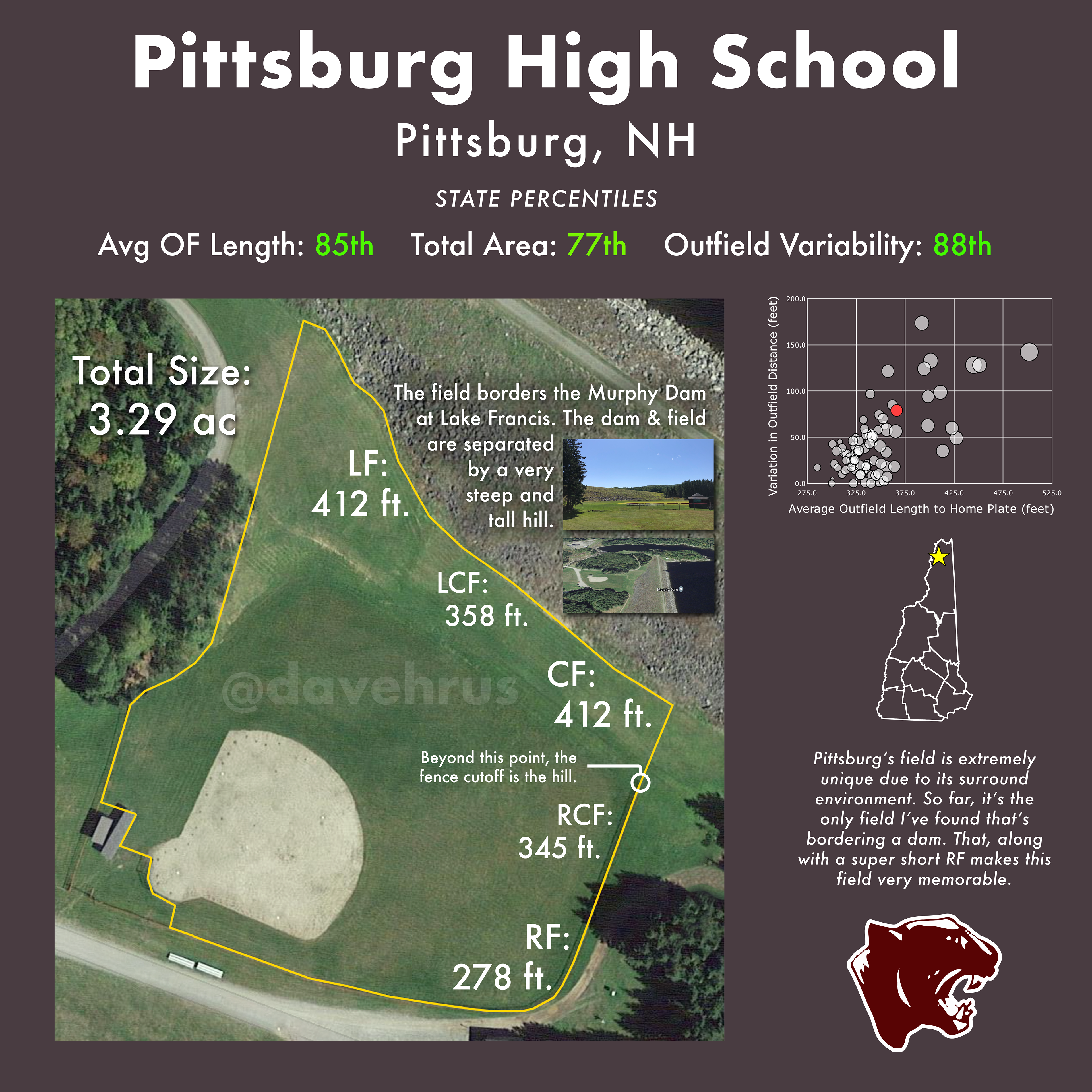
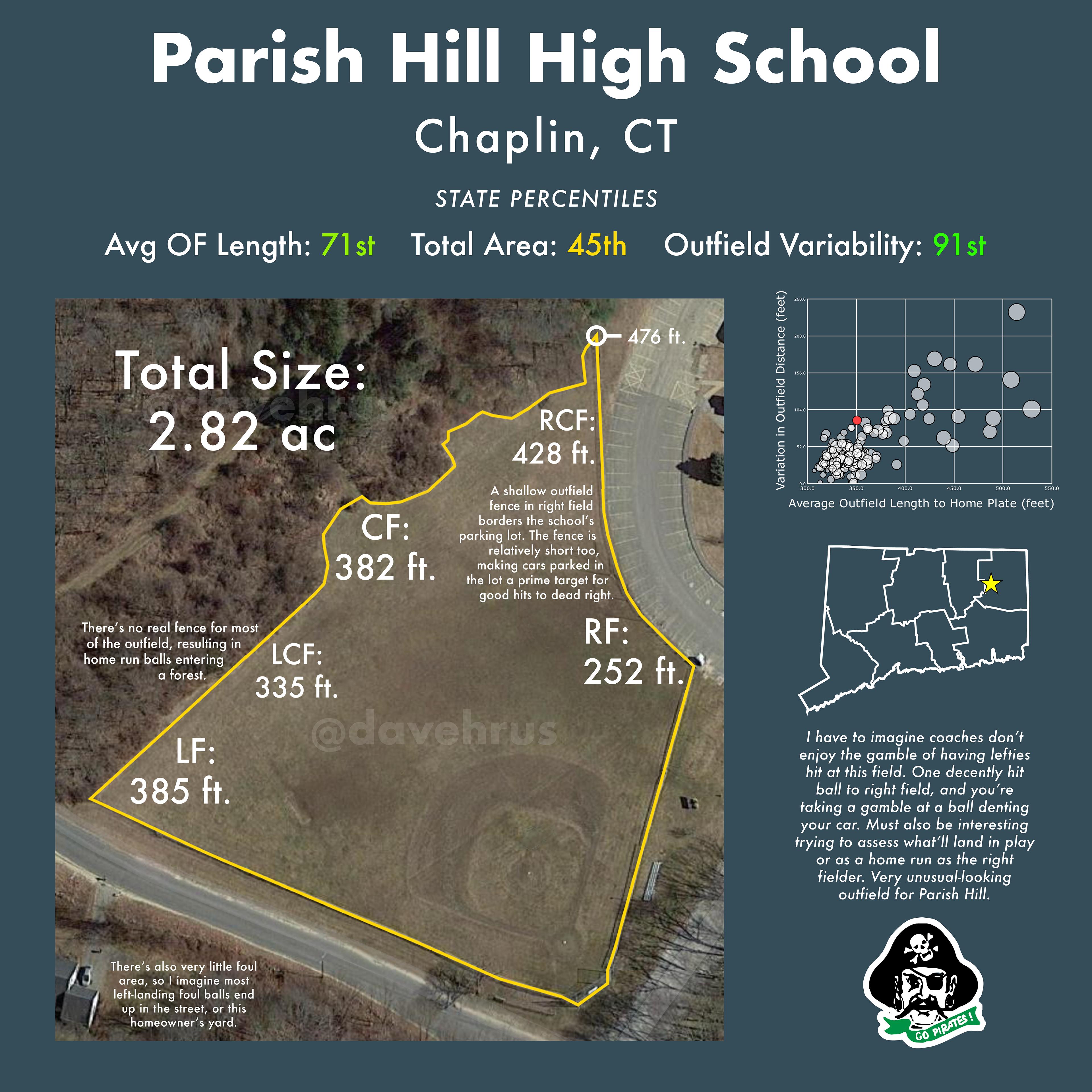
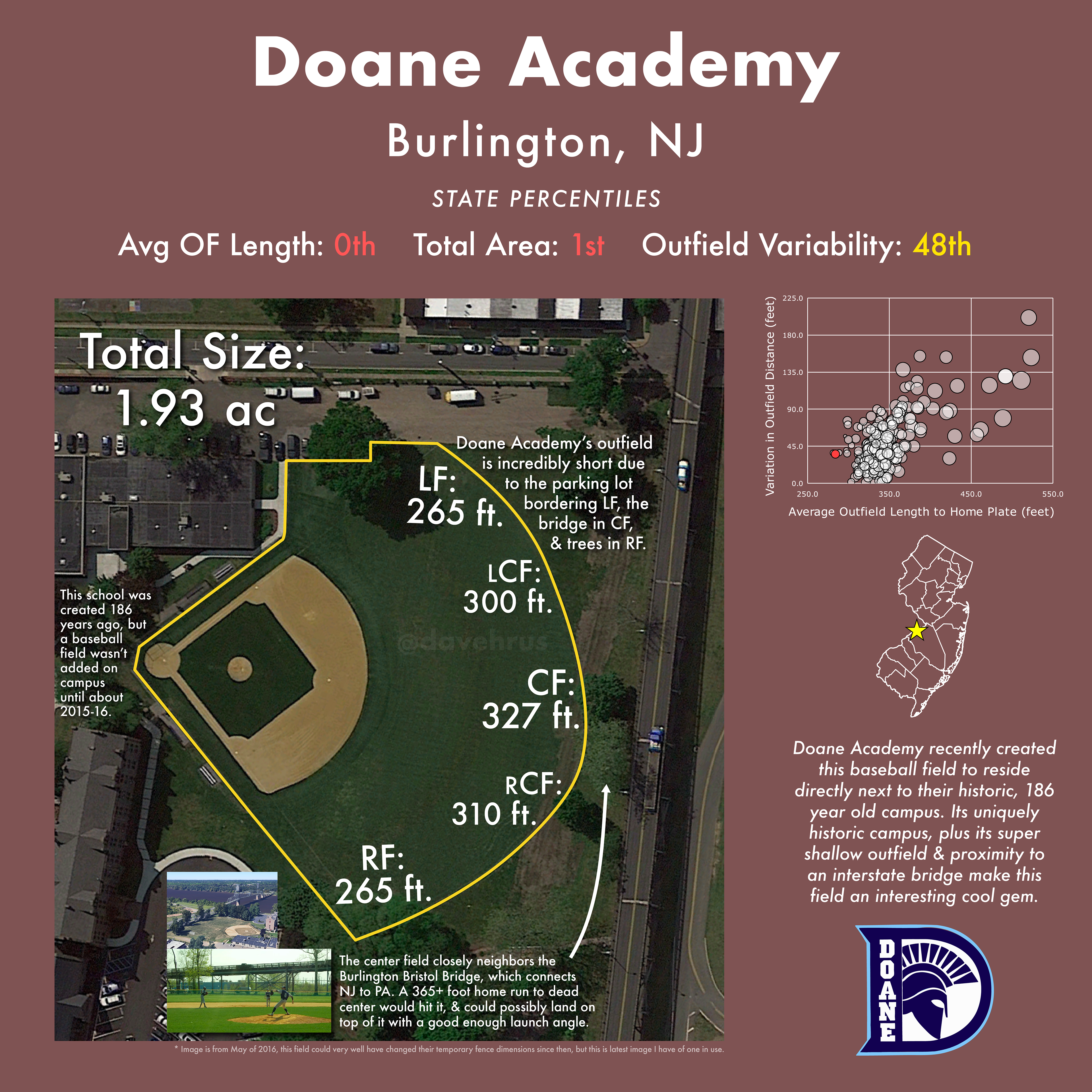
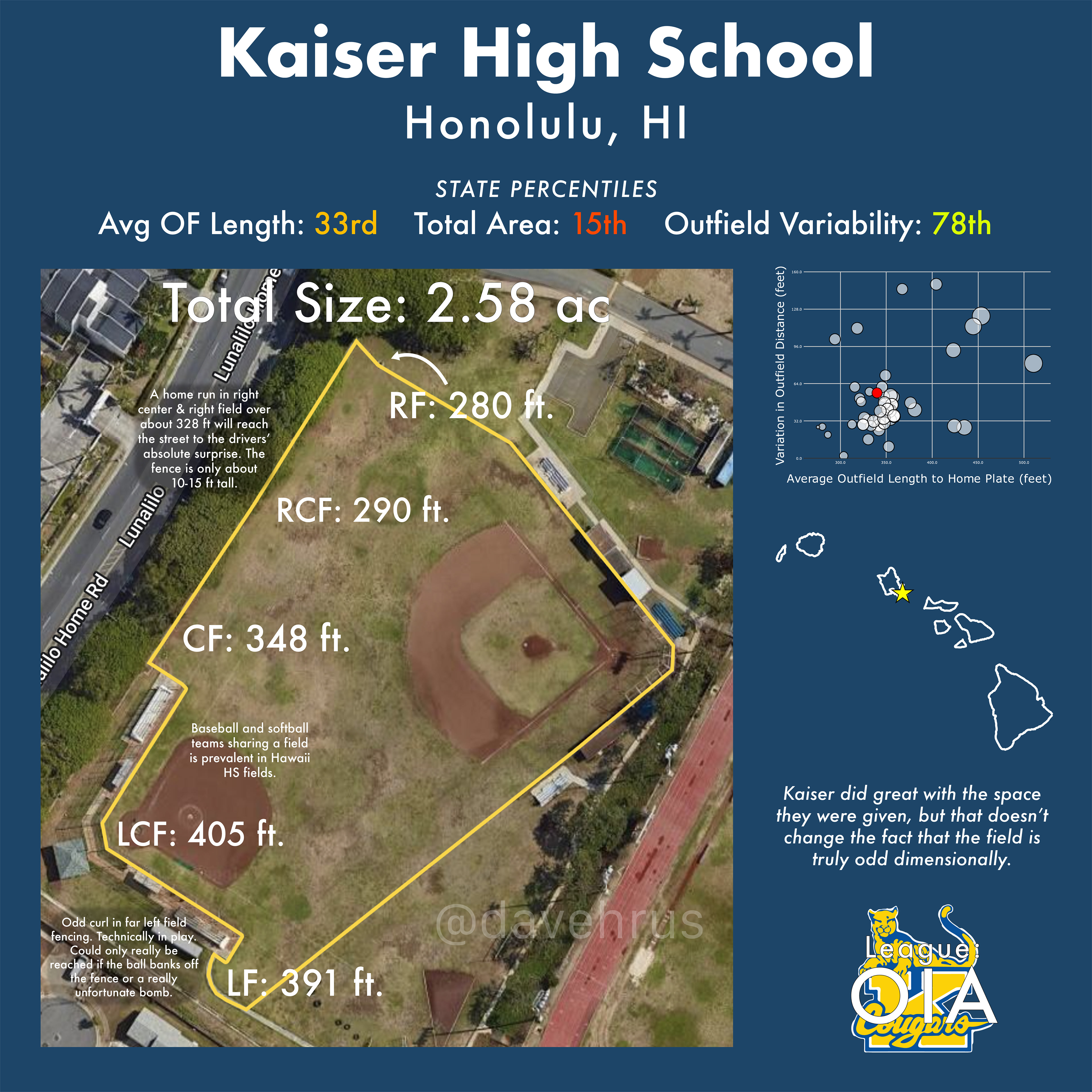
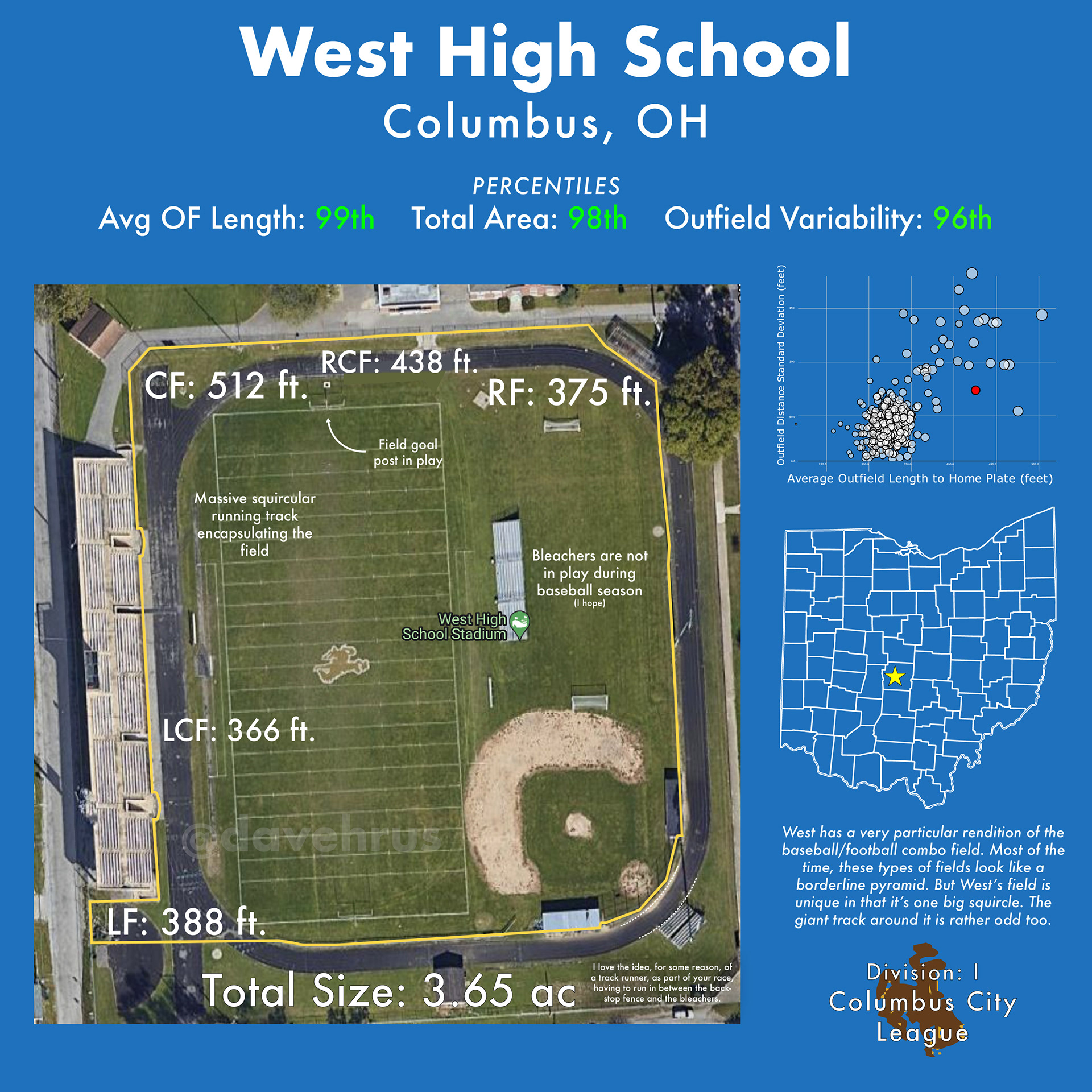
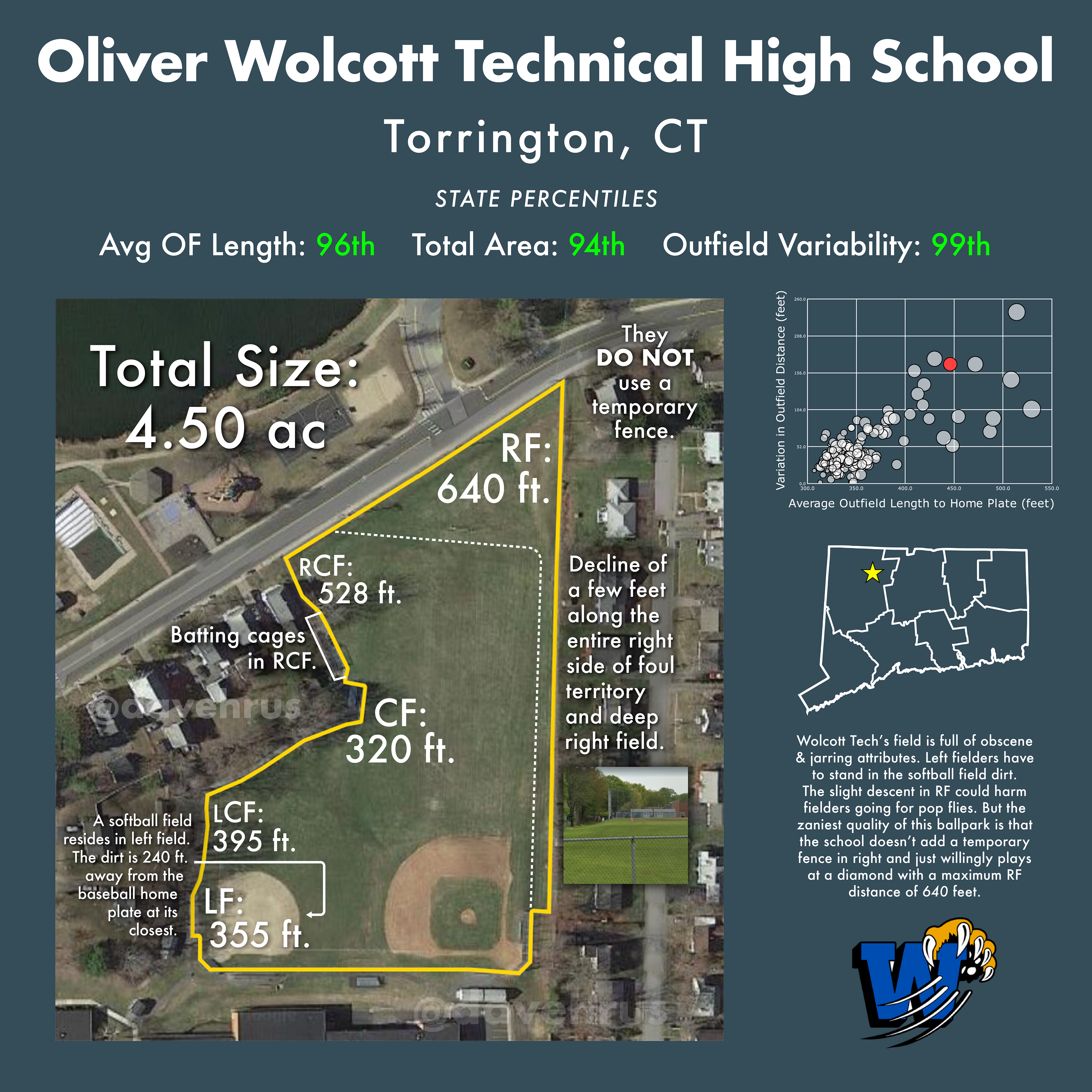
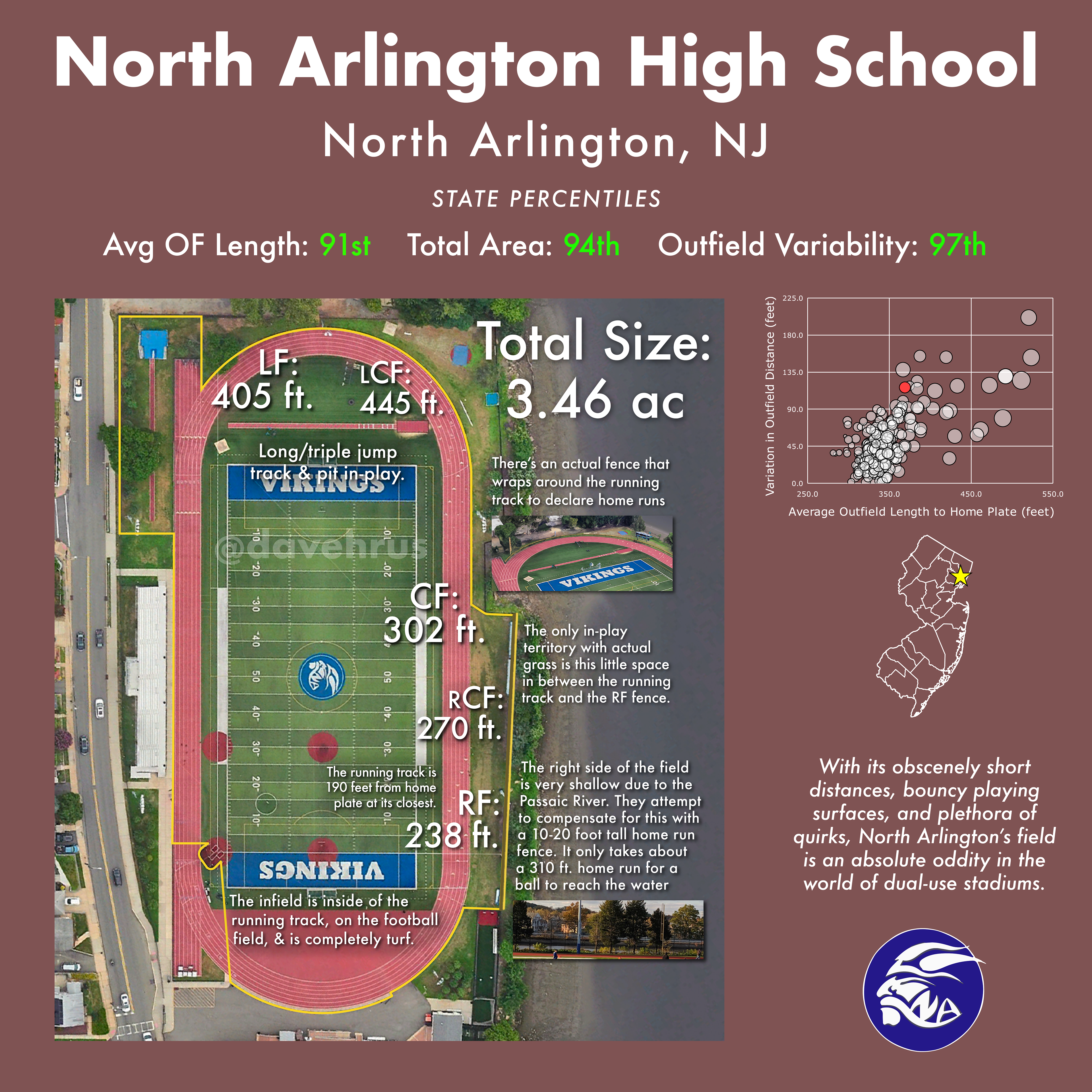
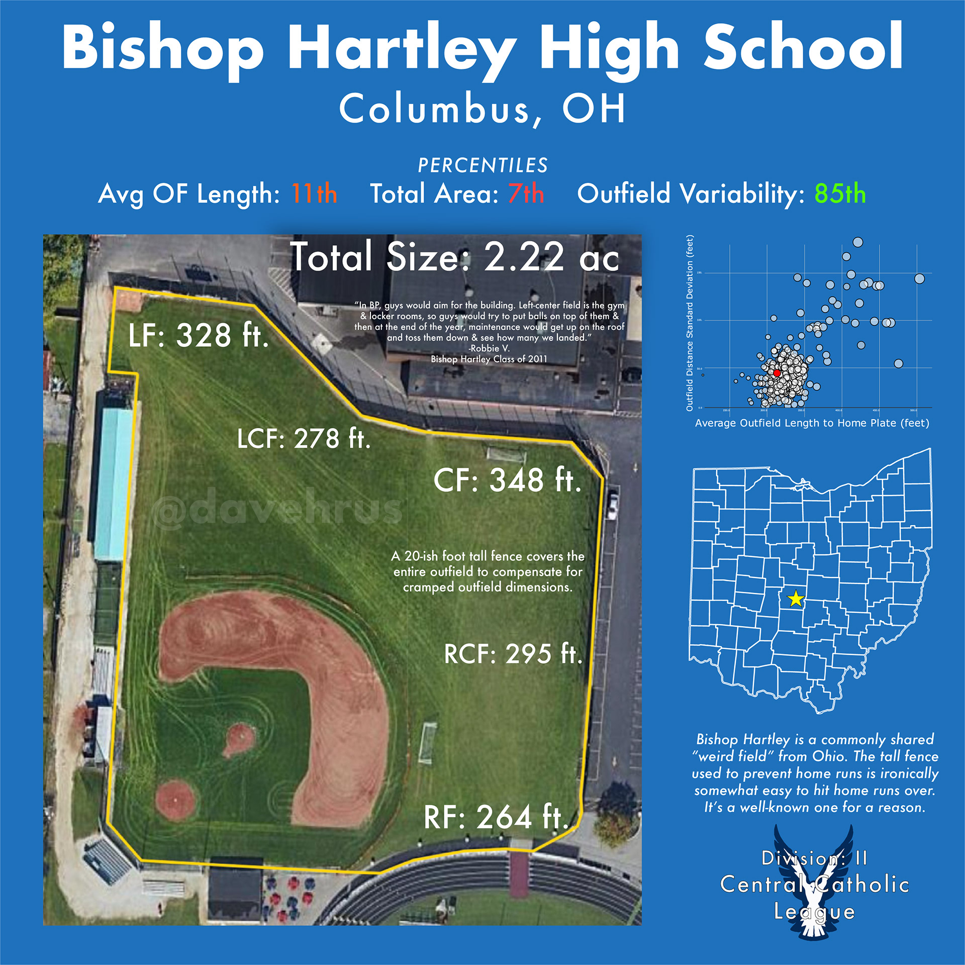
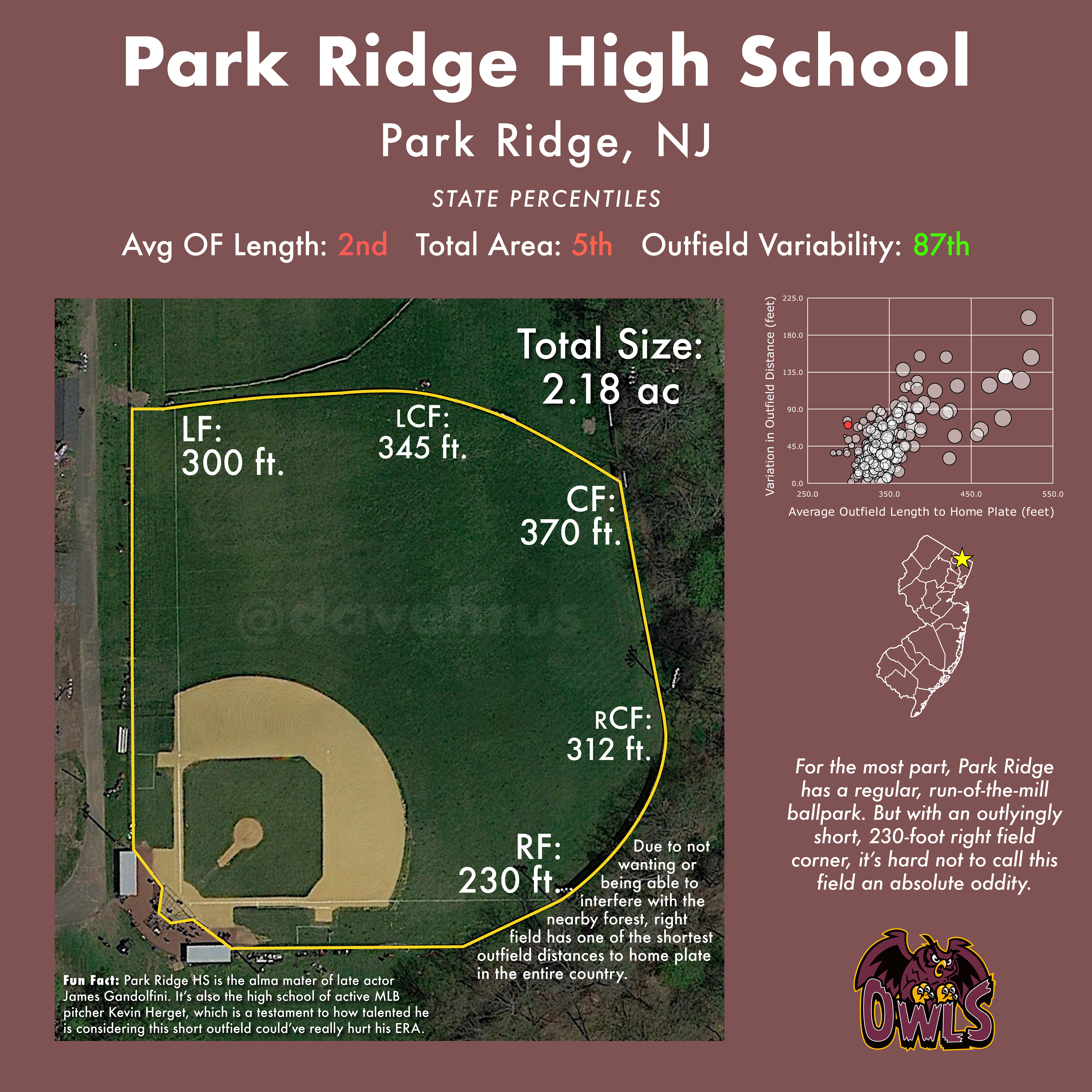
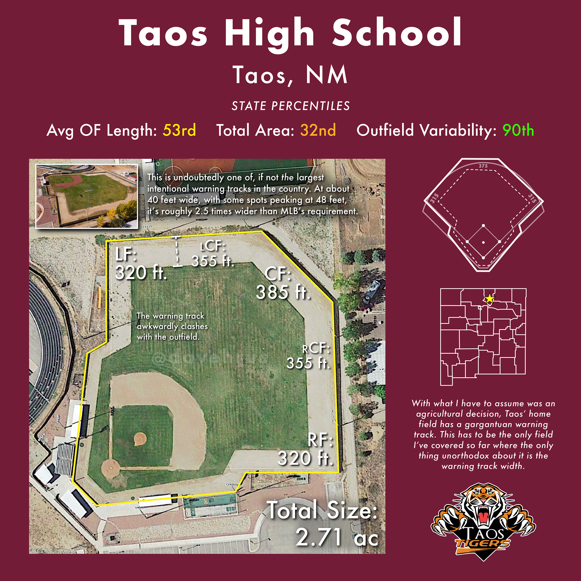
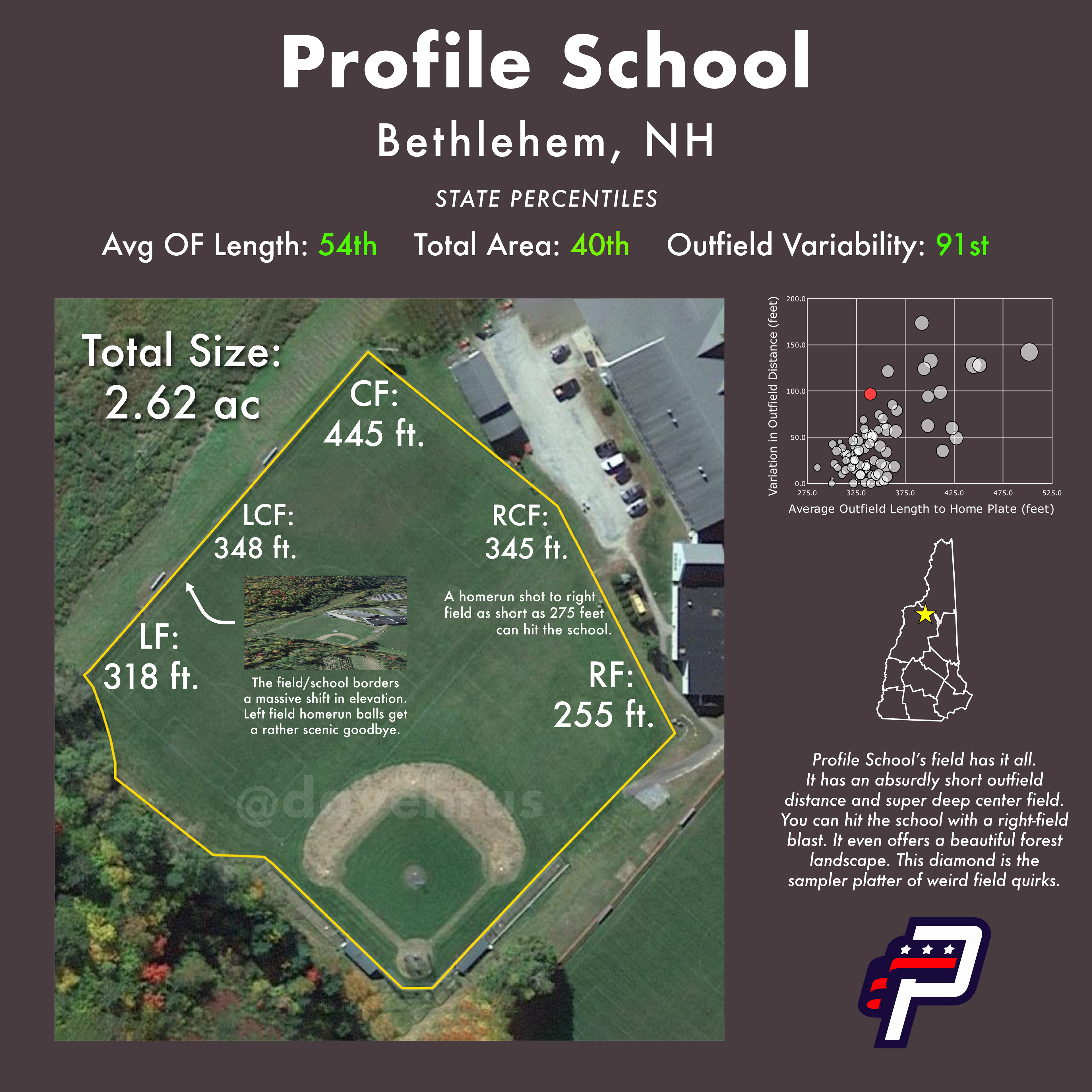
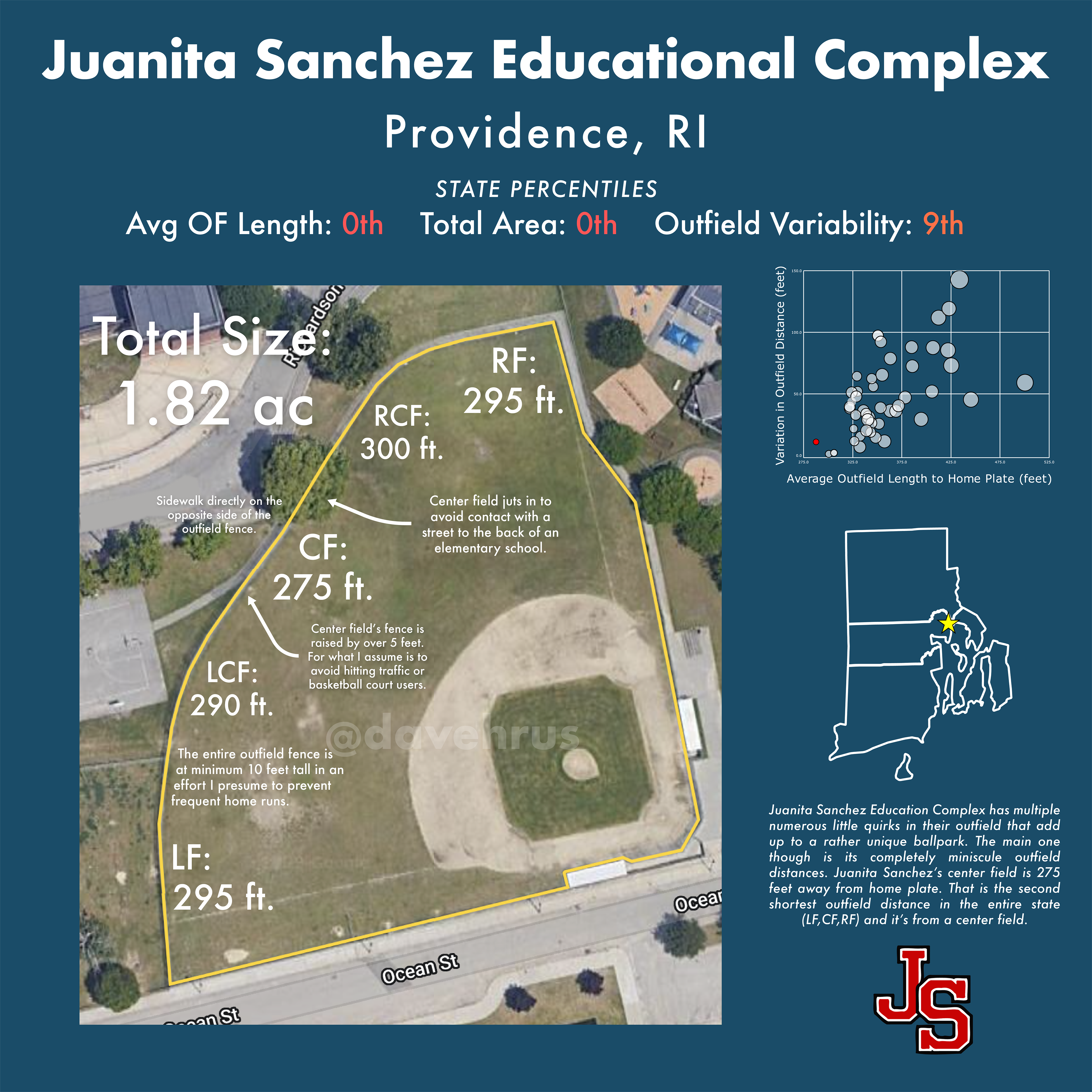
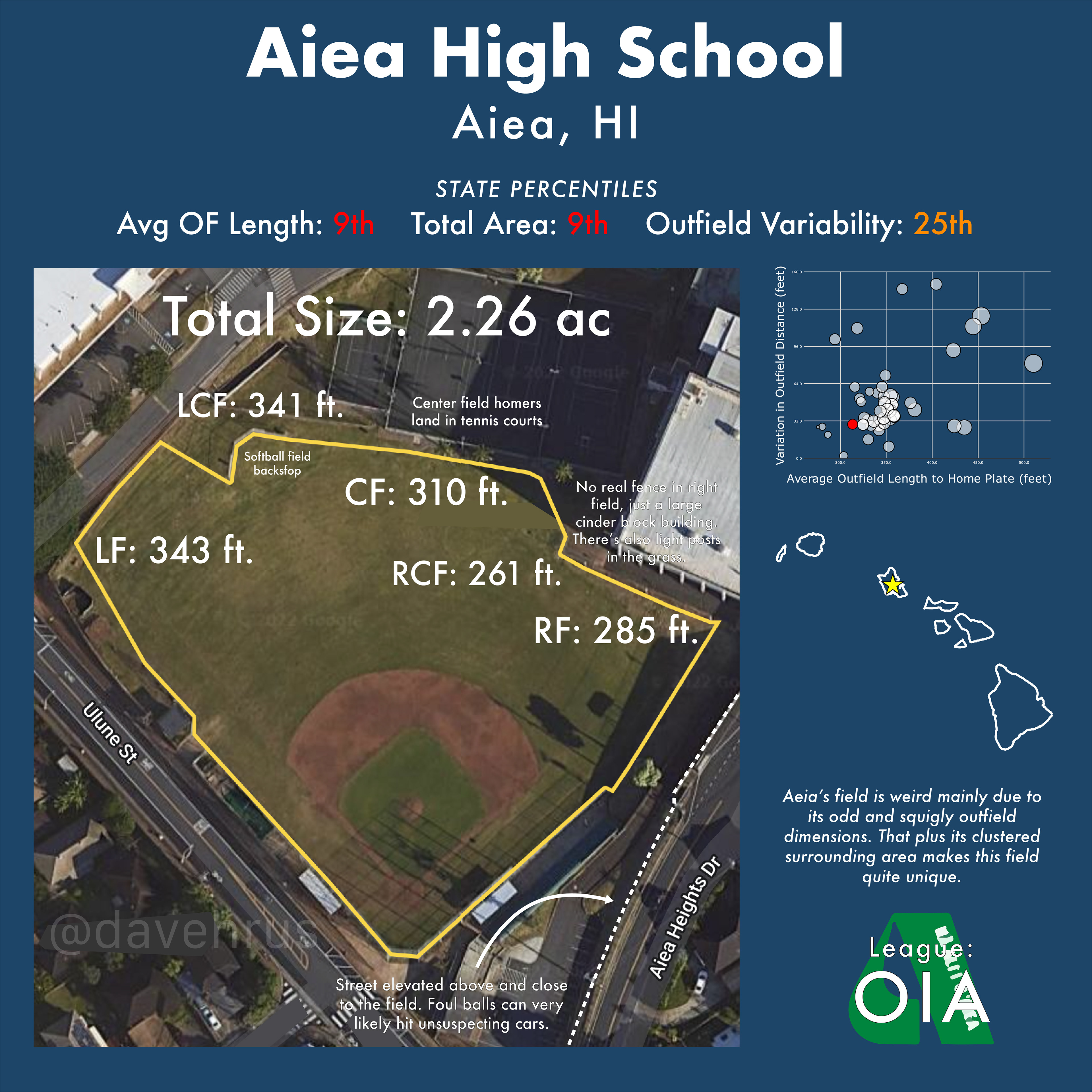
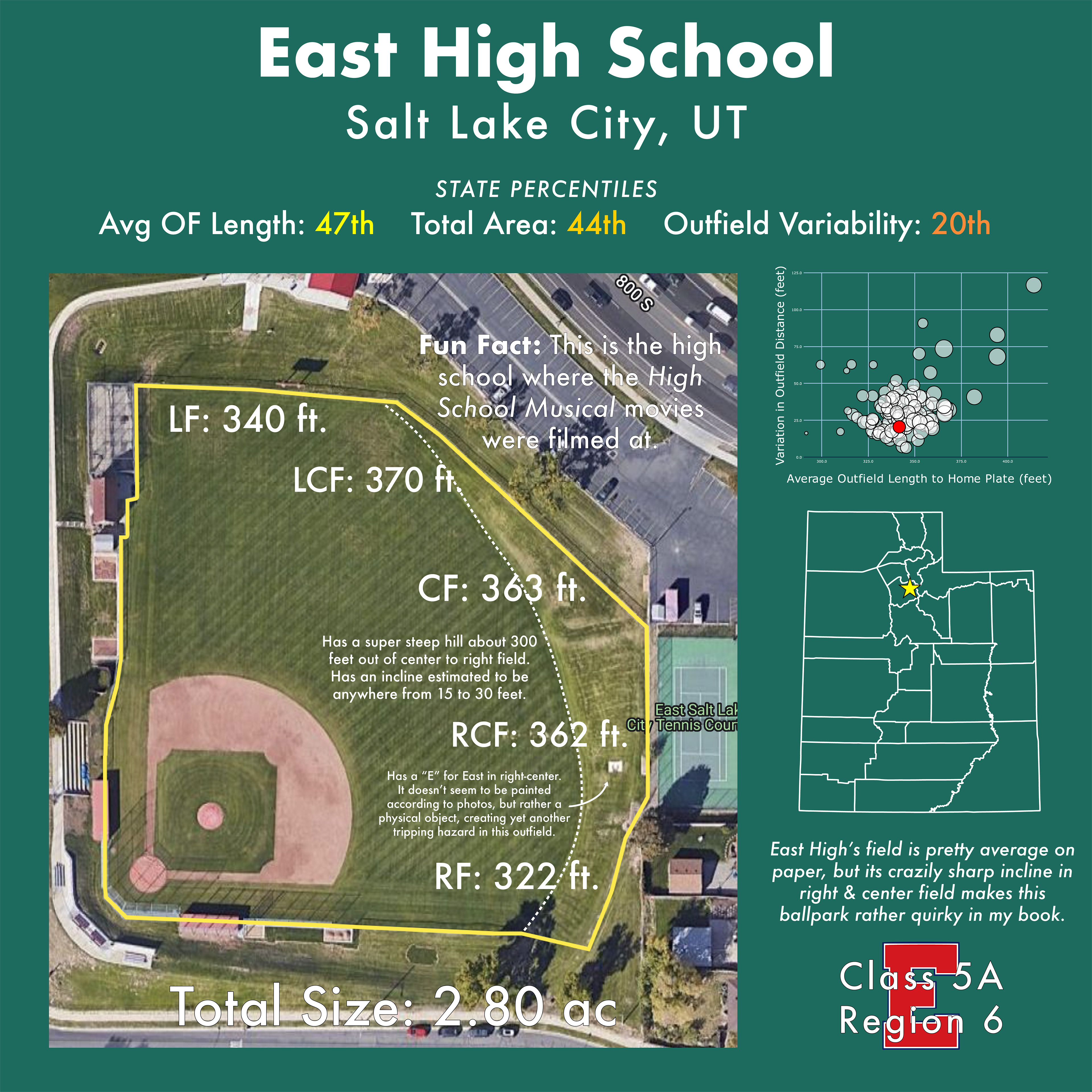
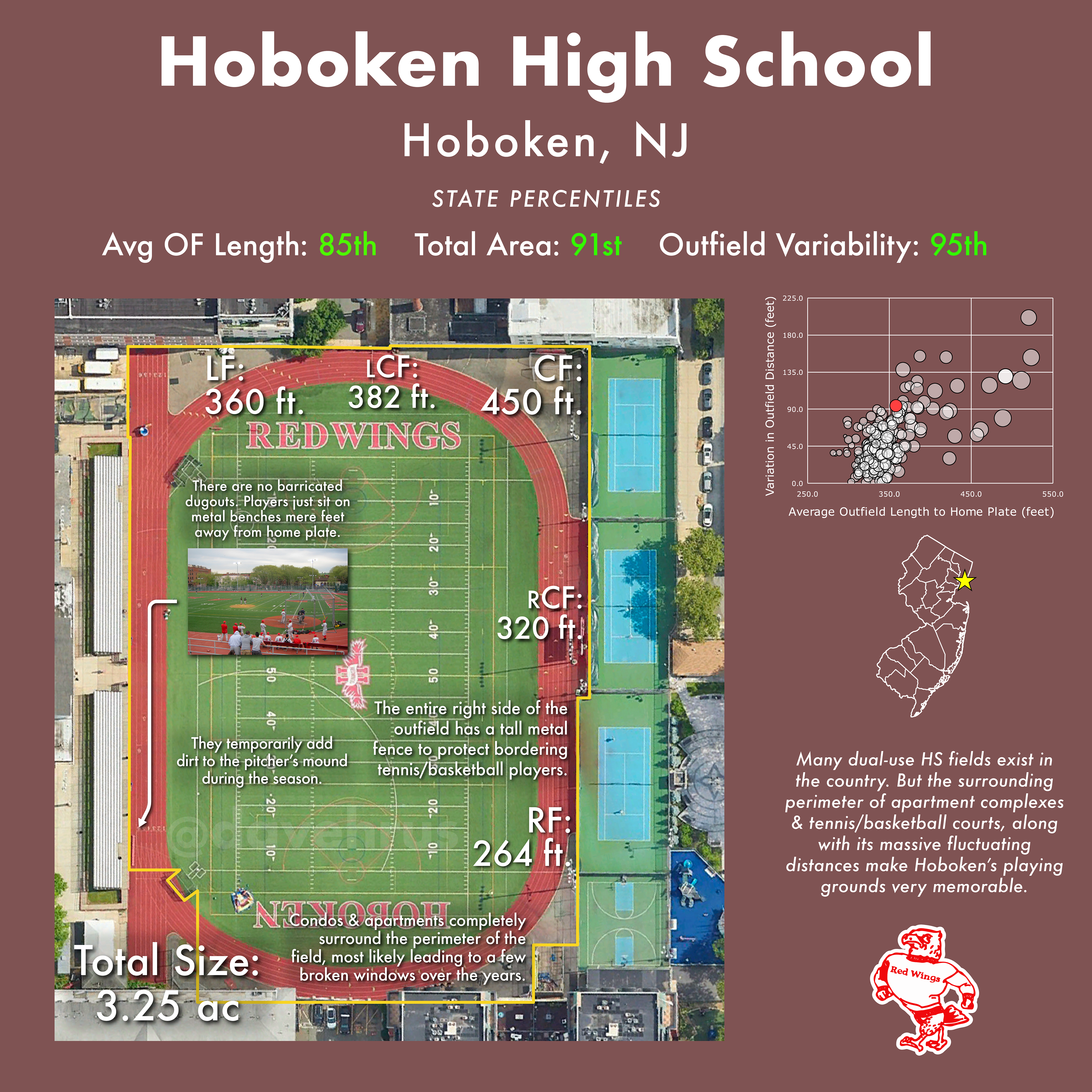
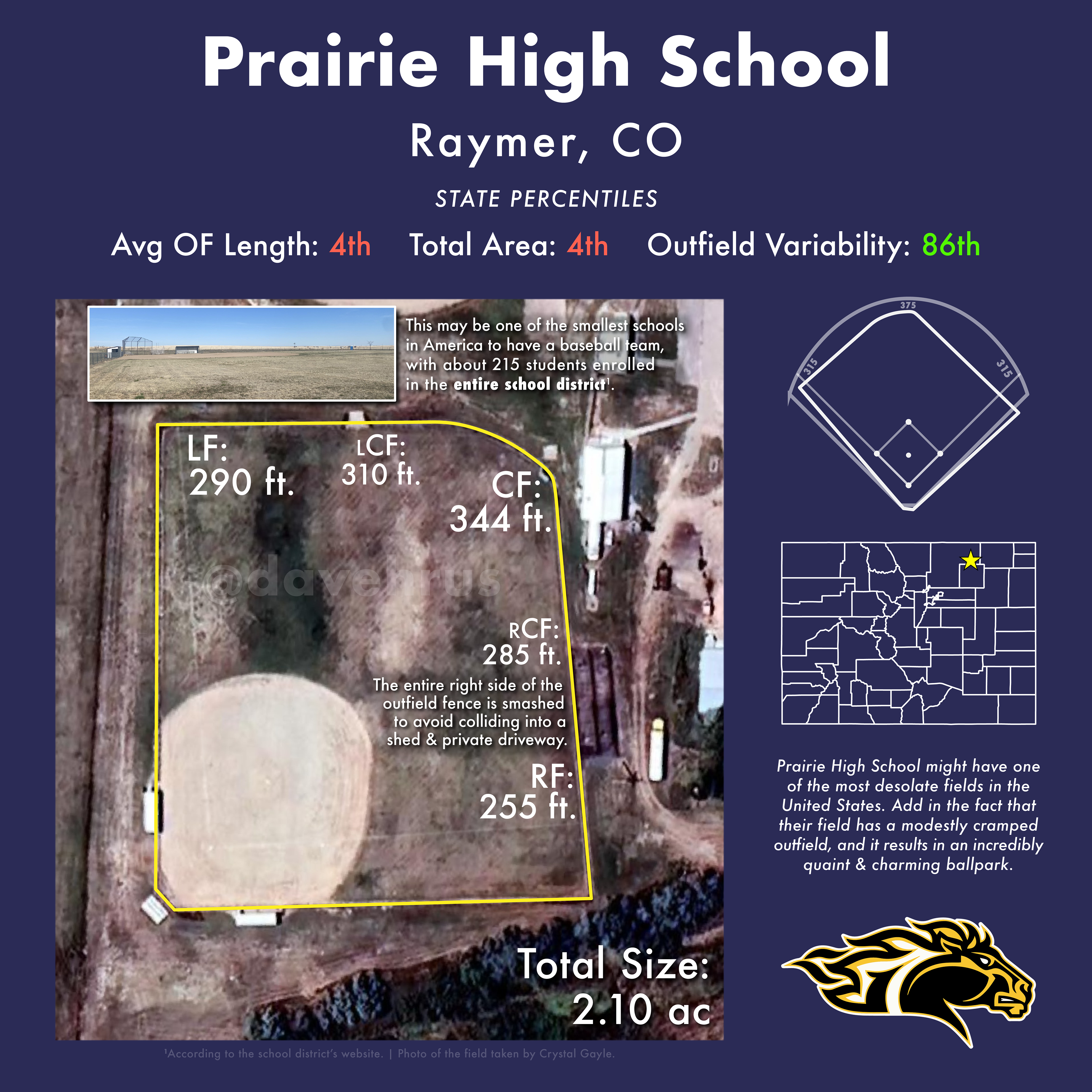
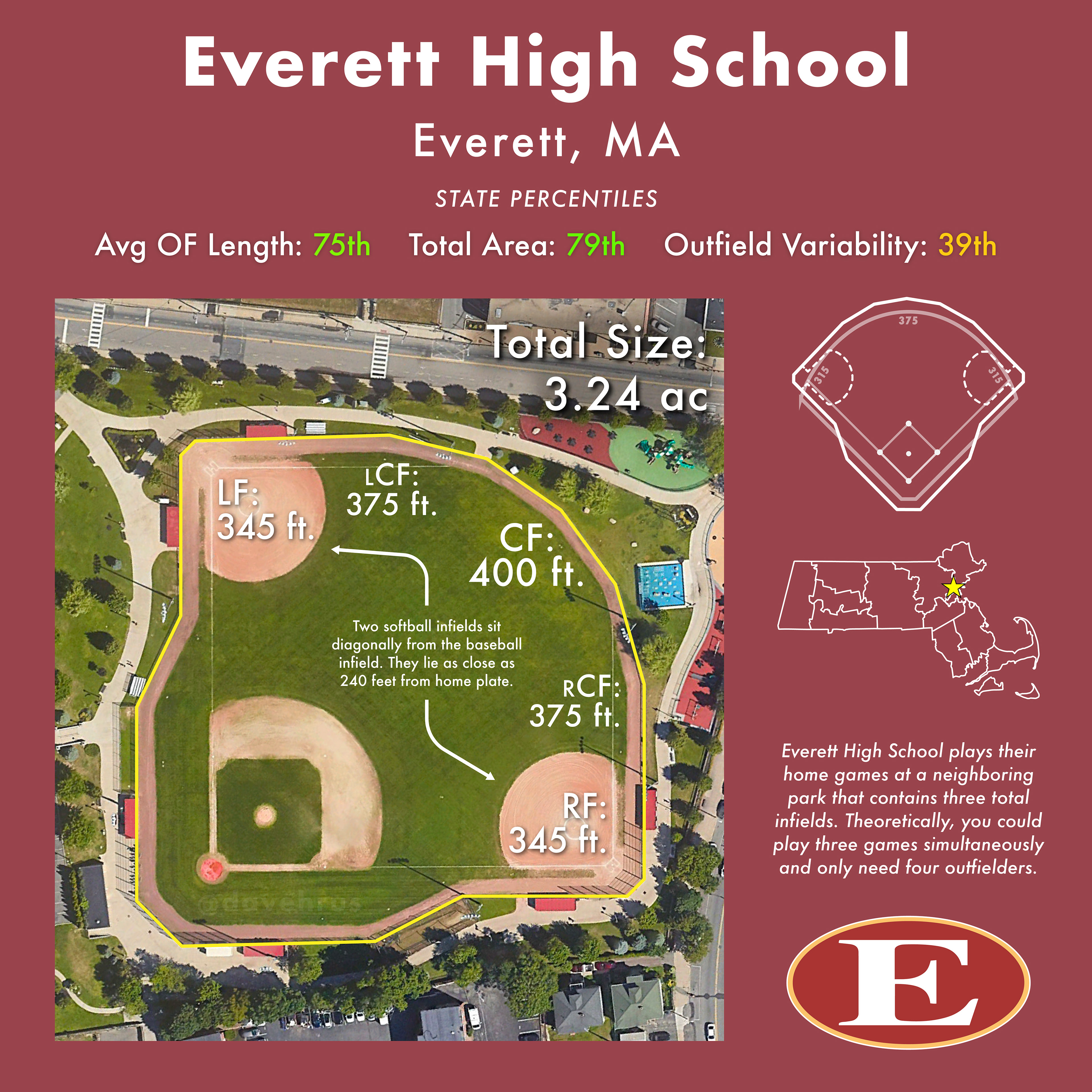
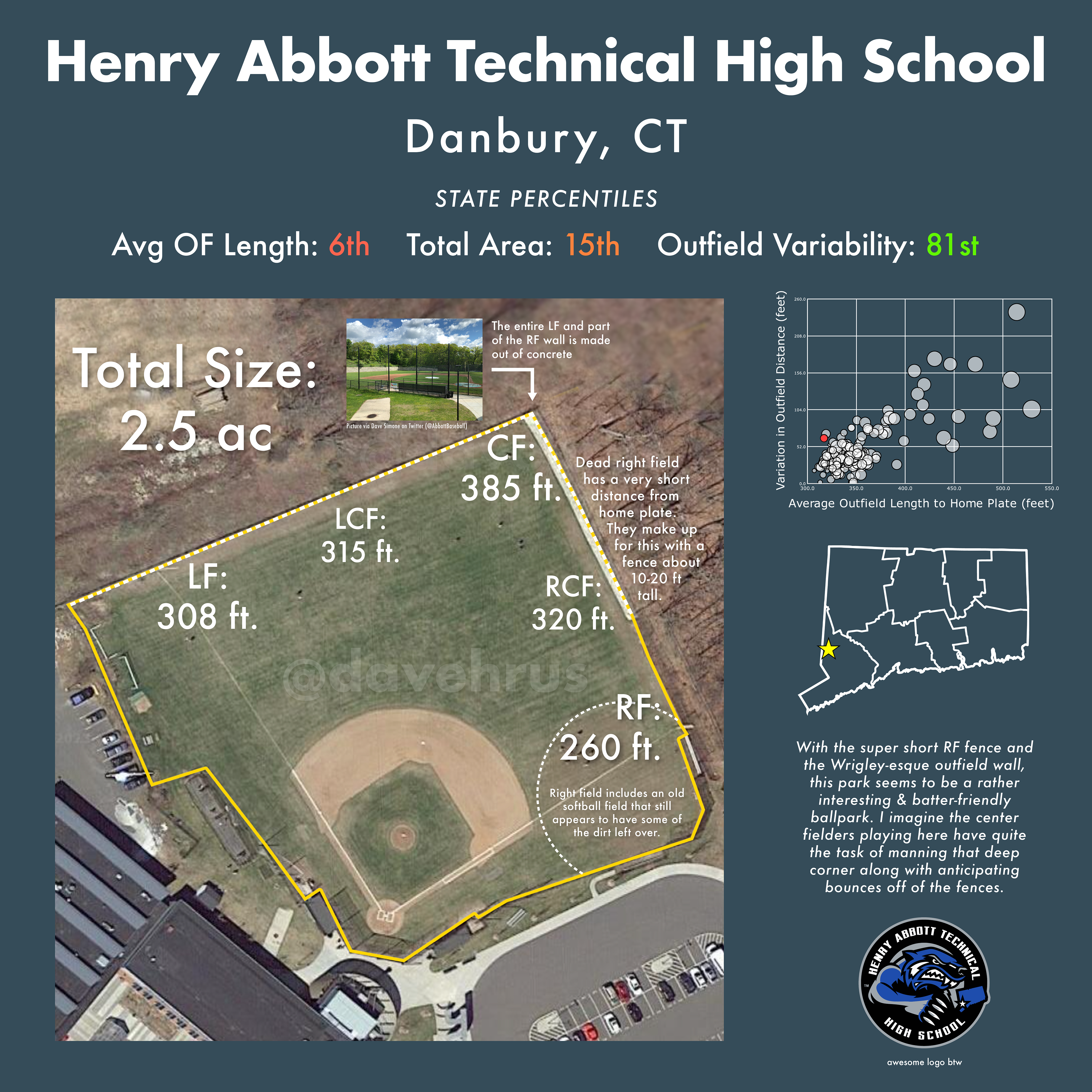
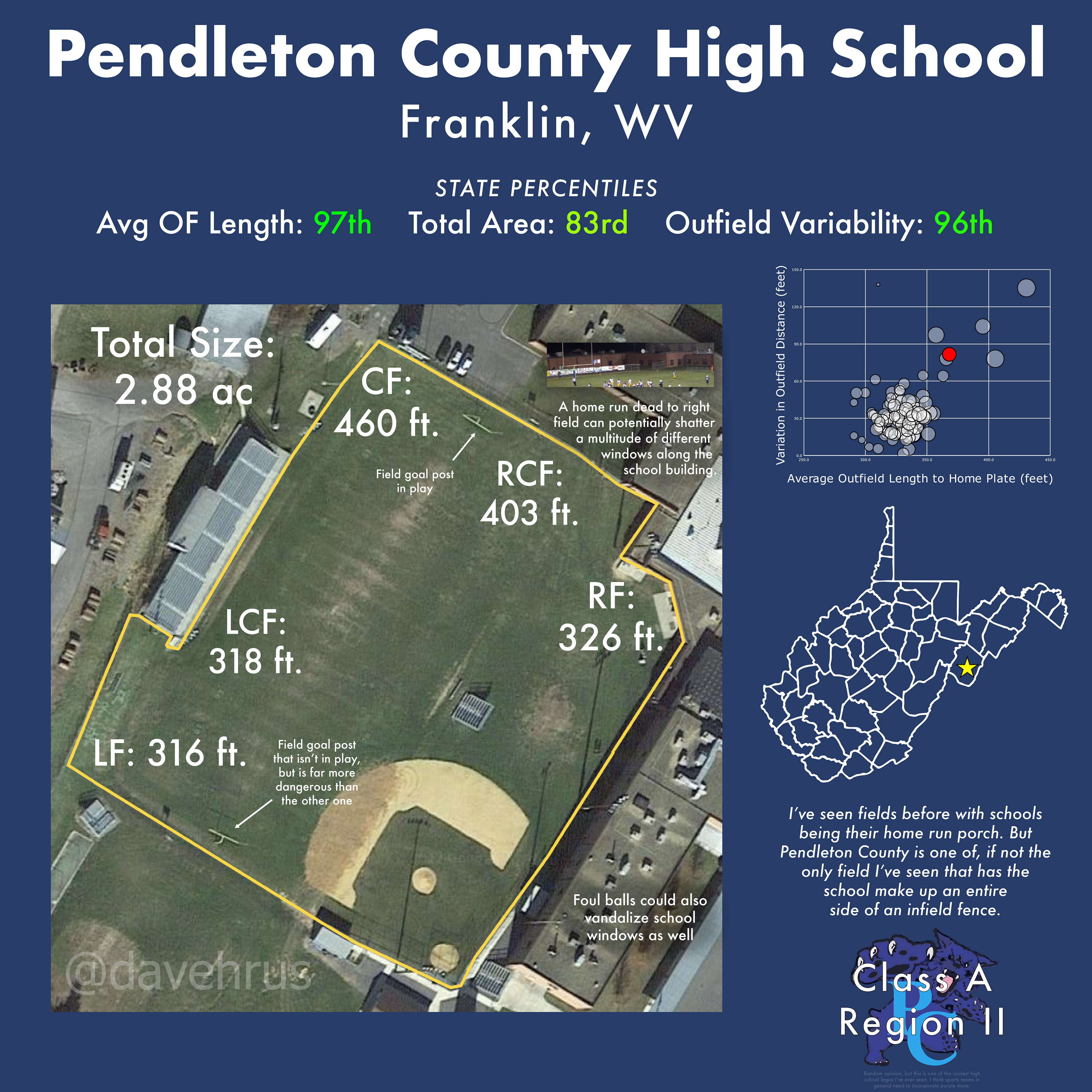
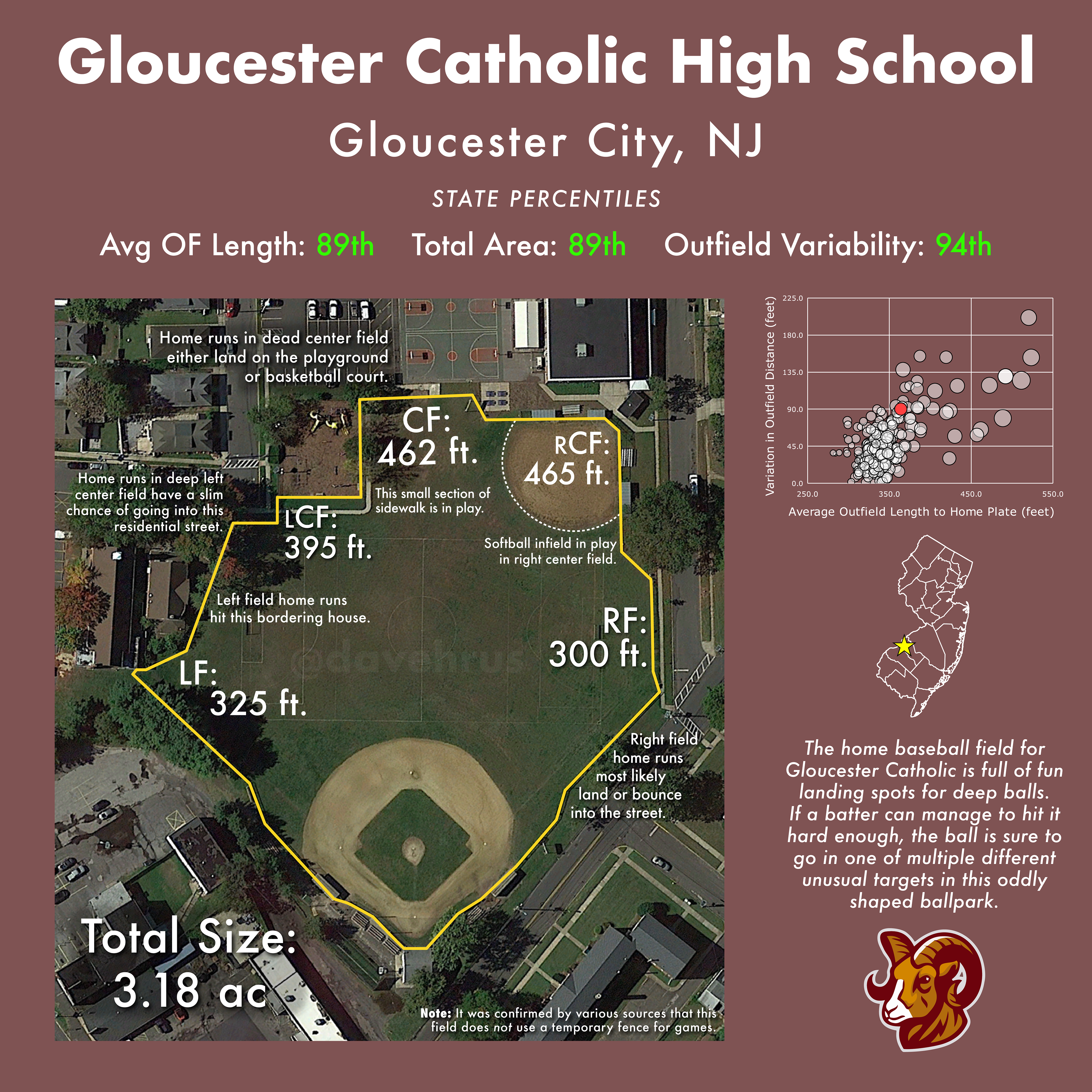
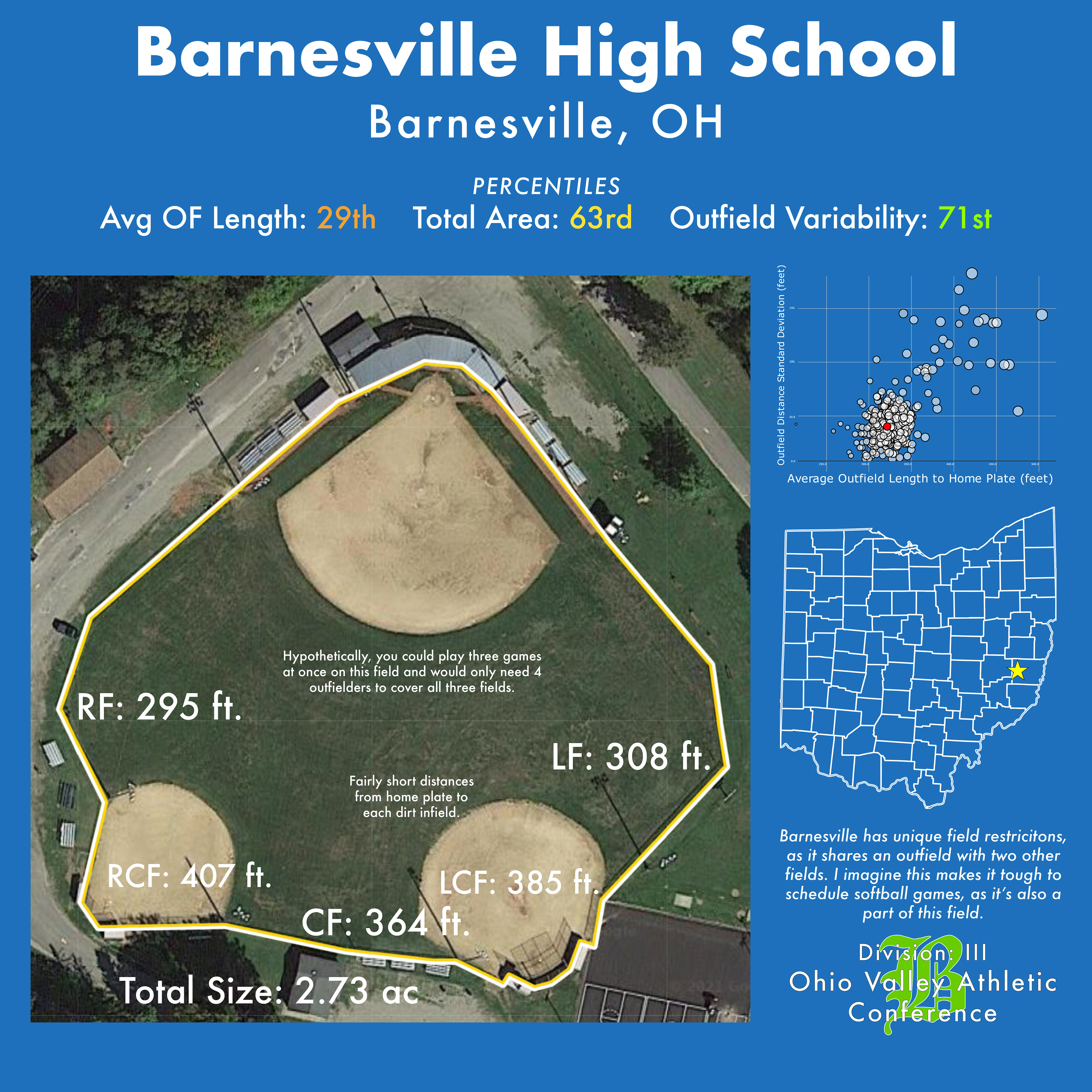
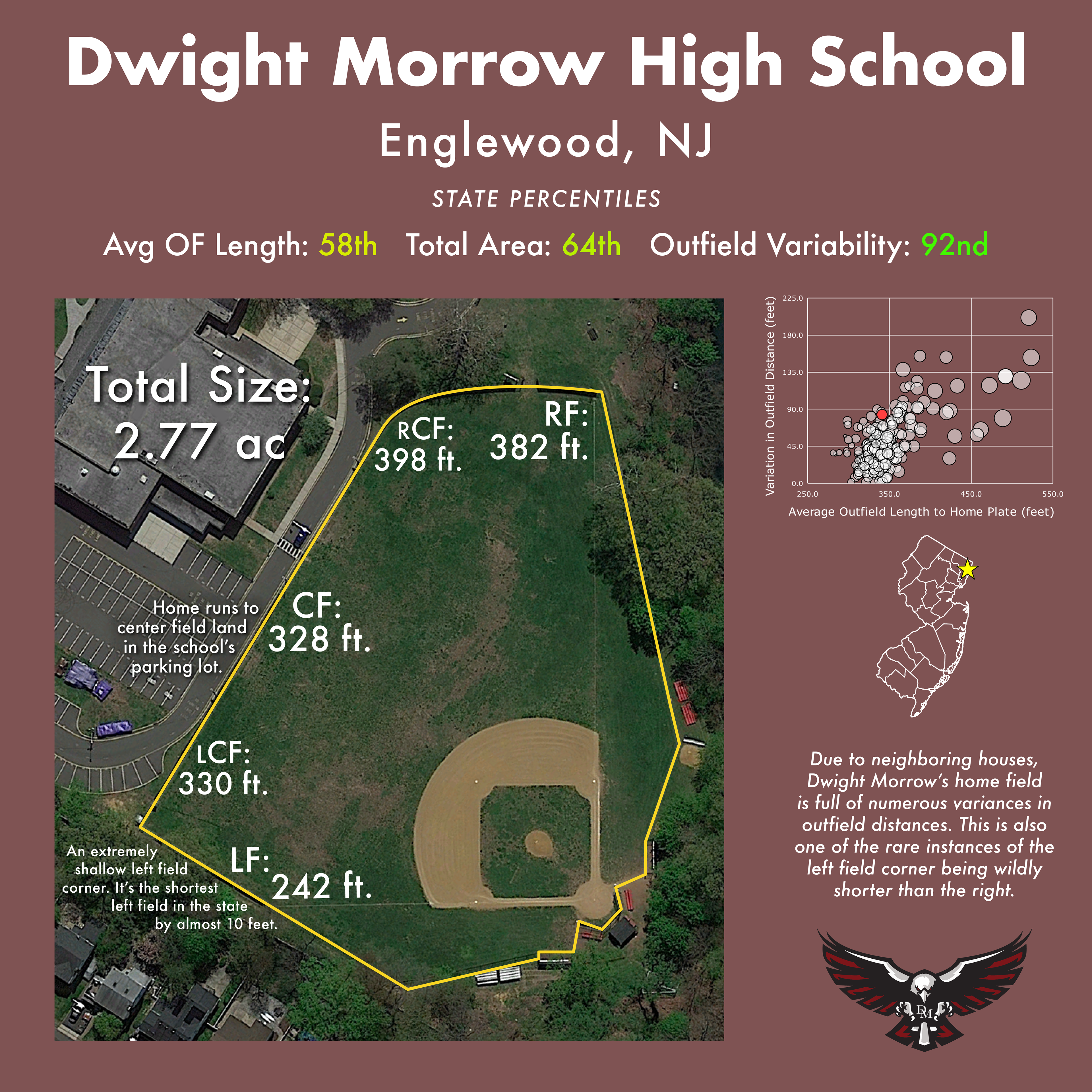
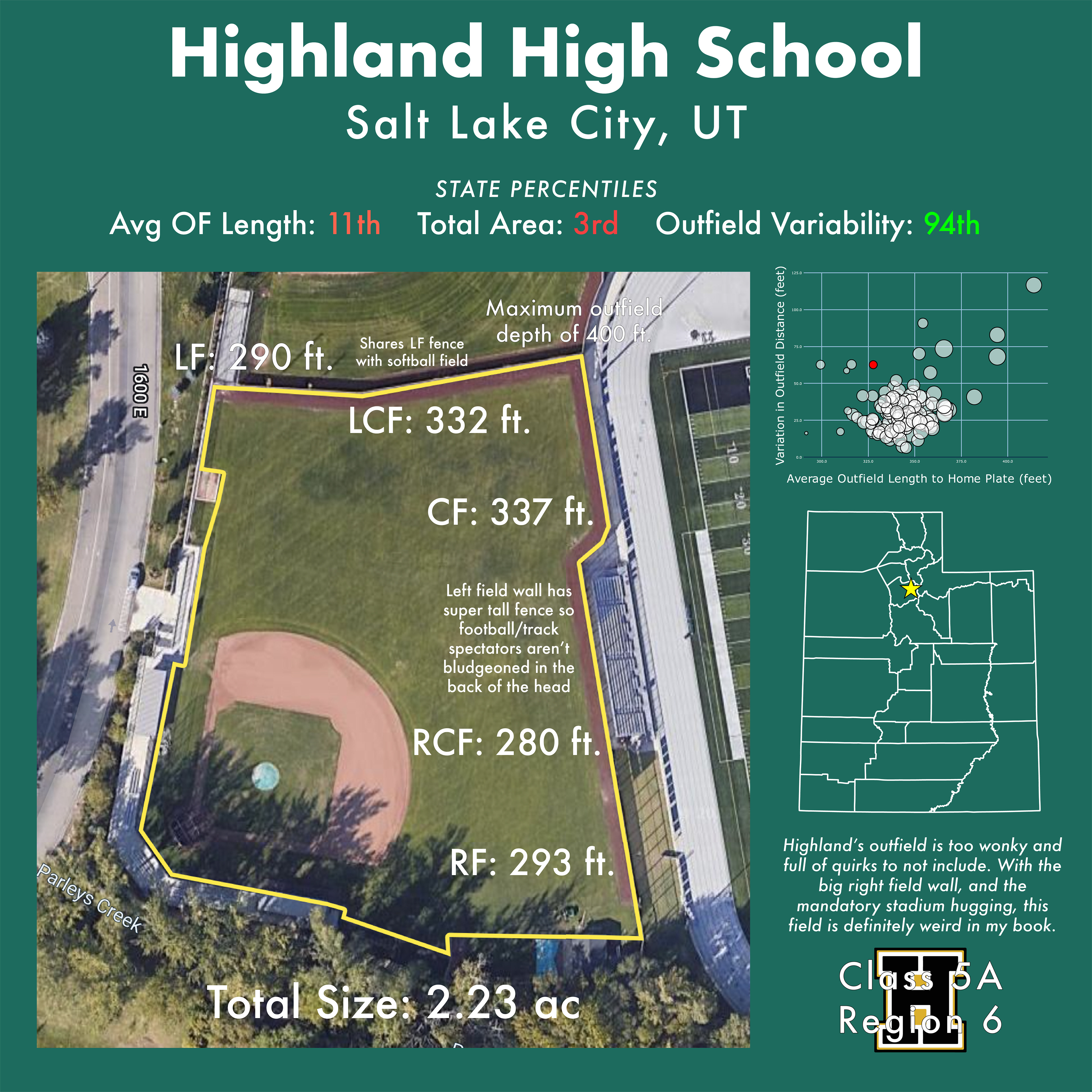
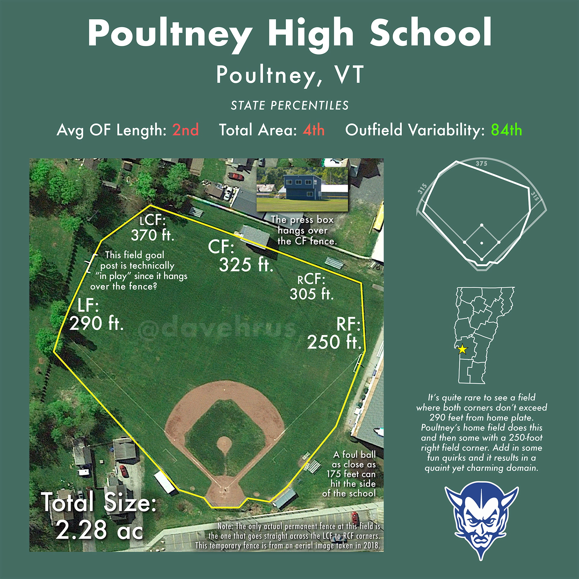
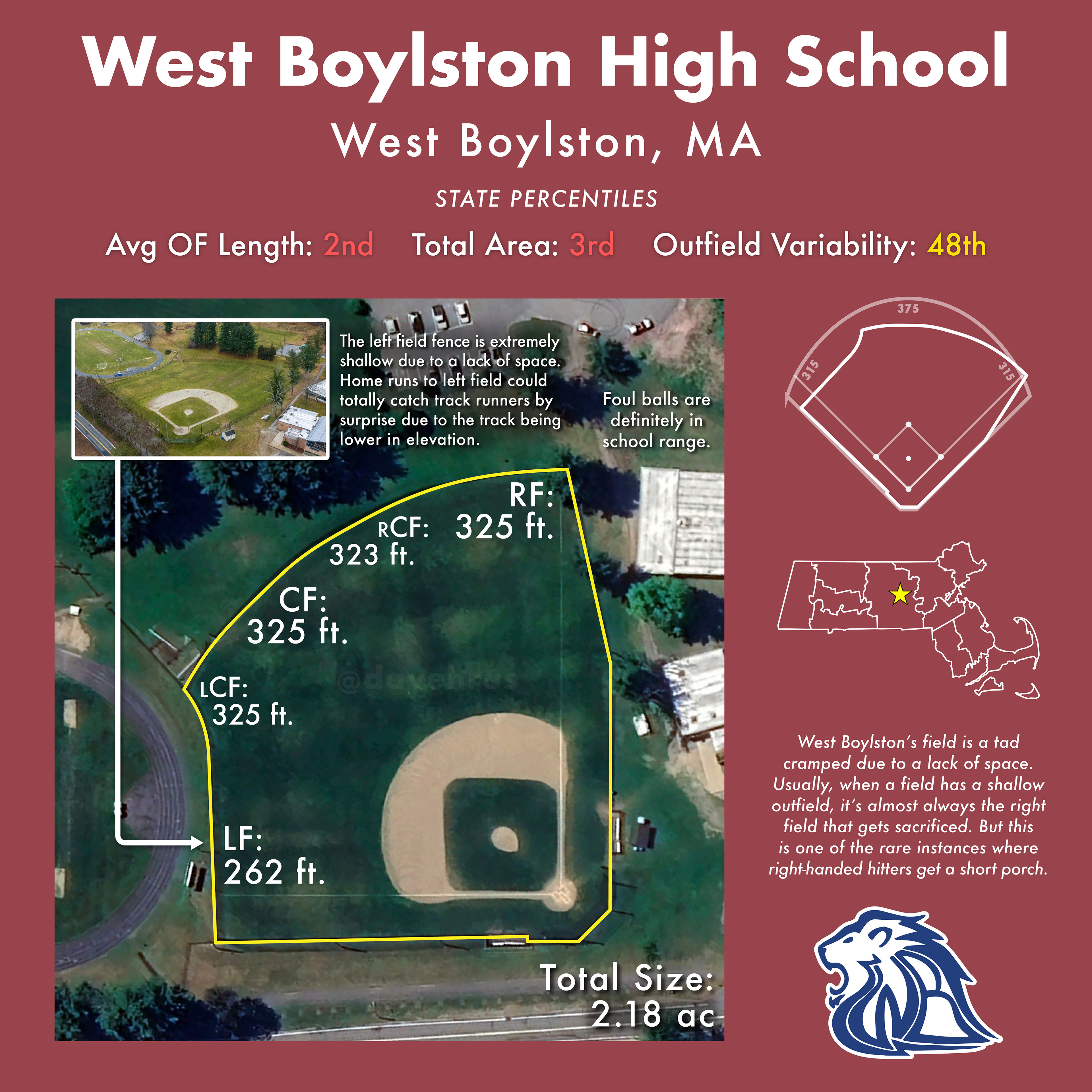
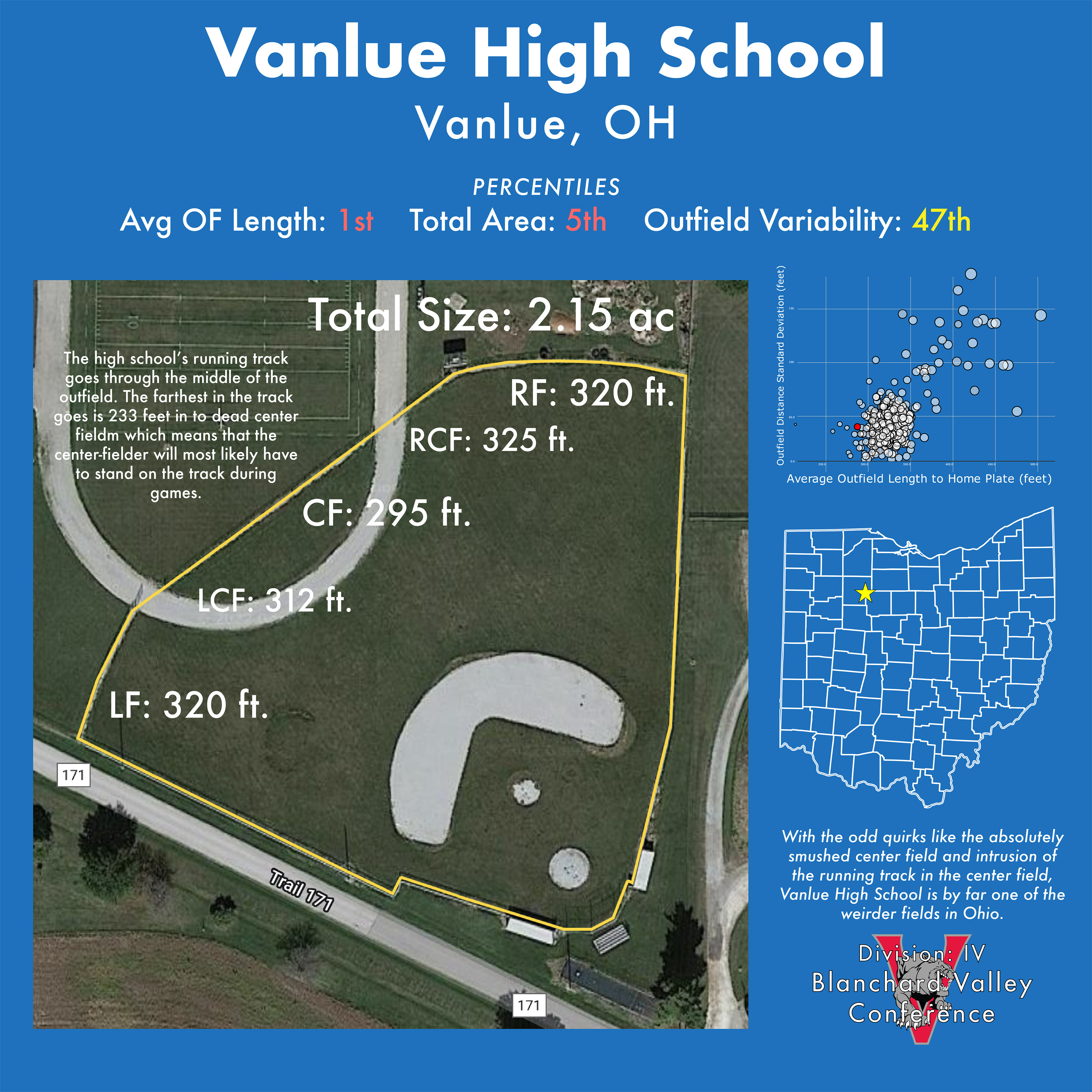
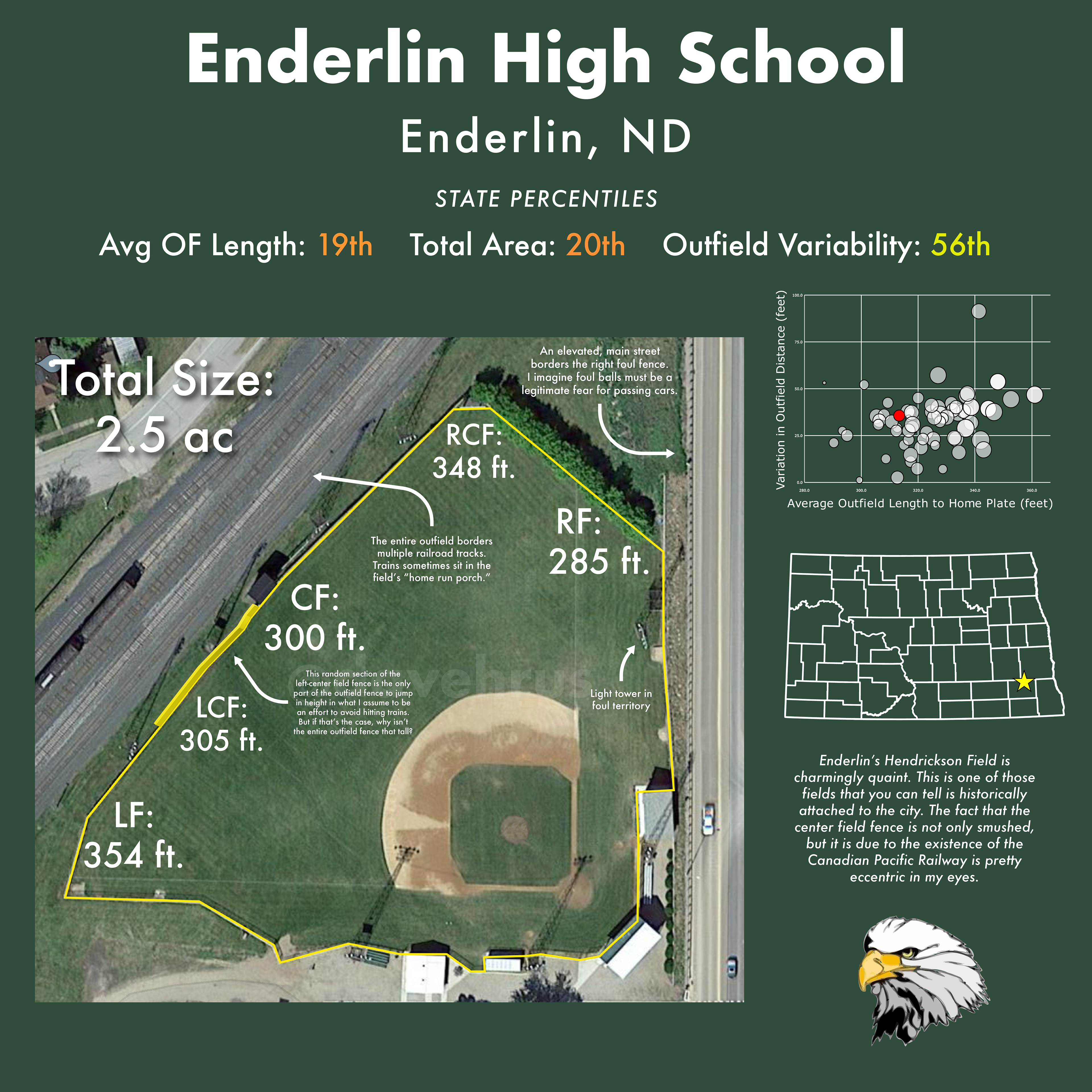
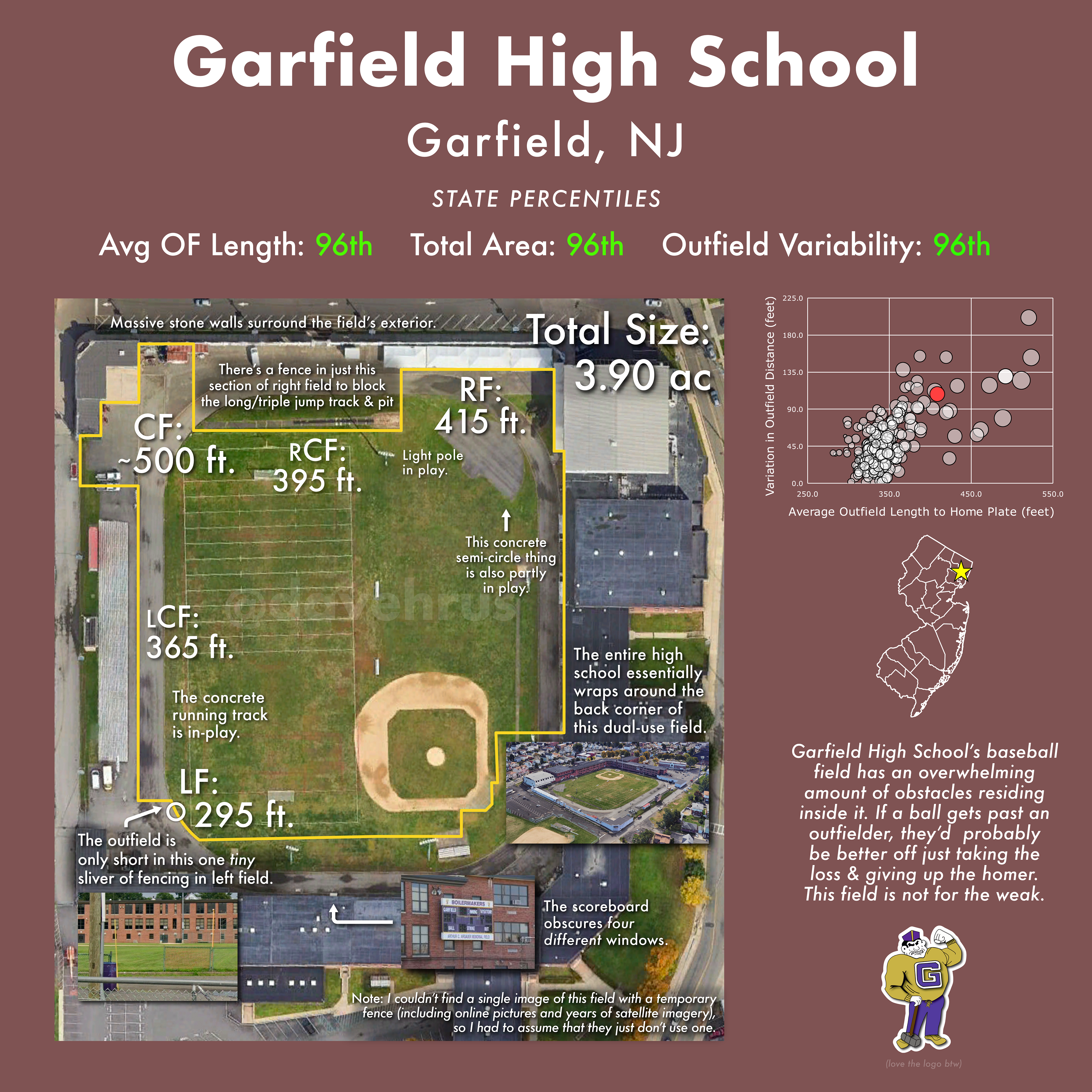
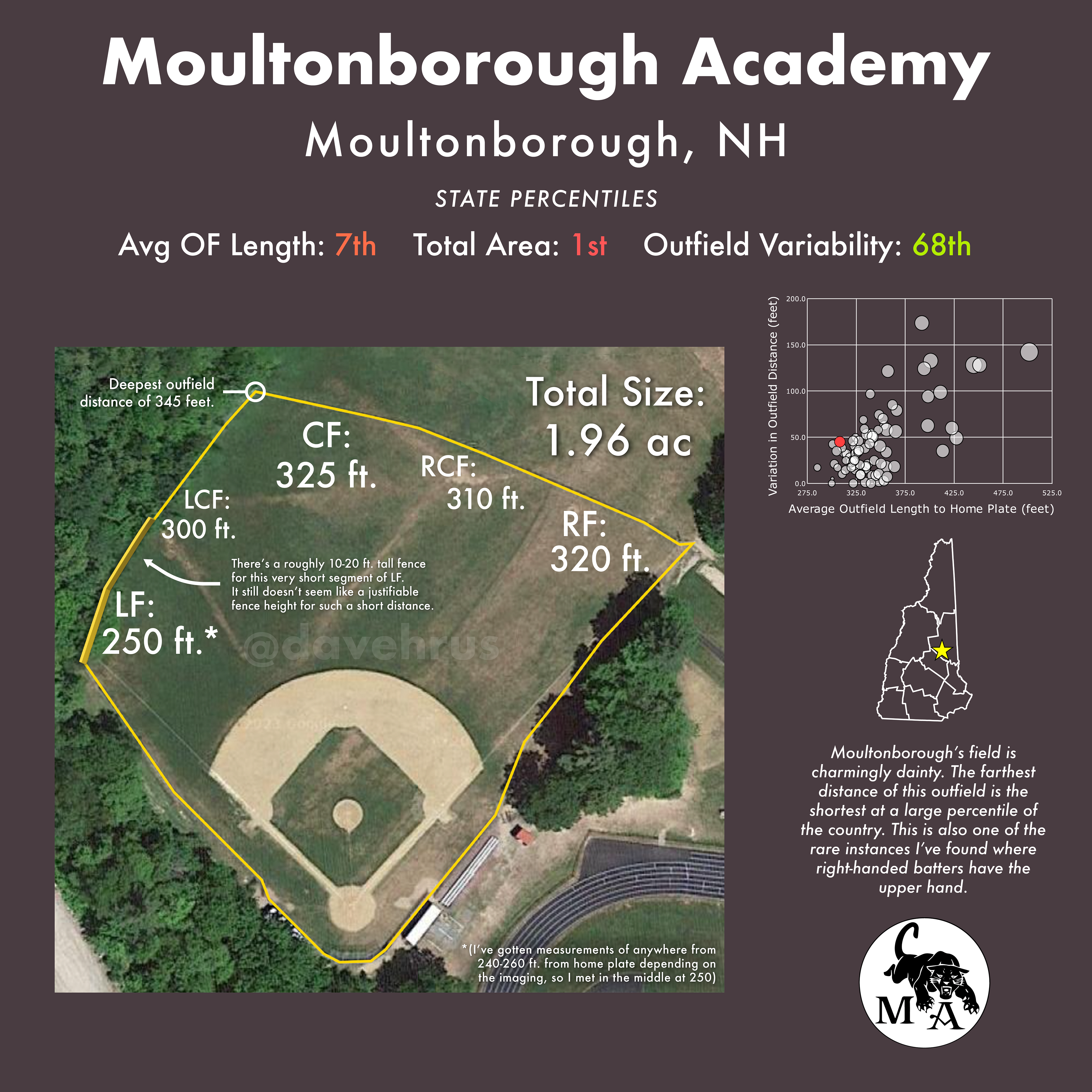
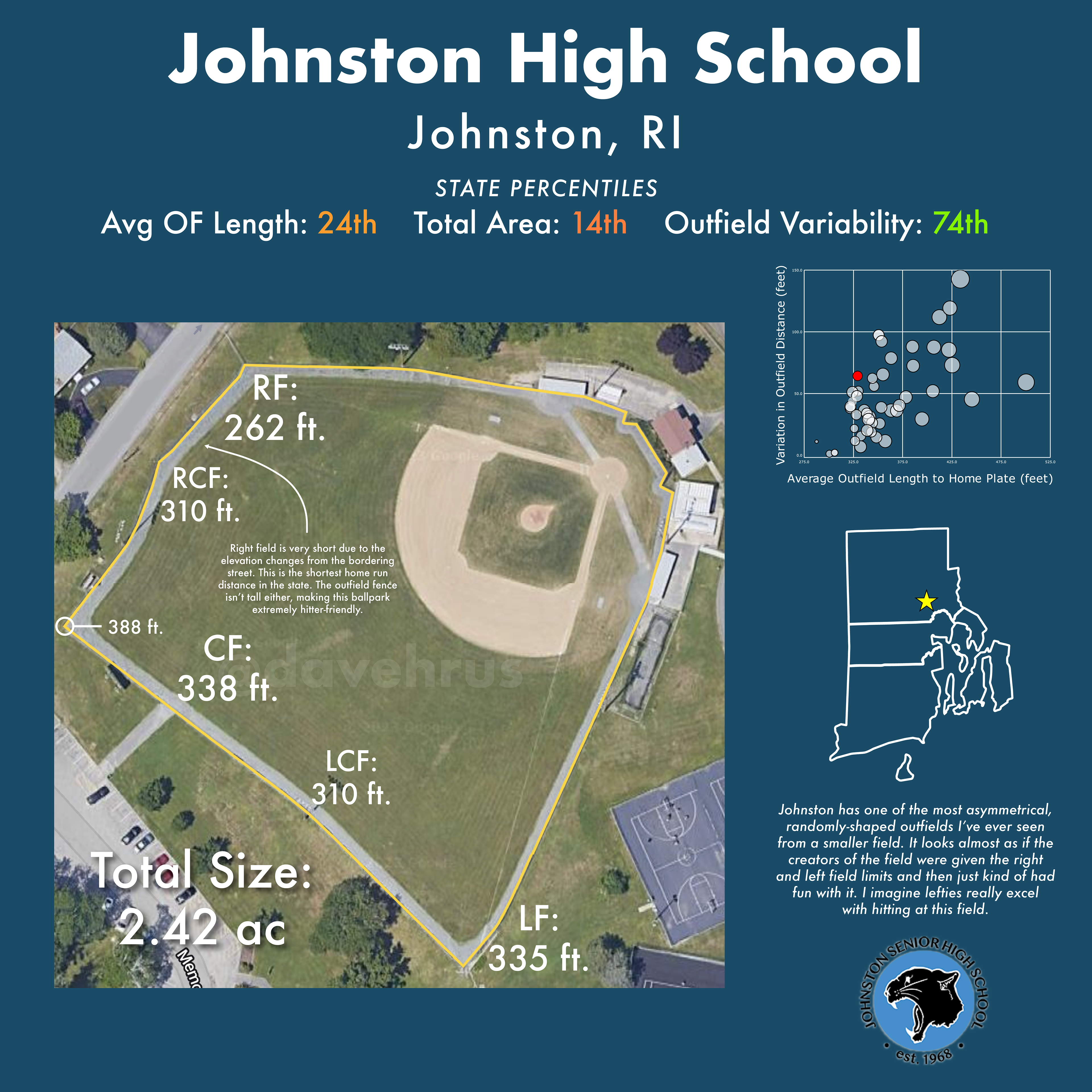
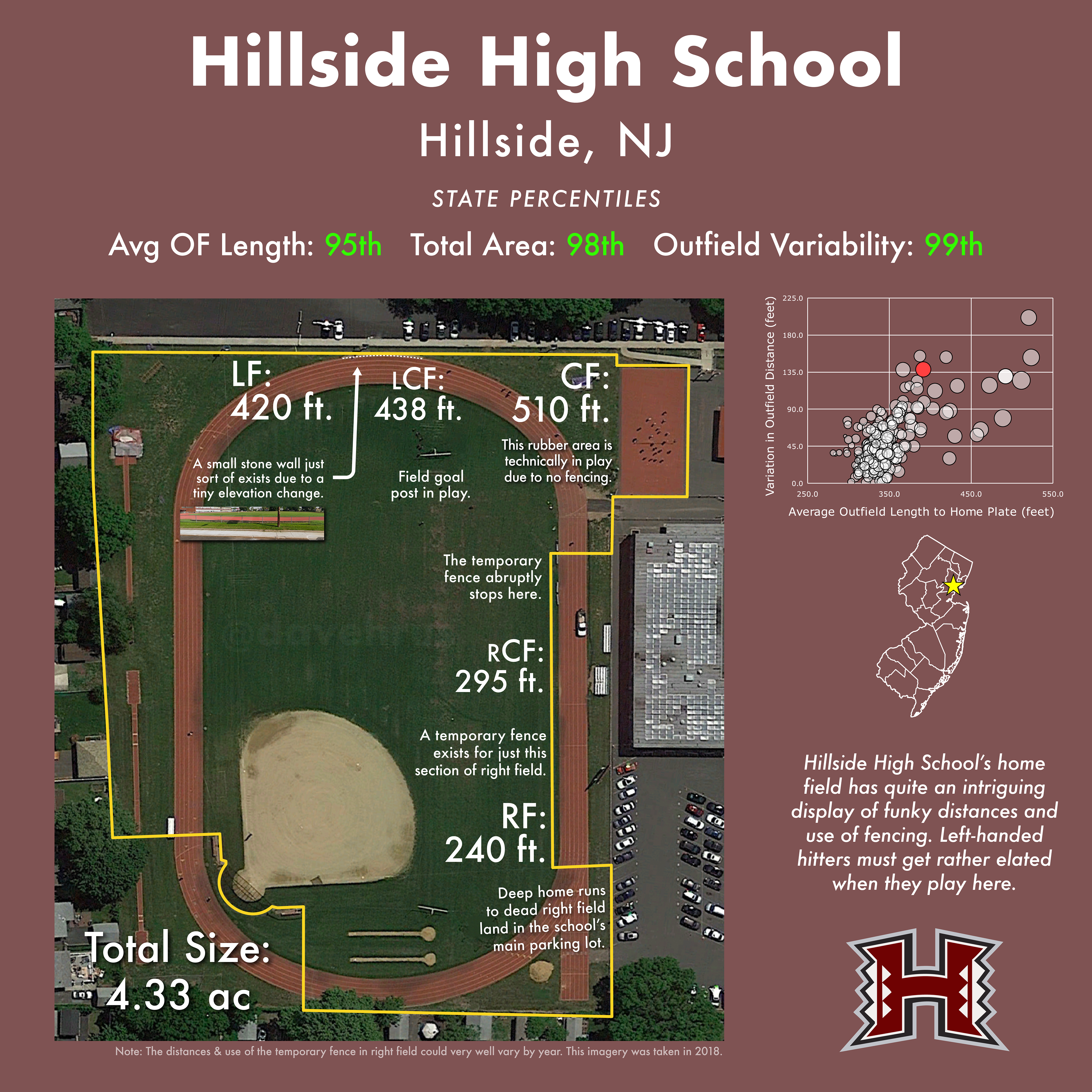
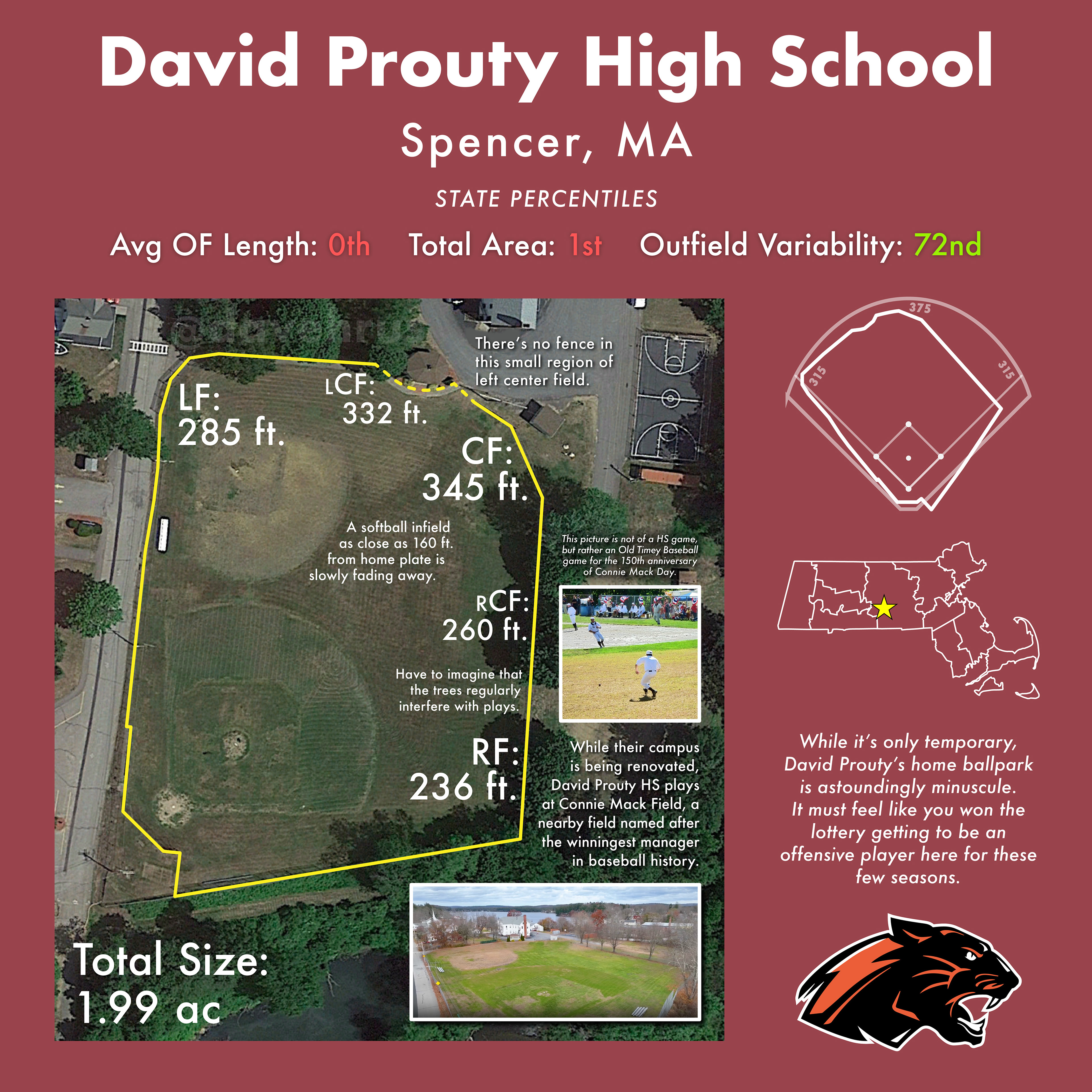
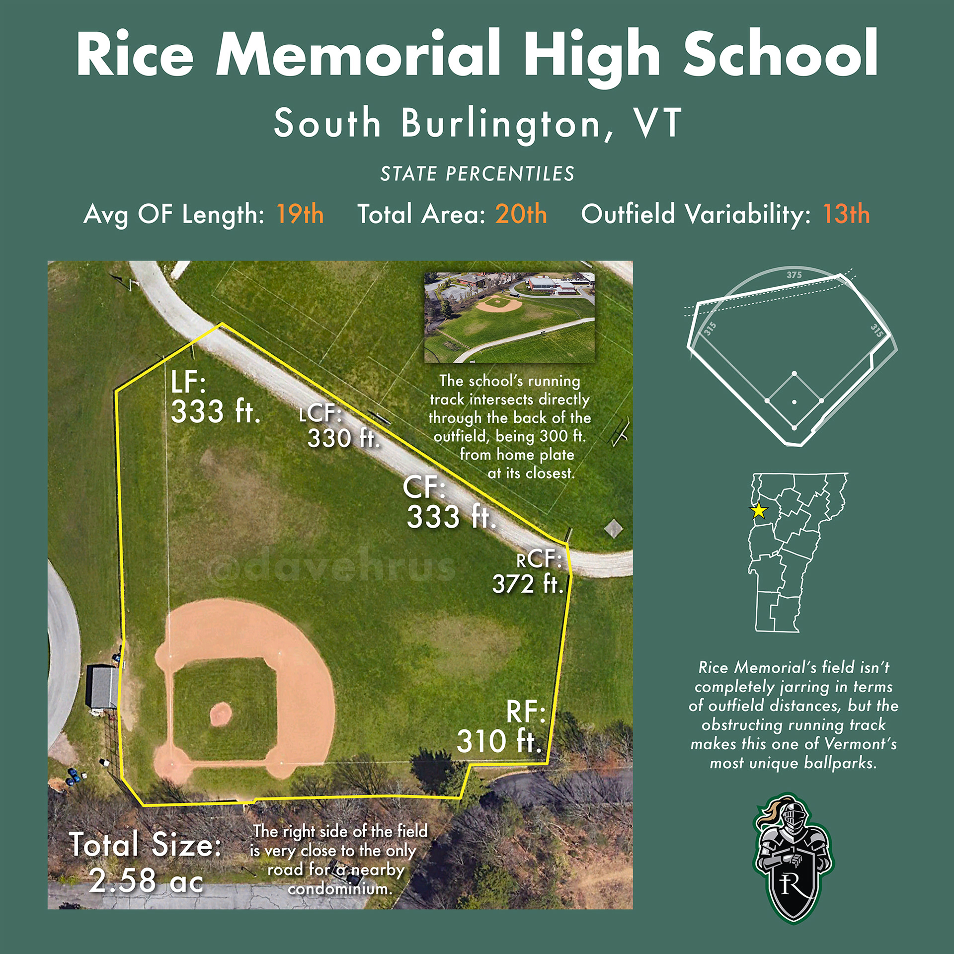
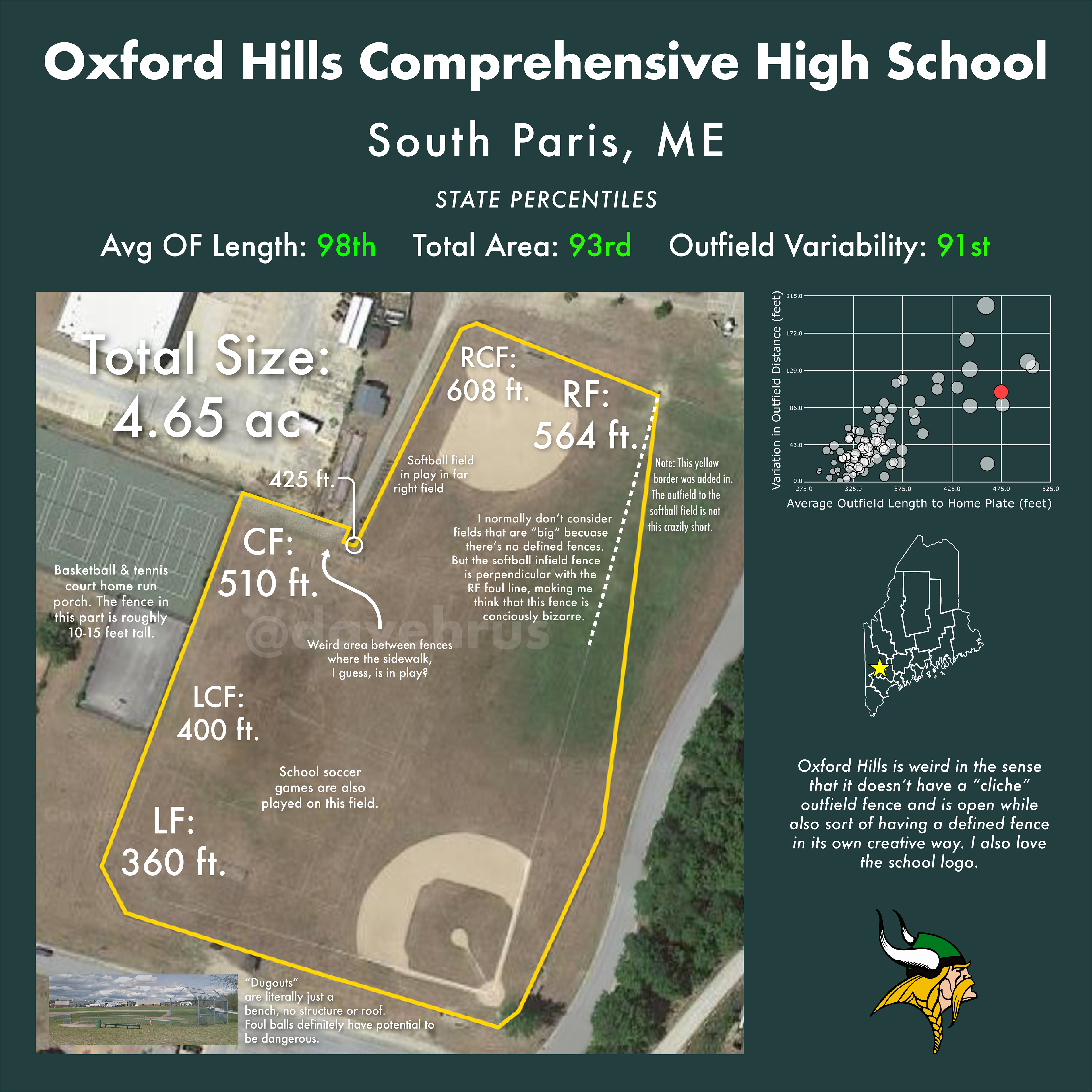
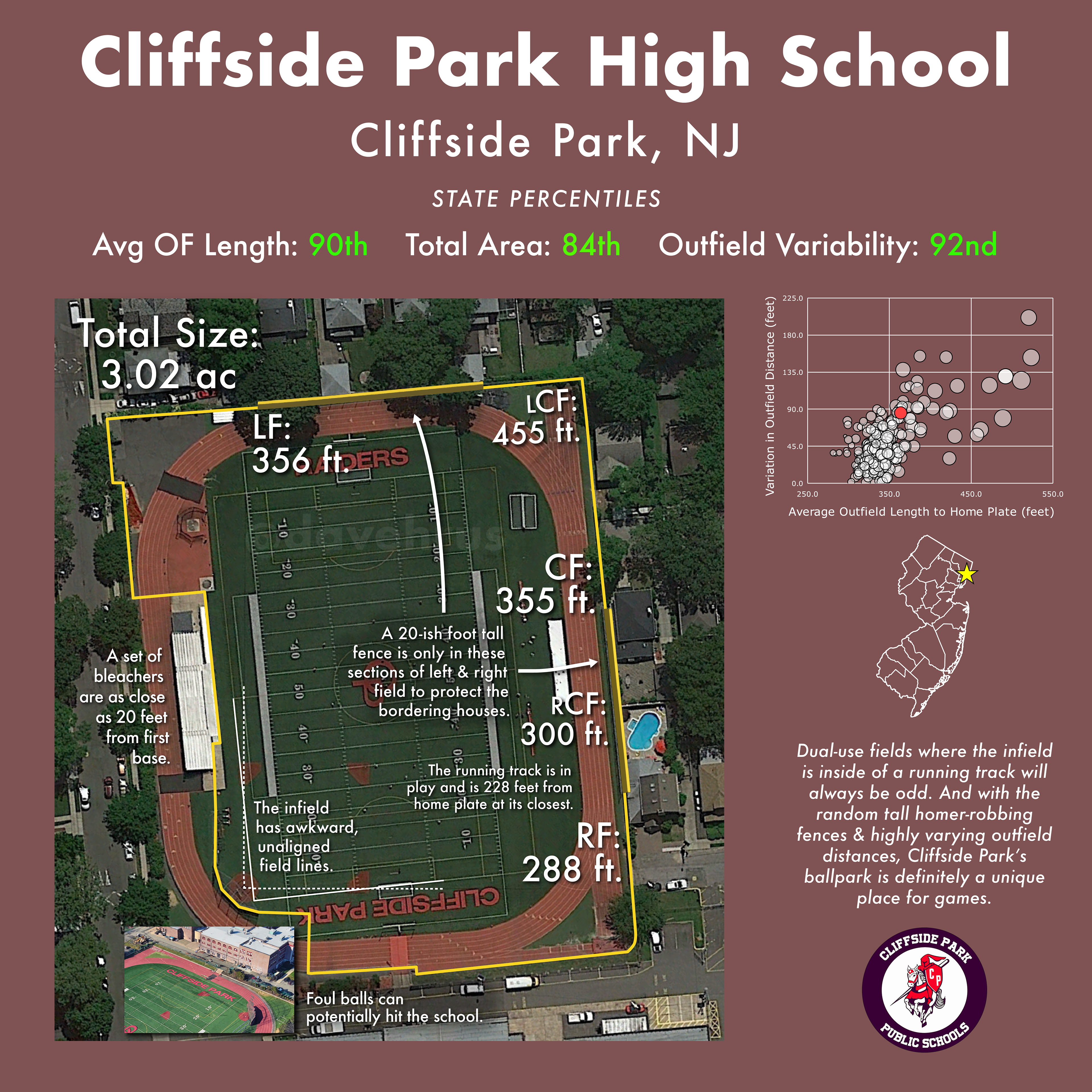
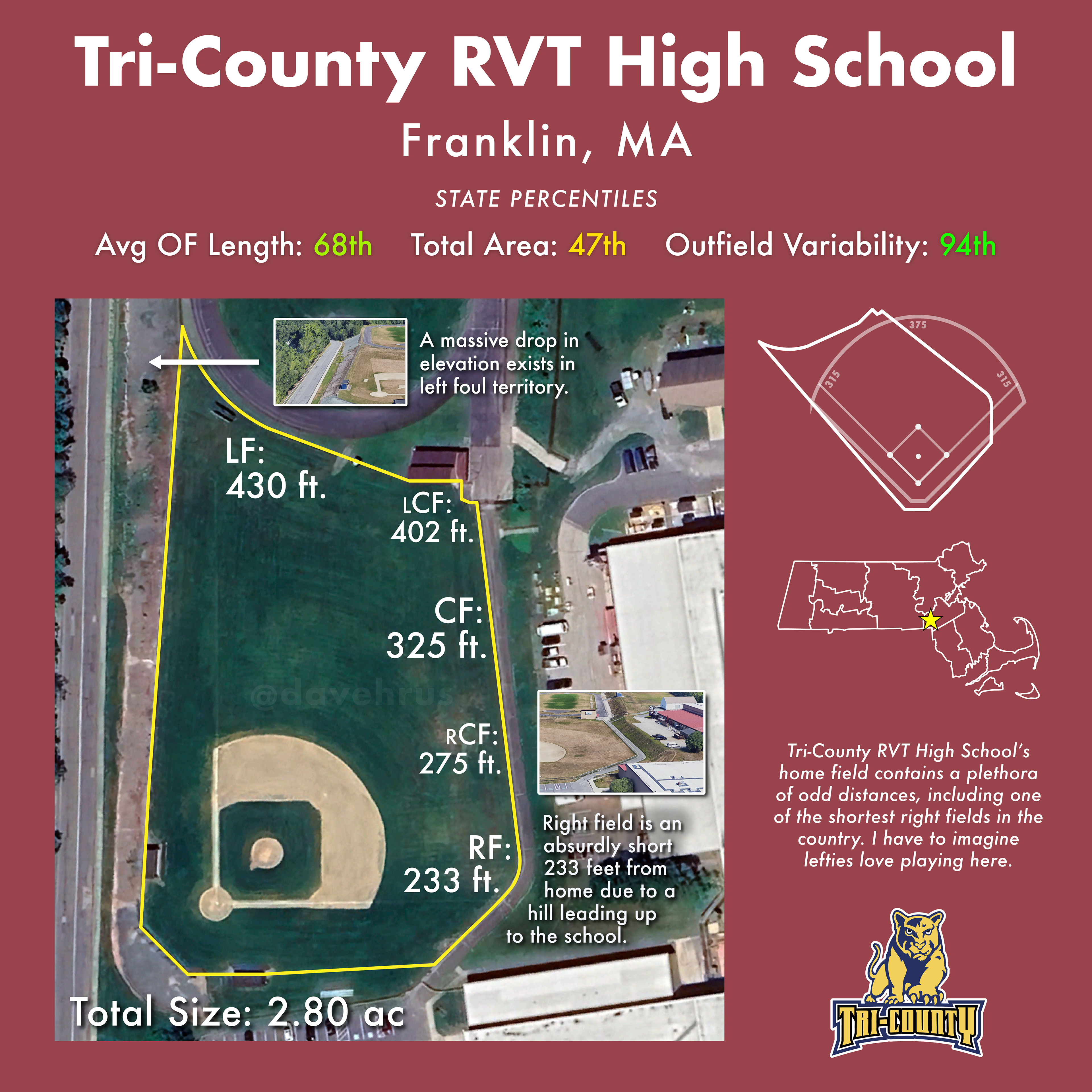
Part of this project is an attempt to find the "Weirdest High School Baseball Field in the United States." After I complete each state, I emphasize each state's most abnormal fields in infographic form and post them on my Twitter. Here are all of the "quirky field" infographics that I've made so far:
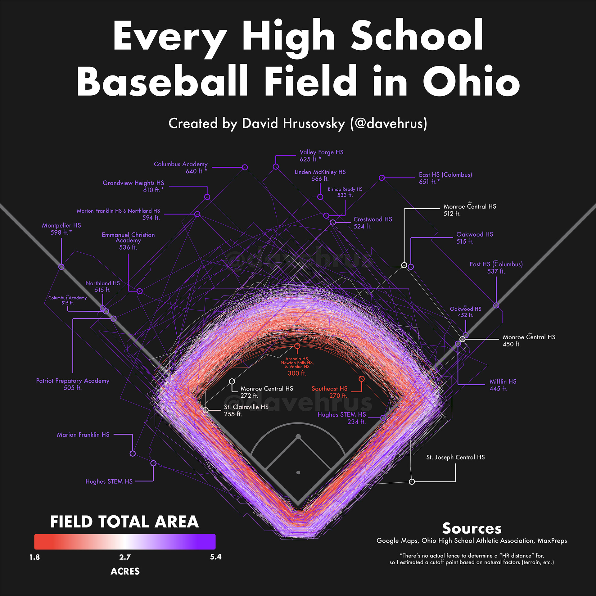
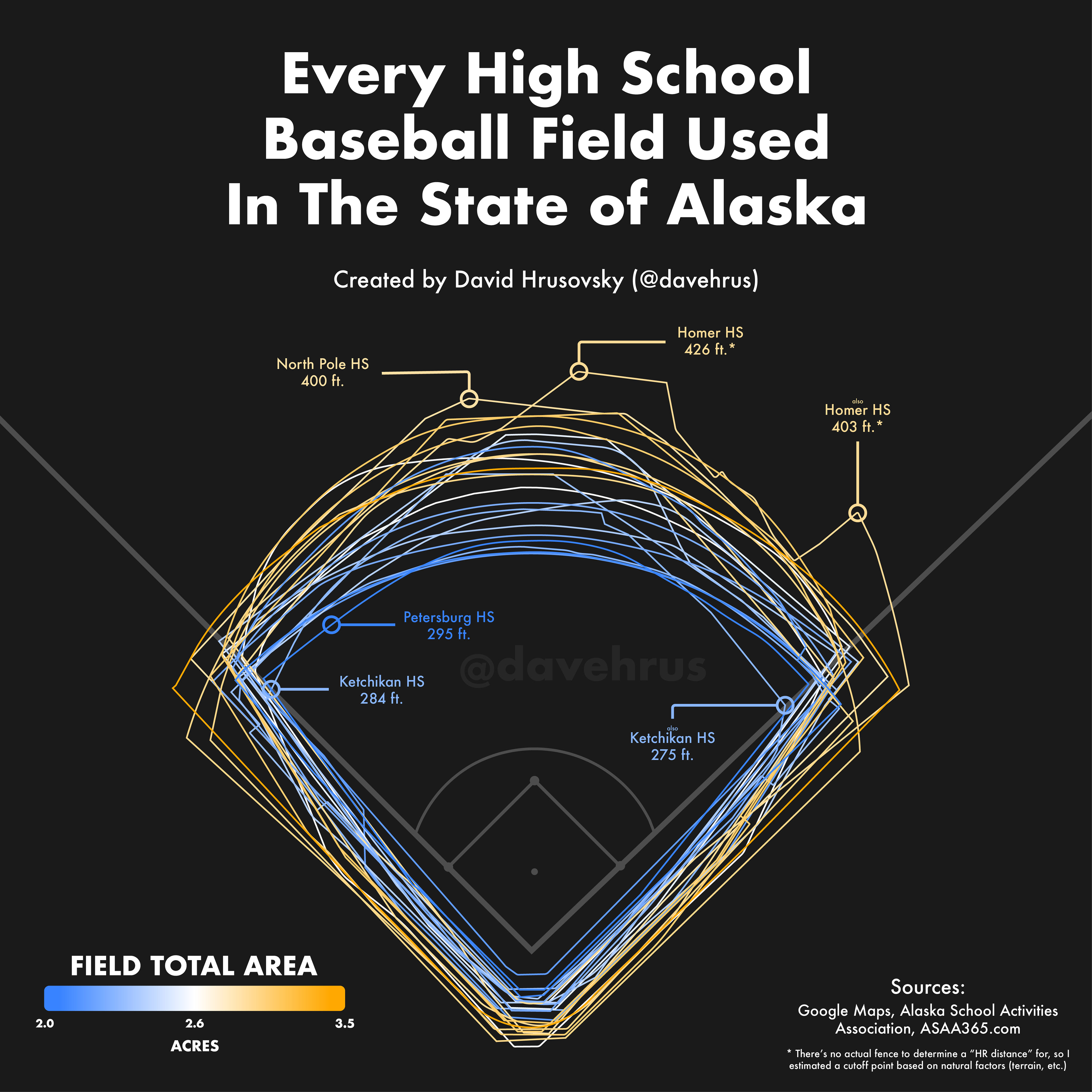
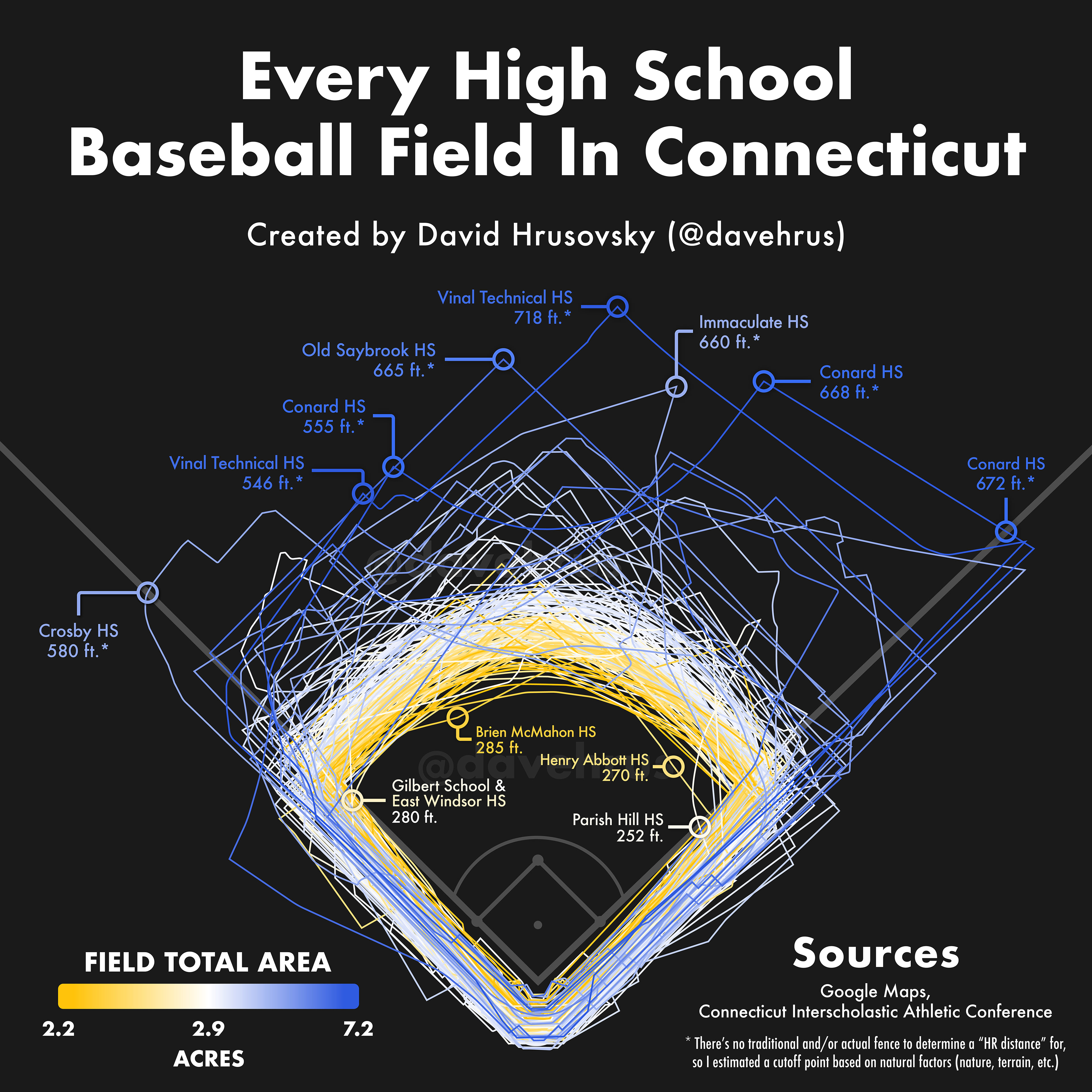
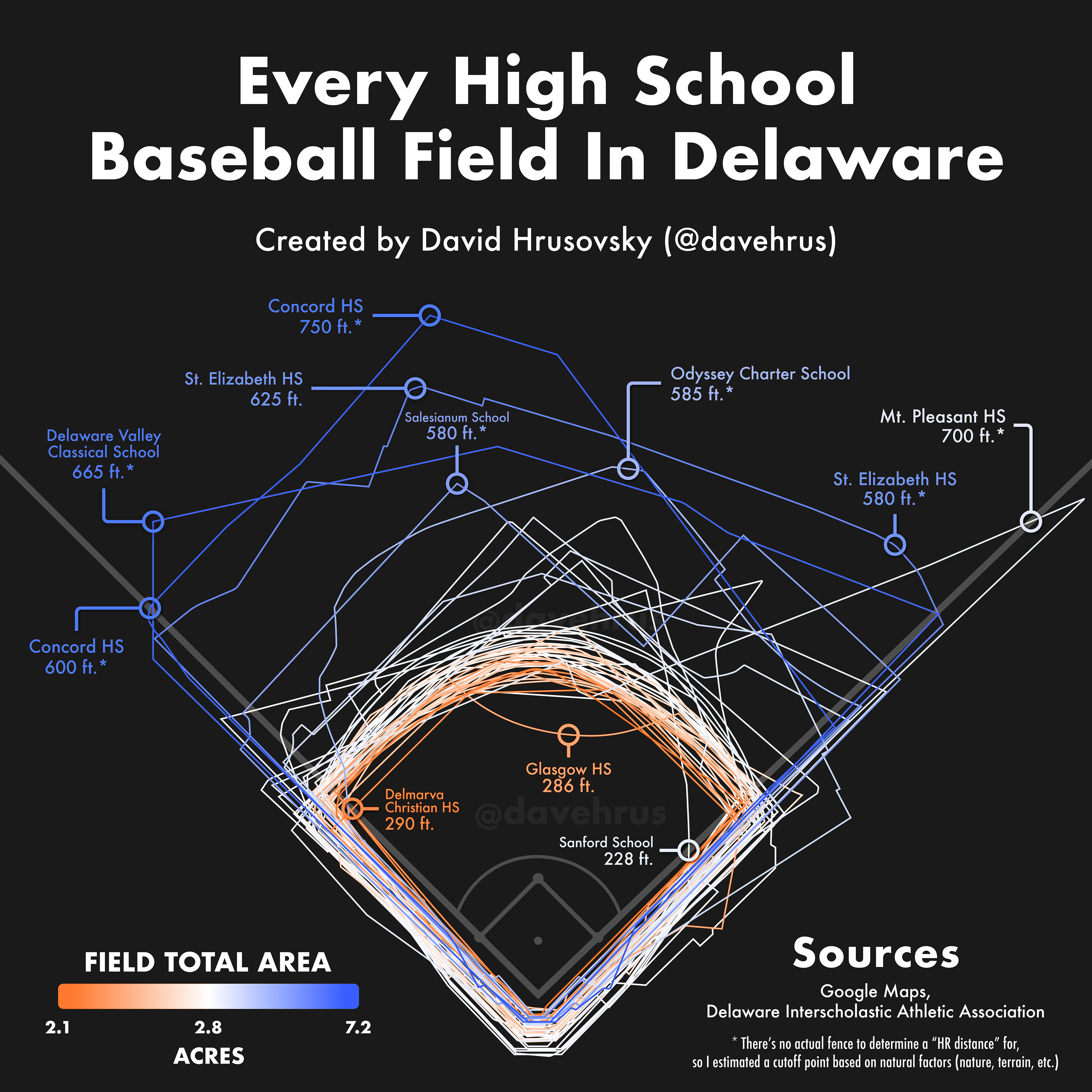
I also have created graphics that overlay all of the field outlines of a state onto one image.
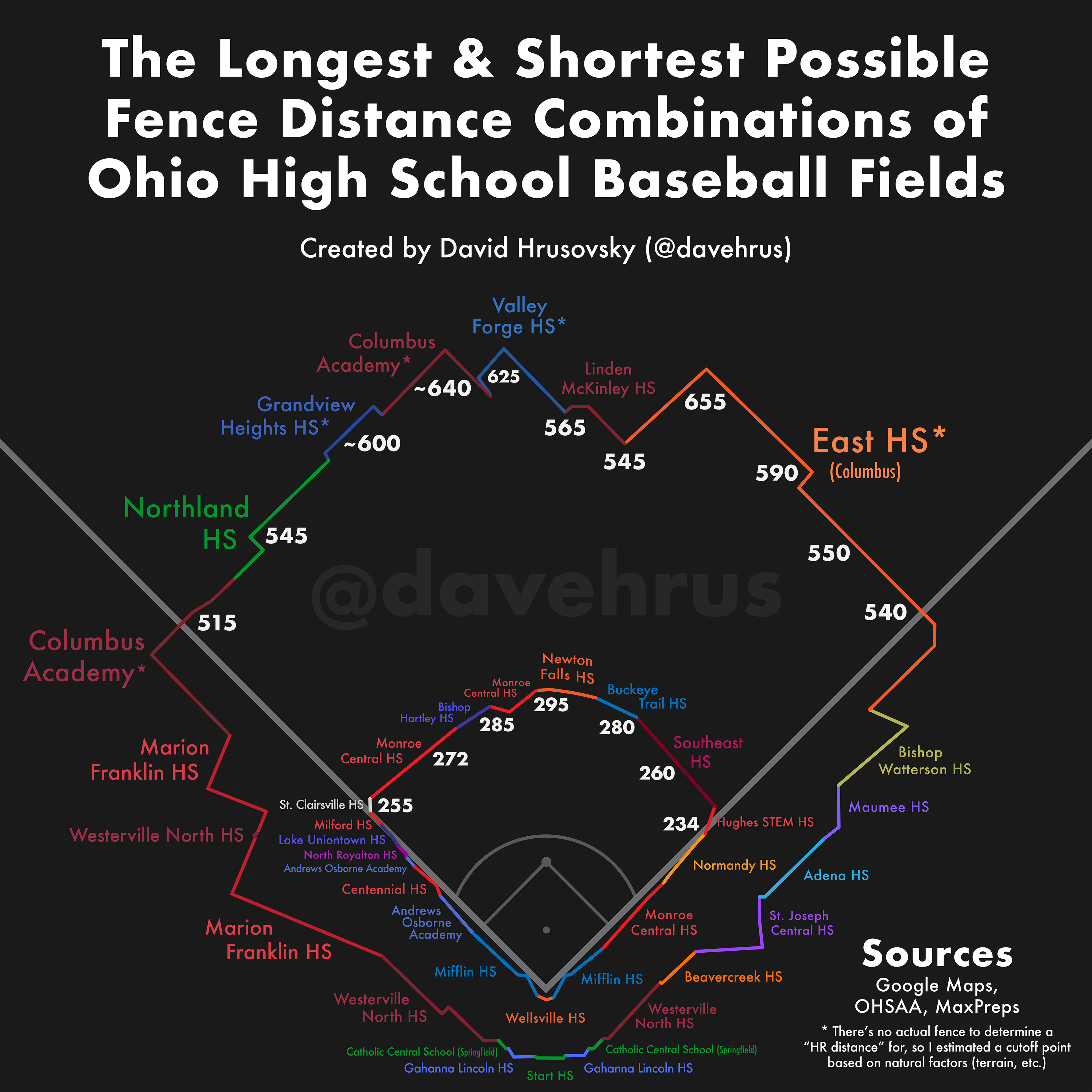
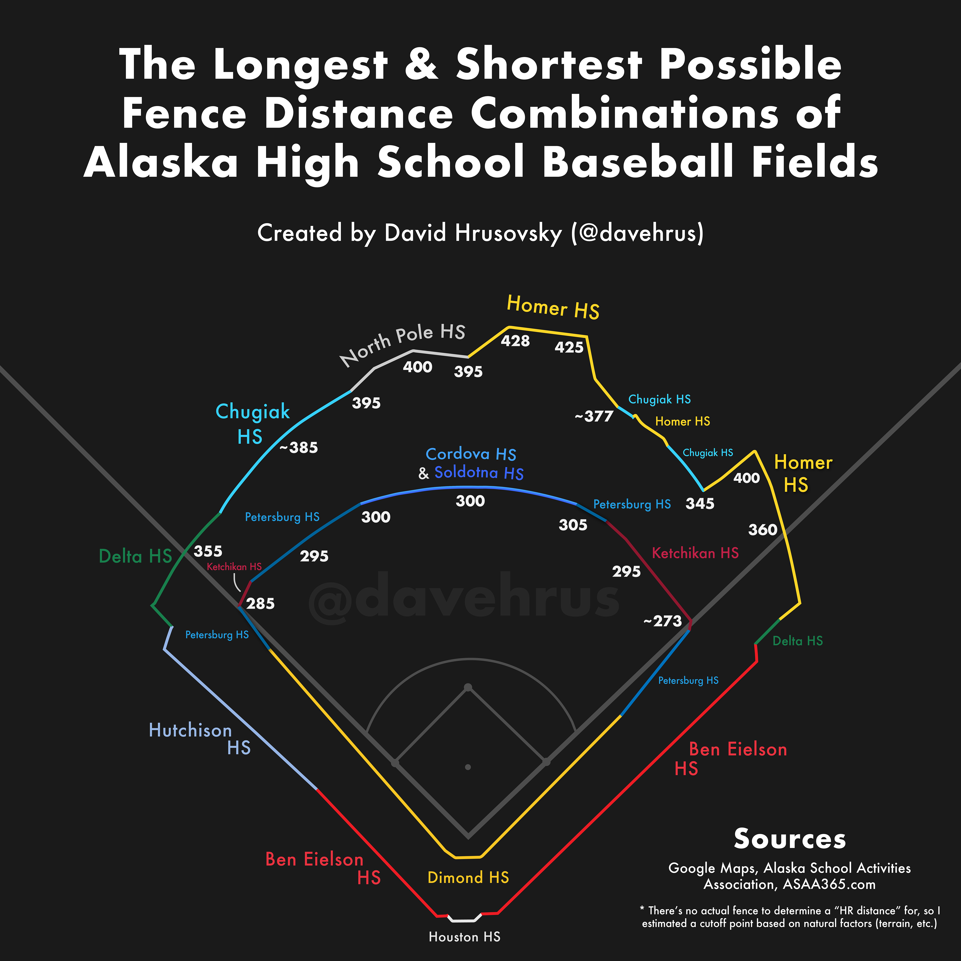
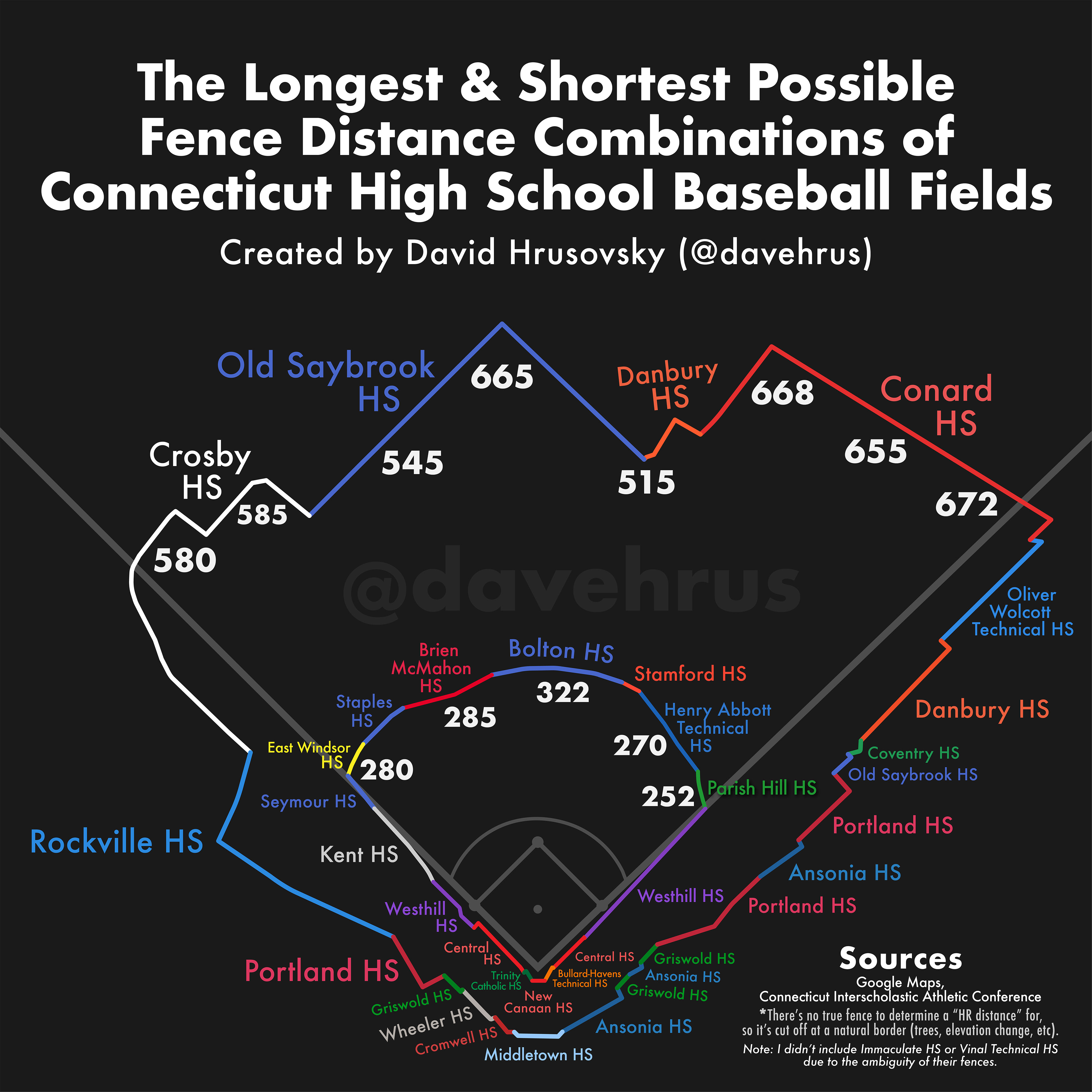
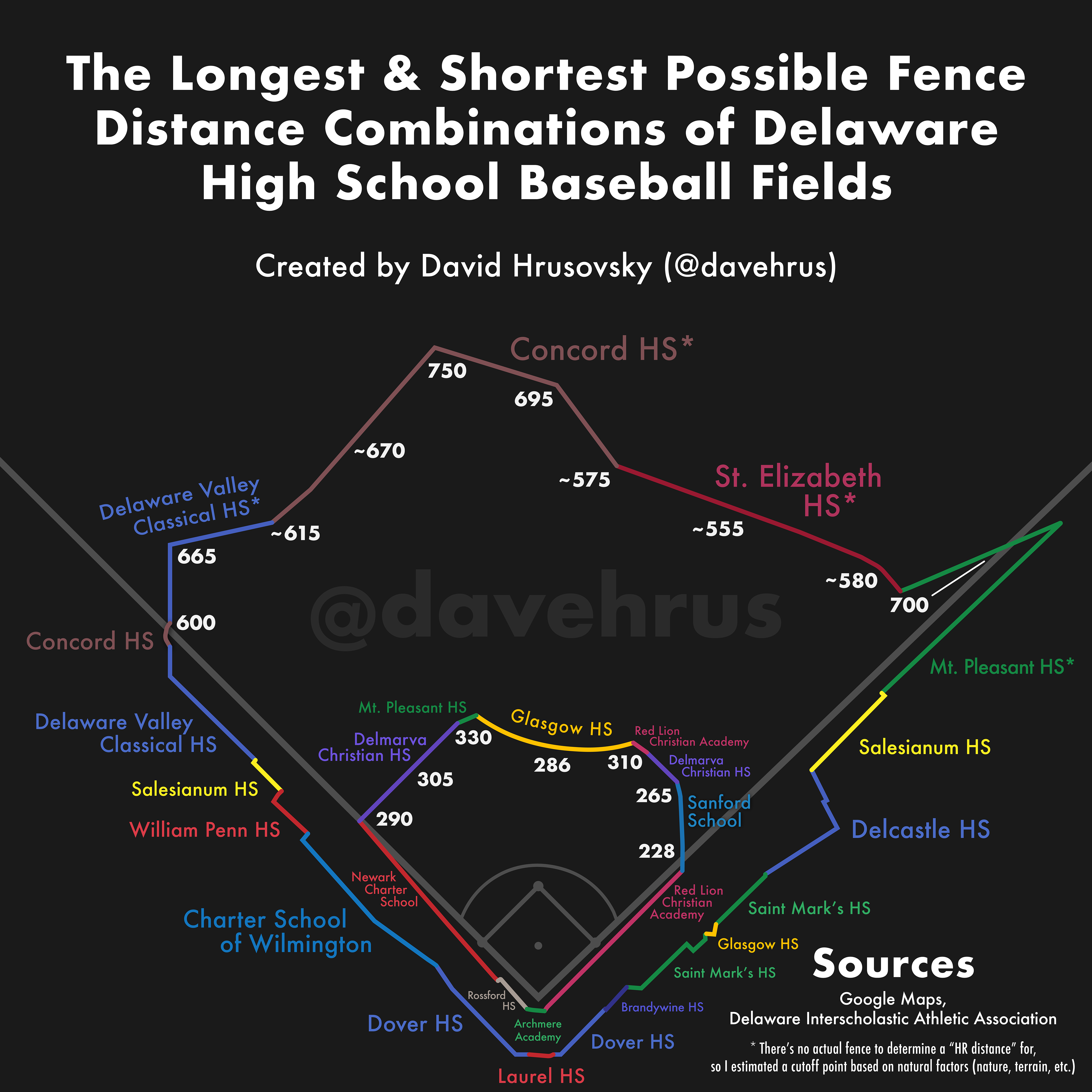
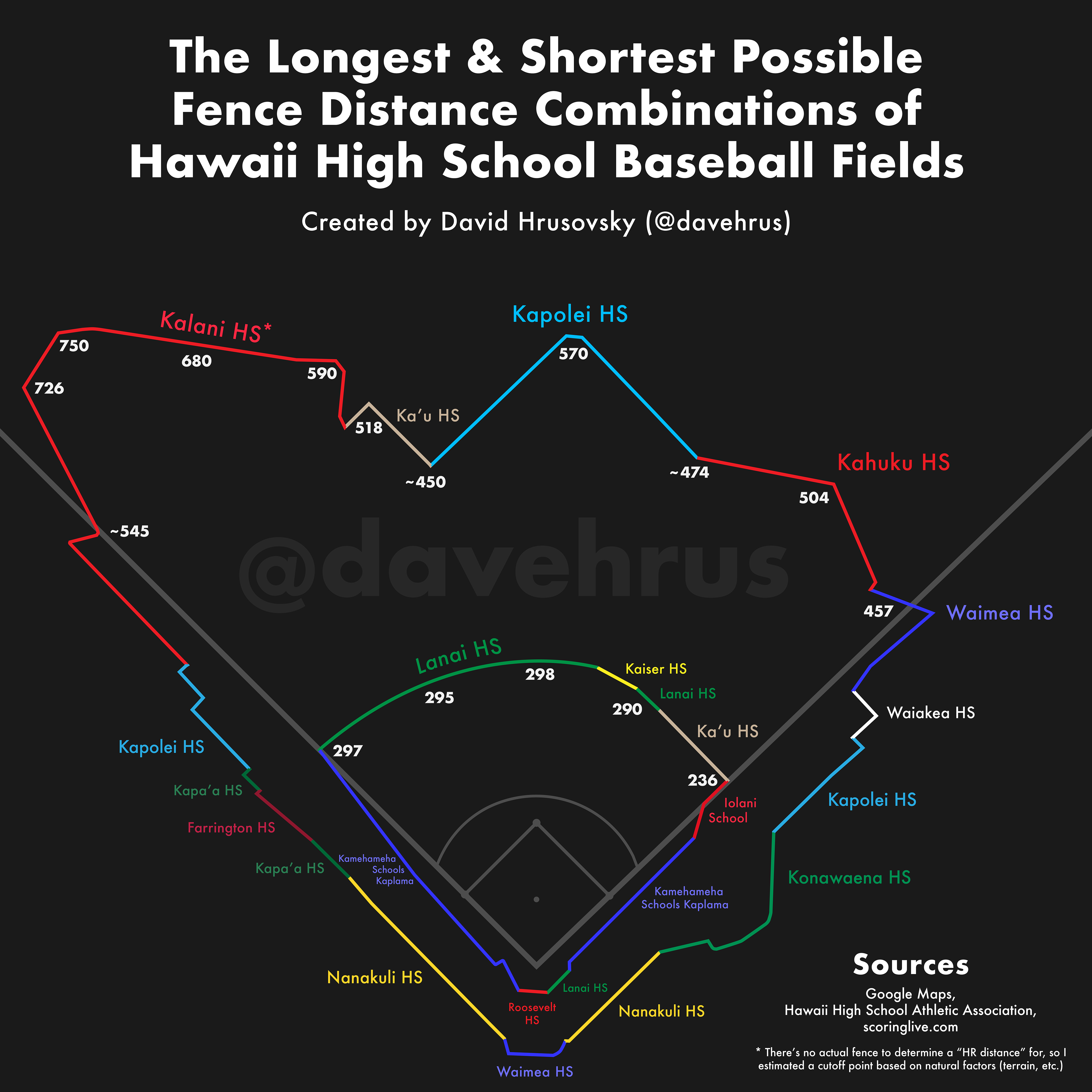
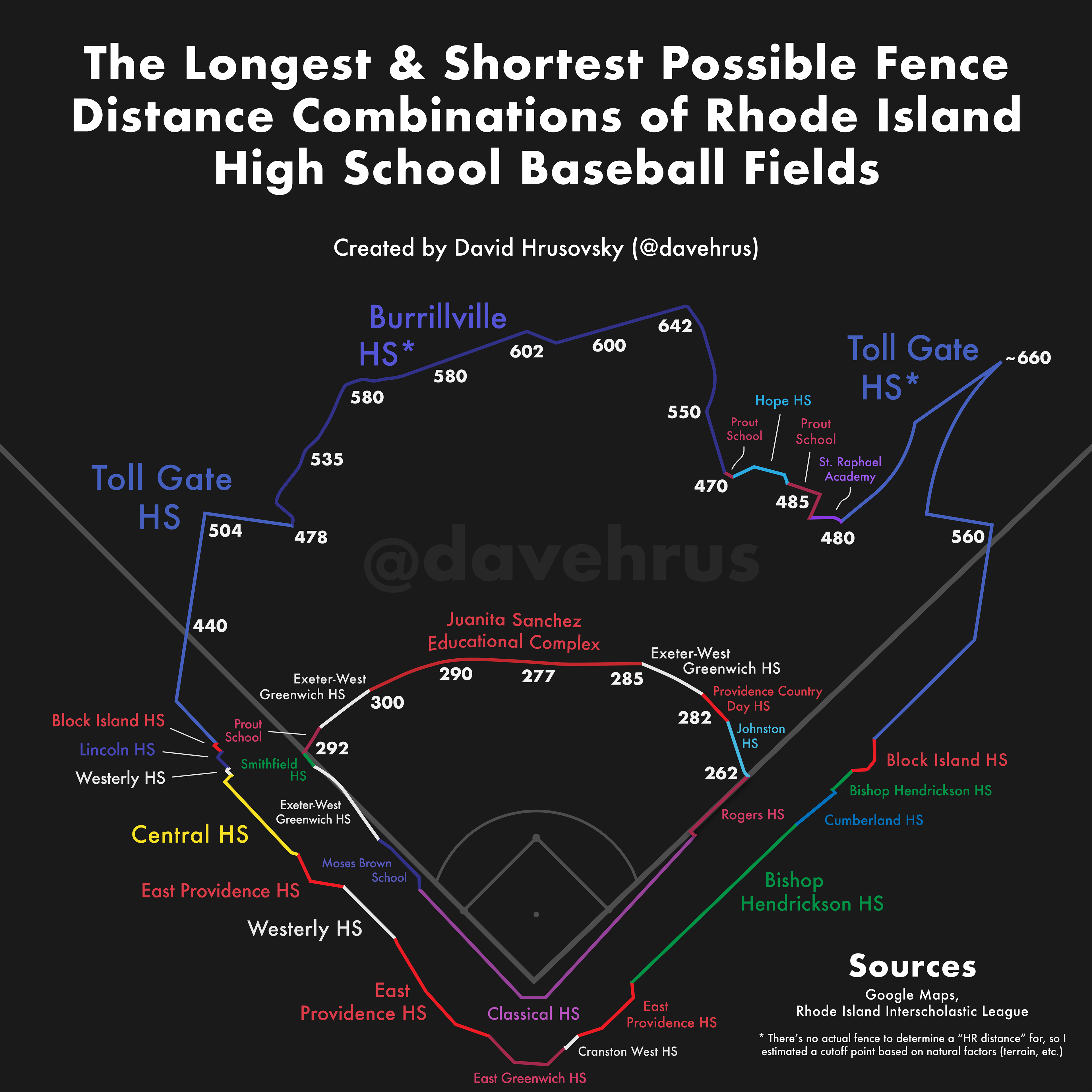
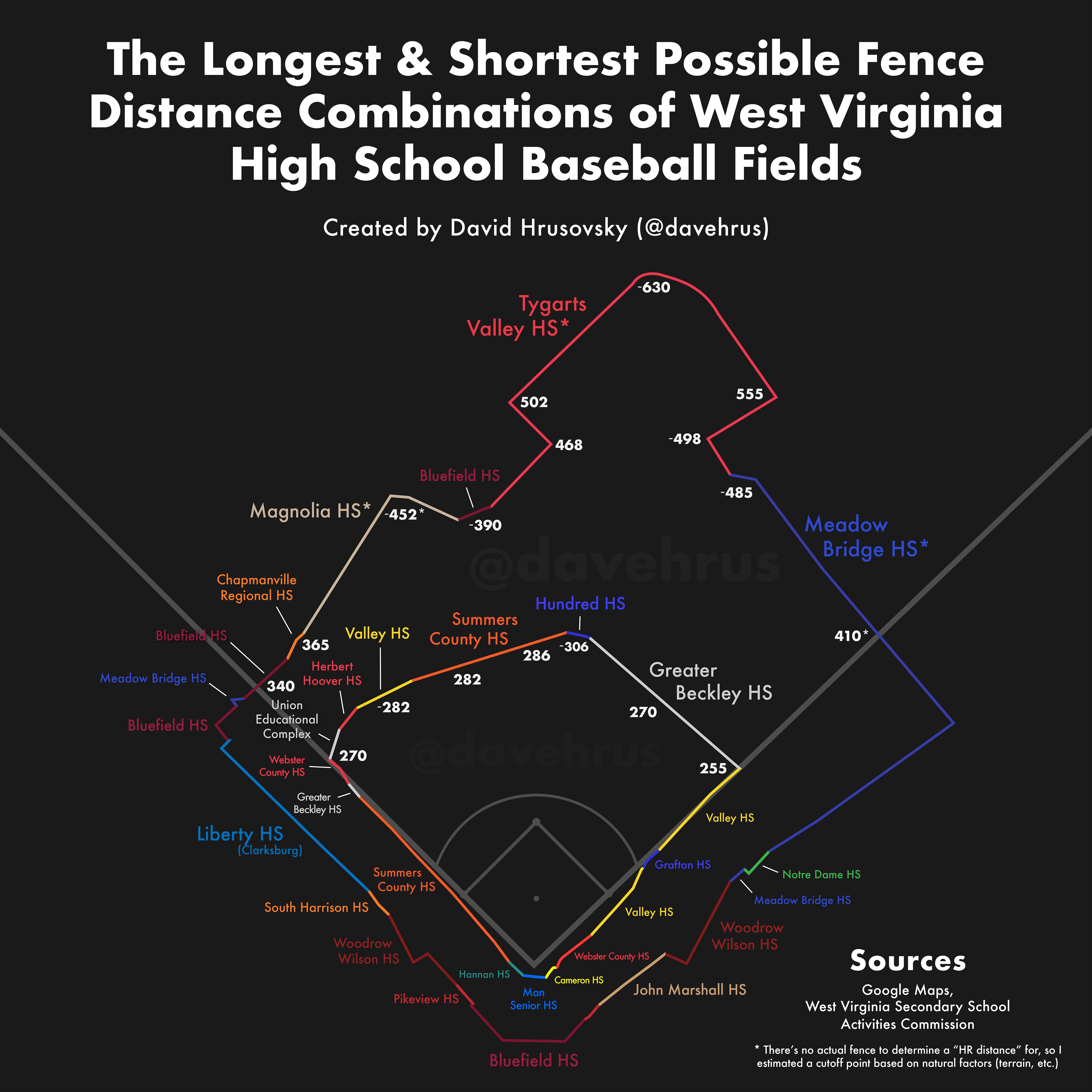
I've also created graphics that utilize the outline overlay images to generate the smallest and largest possible fields for each state, using the minimum and maximum fence combinations available.
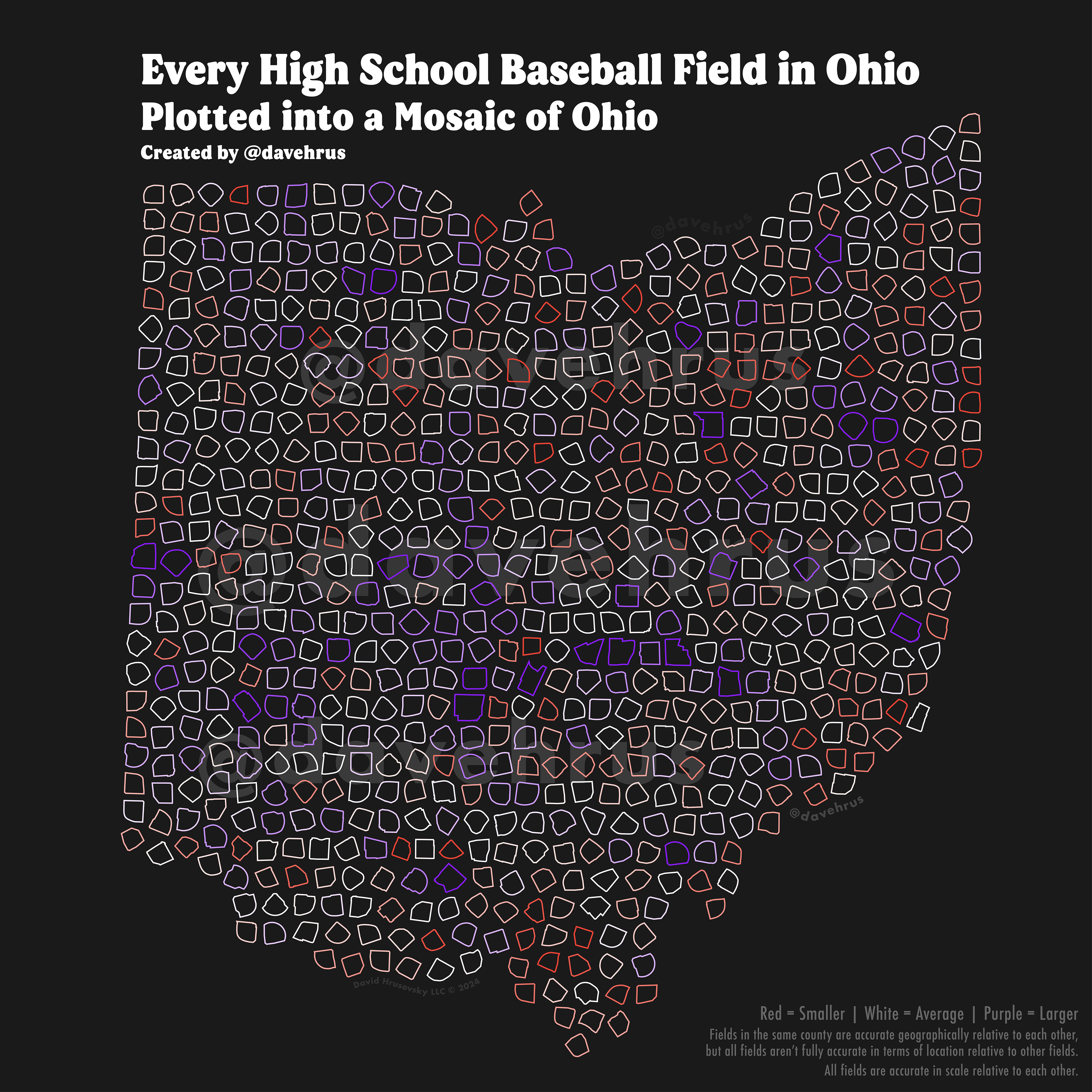
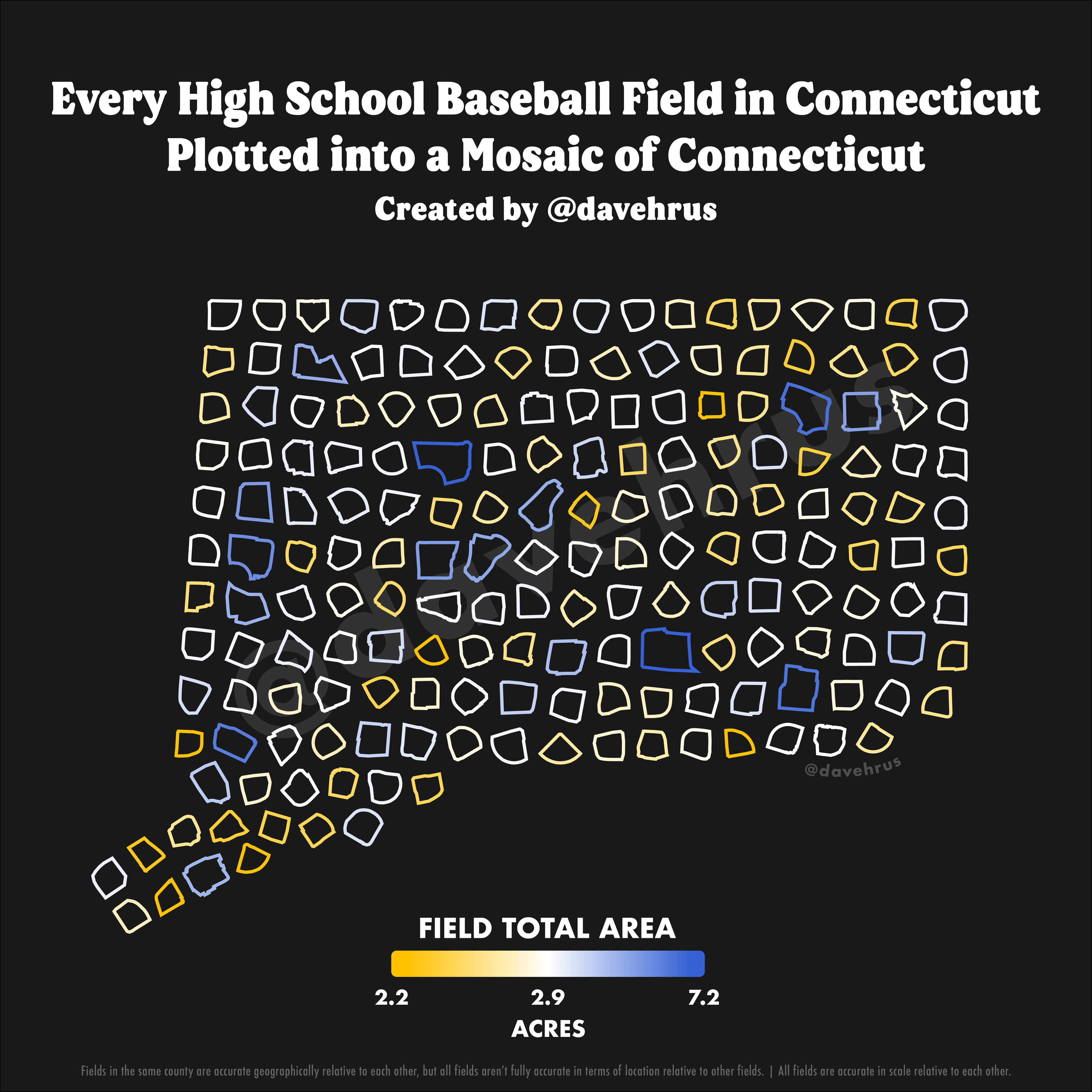
And finally, I recently began taking the outlines of each state's field and turning them into mosaics of their respective state's outline. This creates a striking and wonderfully detailed art piece of each state's high school baseball catalog.
Eventually, once I finish recording a considerable amount of the states, I plan on placing this data onto a website. This website will have all of the data, along with graphs and maps to show off all facets of high school baseball fields.
If you would like to help me with the website process, send me an email at davehrus@gmail.com