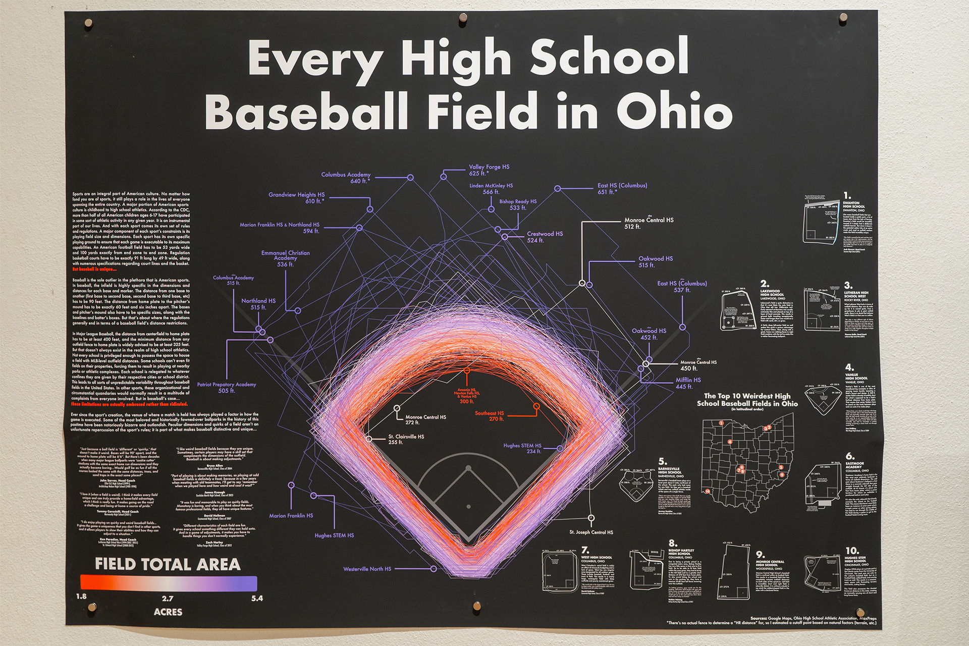
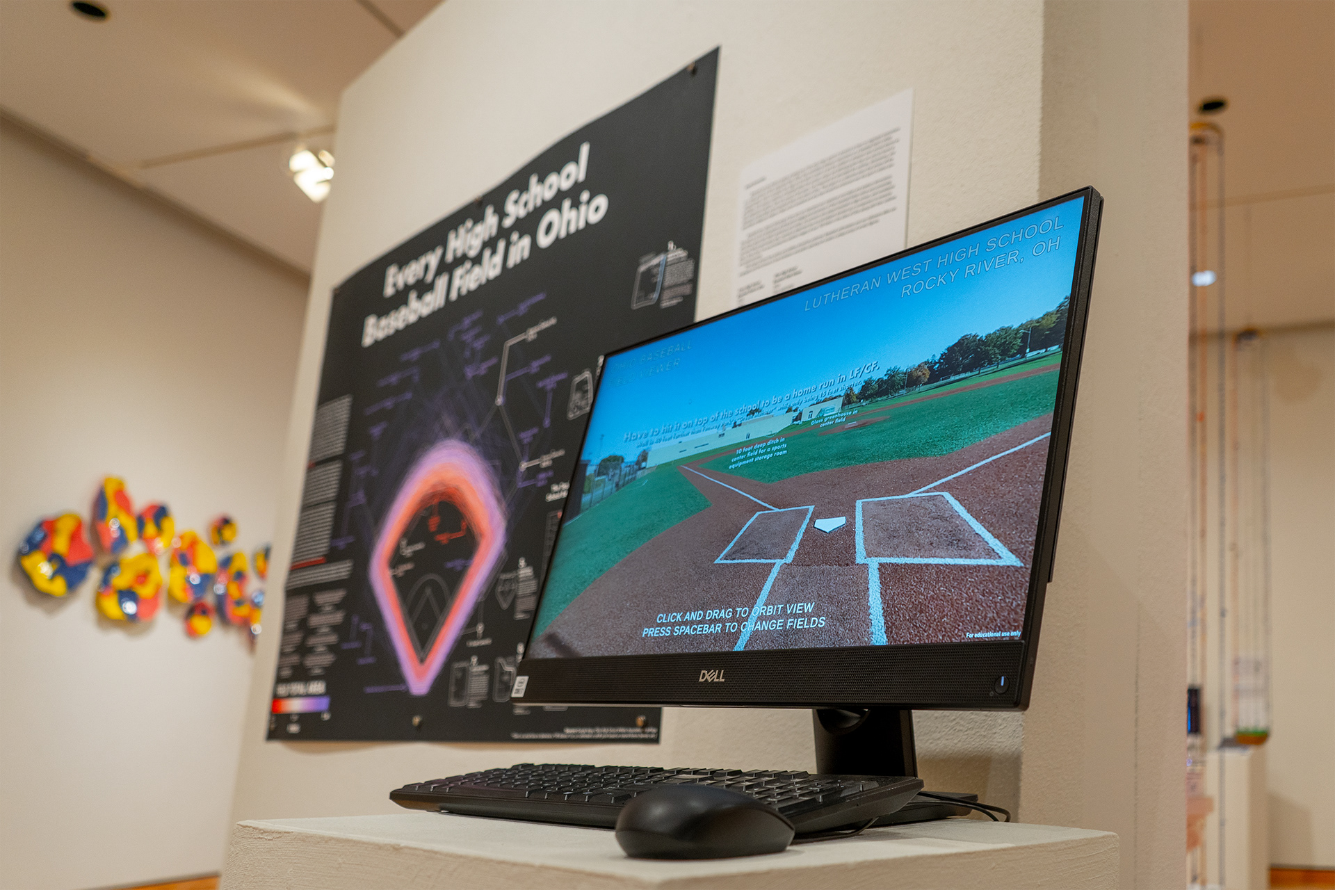


Baseball has the distinct quality of being one of the only major sports in America to have no regulated restrictions on a major portion of their respective field. Other than mandatory distance restrictions on a baseball field’s infield measurements, there’s complete free reign for the field’s creator to set the outfield to whatever each school deems as justifiable. This causes a plethora of baseball fields that contain unique and defining quirks that can only be found at their respective locations. Over the course of two years, I’ve measured and calculated the outlines, dimensions, and distances of every high school baseball field in the state of Ohio. This project is a collective piece that shows off the beautifully ambiguous shapes of high school baseball and why they should be embraced over the sport’s status quo.
This game has a devout following of fans who are obsessed over statistical anomalies and stadium dimensions. This leads to a lot of enthusiasts sharing aerial imaging and old photos of their baseball fields online and conversing with others about their field’s quirkiness and variety. As someone who played baseball in high school, and considered my home field as particularly odd, I wanted to determine how my old ballpark stacked up in comparison to everyone else’s. Since then, I’ve accumulated the satellite imagery of over 700 fields in the state of Ohio along with their outlines and measurements. This project shows how quirks and oddities should be preferred. Baseball enthusiasts and non-followers alike can congregate and find interest in how limitations and public spacing can create a unique array of erratic figures.
This piece was accepted into the 2023 Bowling Green State University BFA Exhibition.